Short answer: Hurricane Wilma crossed south Florida on October 24, 2005, and its eye left the coast near Palm Beach County, well south of Sebastian. Sebastian was under a hurricane warning and took strong north winds: a sensor on the Sebastian Inlet north jetty logged 74 knots sustained and a 90 knot gust. An F1 tornado hit a beachfront home north of the inlet, and Indian River County reported minor wind damage.
Last verified: October 11, 2026, against the sources listed at the end of this page.
What did Hurricane Wilma do to Sebastian in October 2005?
Hurricane Wilma gave Sebastian a few hours of hurricane-force north wind at Sebastian Inlet on October 24, 2005, plus a tornado on the barrier island and minor tree and power line damage across Indian River County (NWS Melbourne).
Wilma never came close to a Sebastian landfall. It crossed the peninsula from the Gulf side, entering near Everglades City in the early morning and reaching the Atlantic near Palm Beach County by late morning, roughly 60 miles south of Sebastian. What made it matter here was its size. The National Hurricane Center warned at 11 a.m. that Wilma was a large hurricane whose strongest eyewall winds extended well away from the center (NHC advisory 37), and Sebastian sat inside the hurricane warning the whole time.
The best local measurement came from a research sensor, not an airport. At the seaward end of the Sebastian Inlet north jetty, a Florida Institute of Technology station logged 74 knots sustained and a 90 knot gust, about 85 and 104 mph, as Wilma's back side swept the coast. By the standard of Frances and Jeanne the year before, the result in Sebastian was light, and the city's own manager later described Wilma that way (Vero News).
Was Sebastian under a hurricane warning for Wilma?
Yes, Sebastian was under a hurricane warning from October 23, 2005, when the National Hurricane Center replaced the watch north of Jupiter Inlet to Titusville with a warning, until Wilma moved out to sea (NHC advisory 32).
The upgrade came at 4 a.m. CDT on Sunday, October 23, while Wilma was still in the Gulf of Mexico, and it put the whole Indian River County shoreline, Sebastian Inlet included, inside the warned coast (NHC advisory 32). By 11 p.m. that night the hurricane warning on the Florida east coast ran from Titusville southward, including Lake Okeechobee (NHC advisory 35).
The track that followed explains why Sebastian got wind but not the eye. At 7 a.m. EDT on Monday, October 24, Wilma's center was just inland, about 10 miles north of Everglades City, moving northeast near 23 mph (NHC advisory 36A). Four hours later the center was about 15 miles north-northeast of West Palm Beach with 105 mph winds, a Category 2, moving northeast near 25 mph (NHC advisory 37). From there the eye headed out over the Atlantic, so Sebastian stayed on the storm's northwest side, the side where the wind blows from the north.
How strong were Wilma's winds at Sebastian Inlet?
Wilma's strongest measured winds near Sebastian were 74 knots sustained and 90 knots in gusts at the seaward end of the Sebastian Inlet north jetty around 12:30 p.m. EDT on October 24, 2005 (NWS Melbourne).
The jetty instrument belonged to the Florida Institute of Technology's Department of Marine and Environmental Systems, and the NWS Melbourne post tropical cyclone report lists both readings at 1630 UTC. The same station recorded a minimum pressure of 973.0 millibars at that hour, close to the 975.3 millibars the Vero Beach airport reported at 1531 UTC. That reading places the strongest wind at Sebastian Inlet around midday, after the eye had already left the coast to the south.
| Station | County | Highest sustained | Highest gust |
|---|---|---|---|
| Sebastian Inlet north jetty (Florida Tech sensor) | Brevard | 74 knots (about 85 mph) | 90 knots (about 104 mph) |
| Vero Beach airport ASOS (failed before the peak) | Indian River | 35 knots (about 40 mph) | 48 knots (about 55 mph) |
| Melbourne airport ASOS | Brevard | 42 knots (about 48 mph) | 52 knots (about 60 mph) |
| Fort Pierce airport ASOS (failed before the peak) | St. Lucie | 45 knots (about 52 mph) | 68 knots (about 78 mph) |
Inland numbers are lower and incomplete. The Vero Beach airport ASOS logged 35 knots sustained and a 48 knot gust in the morning, but the NWS notes that the Vero Beach and Fort Pierce sites failed during or prior to the height of the storm, so their true peaks were not captured (NWS Melbourne). The jetty site, exposed to open water at the mouth of the inlet, is the closest thing to a full Sebastian record.
Did Wilma cause a tornado near Sebastian?
Yes, an F1 tornado from a Wilma rain band destroyed a beachfront home about 3 miles north of Sebastian Inlet early on October 24, 2005, and a separate F0 touched down in western Indian River County the evening before (NWS Melbourne).
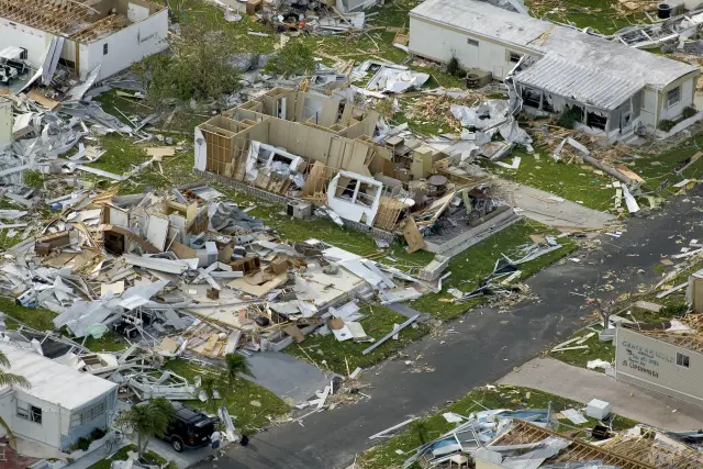
The F1 came ashore from a rainband moving northwest toward the Brevard coast. The NWS Melbourne survey says it removed the upper floor of a house built over a ground level garage, on the barrier island north of Sebastian Inlet, and the same rotating storm then touched down in Palm Bay and again as an F1 in West Melbourne, where it destroyed a large section of an apartment roof. The NWS photo set for Wilma includes images labeled as tornado damage north of the Sebastian Inlet Bridge.
The Indian River County tornado struck on October 23, ahead of the hurricane. Several public reports came in of a tornado about 10 miles east of Yeehaw Junction, and a ground survey confirmed tree damage along State Road 60, the road that links Vero Beach with the interior of the county (NWS Melbourne). Both tornadoes came from the long-lived rain bands that Wilma pushed up the Atlantic side of the state.
What damage did Wilma leave in Indian River County?
Indian River County reported minor wind damage from Wilma, with trees and power lines down, and a communications tower that blew down and damaged the county Emergency Operations Center (NWS Melbourne).
Rain was moderate: the Vero Beach airport measured 5.53 inches for the storm, compared with 13.26 inches at Kennedy Space Center, where the heaviest totals fell in northern Brevard (NWS Melbourne). On the beaches from Cape Canaveral to Jupiter Inlet, which include the Sebastian Inlet State Park shoreline, a brief period of onshore wind followed by strong north wind cut beach erosion of 1 to 3 feet.
The federal record dates Wilma's Florida disaster to the same day the Sebastian Inlet jetty gauge peaked: FEMA's major disaster declaration DR-1609 was issued on October 24, 2005, with an incident period of October 23 to November 18, 2005 (FEMA). Eight years later, in a June 2013 Vero News report on storm readiness, Sebastian City Manager Al Minner contrasted the 2004 hurricanes with Wilma, saying the city was hit again the following year by Hurricane Wilma, which was wimpy by comparison (Vero News).
Frequently asked questions
Did Hurricane Wilma hit Sebastian directly?
No. Wilma came ashore near Everglades City and its center was about 15 miles north-northeast of West Palm Beach at 11 a.m. on October 24, 2005, before heading out to sea. Sebastian was well north of the eye but inside the hurricane warning.
What was the highest wind gust at Sebastian Inlet during Wilma?
The NWS Melbourne report lists a 90 knot gust, about 104 mph, and 74 knots of sustained wind at the seaward end of the Sebastian Inlet north jetty at 1630 UTC on October 24, 2005, measured by a Florida Institute of Technology sensor.
Why are the Vero Beach airport wind readings for Wilma low?
The National Weather Service notes that the Vero Beach and Fort Pierce ASOS stations failed during or before the height of the storm, so their data are incomplete. Vero Beach logged 35 knots sustained and a 48 knot gust before it failed.
How much rain did Wilma bring to the Sebastian area?
Wilma was not a heavy rain storm for Indian River County. The Vero Beach airport recorded 5.53 inches for the event, while the heaviest totals, 10 to 13 inches, fell in northern Brevard County around Kennedy Space Center.
Was there a federal disaster declaration for Wilma in Florida?
Yes. FEMA issued major disaster declaration DR-1609 for Florida on October 24, 2005. Its incident period runs from October 23 to November 18, 2005, which covers the day Wilma crossed the state and swept the Indian River County coast.
Sources
- Hurricane Wilma October 23-24, 2005 Preliminary Summary Report for East Central Florida (NWS Melbourne) https://www.weather.gov/mlb/wilma Used for: Sebastian Inlet north jetty winds and pressure, Vero Beach ASOS, rainfall, tornadoes, erosion, Indian River County damage
- Hurricane Wilma Public Advisory 32, Oct. 23, 2005 (National Hurricane Center) https://www.nhc.noaa.gov/archive/2005/pub/al242005.public.032.shtml? Used for: hurricane warning north of Jupiter Inlet to Titusville
- Hurricane Wilma Public Advisory 35, Oct. 23, 2005 (National Hurricane Center) https://www.nhc.noaa.gov/archive/2005/pub/al242005.public.035.shtml? Used for: hurricane warning from Titusville southward
- Hurricane Wilma Intermediate Advisory 36A, Oct. 24, 2005 (National Hurricane Center) https://www.nhc.noaa.gov/archive/2005/pub/al242005.public_a.036.shtml? Used for: center inland 10 miles north of Everglades City at 7 a.m.
- Hurricane Wilma Public Advisory 37, Oct. 24, 2005 (National Hurricane Center) https://www.nhc.noaa.gov/archive/2005/pub/al242005.public.037.shtml? Used for: center 15 miles NNE of West Palm Beach at 11 a.m., Category 2, 25 mph
- Florida Hurricane Wilma (DR-1609-FL), FEMA https://www.fema.gov/disaster/1609 Used for: DR-1609 declaration date and incident period
- Fellsmere, Sebastian prepare for active hurricane season (Vero News, June 28, 2013) https://veronews.info/?p=95852 Used for: Sebastian city manager's 2013 comparison of Wilma with 2004 storms
How this page was made
Digital Towns uses AI assistance to research and write its guides, and every page is only as good as the sources it cites. Our goal is the most accurate, useful local information possible.
This page was fact-checked twice before publishing.
If you see an error, or anything you can show is false, tell us right away and we will take a third look.
Report an error
Thank you. We'll take a third look and correct the page if it's wrong.