Short answer: Turkey Creek is the tidal creek that, with direct discharge, carries the majority of Palm Bay water to the Indian River Lagoon, entering it between Castaway Point and Palm Bay Point. The USGS gauge on the creek lists a 105 square mile drainage area, and the Melbourne-Tillman outlet canal has fed it since 1924. A citrus firm formed in 1870 built its packing house at Tillman's Wharf at the mouth, and manatees use the creek, which has been an idle speed zone below structure MS-1.
Last verified: October 13, 2026, against the sources listed at the end of this page.
Where does Turkey Creek run, and how much land drains to it?
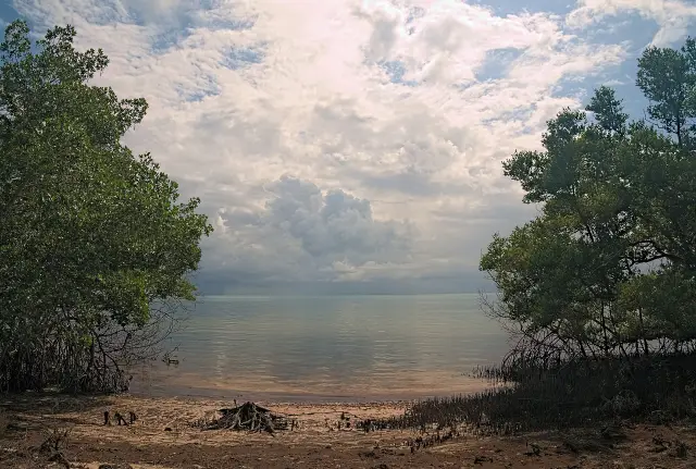
Turkey Creek is a tidal creek in Palm Bay whose USGS gauge lists a 105 square mile drainage area, and it meets the Indian River Lagoon between Castaway Point and Palm Bay Point.
The federal gauge on the creek, USGS 02250030 Turkey Creek at Palm Bay, FL, is classed as a tidal stream, sits in the Cape Canaveral hydrologic subbasin, and has a data record that begins on January 14, 1981 (USGS Water Data). The City of Palm Bay sends residents to that same gauge for real-time levels on its flood information page (City of Palm Bay flood information).
Palm Bay Public Works says the majority of water in Palm Bay reaches the Indian River Lagoon through Turkey Creek or via direct discharge (City of Palm Bay stormwater). The 1982 manatee report on the creek adds that Turkey Creek empties into the Indian River after widening into a small bay (1982 Turkey Creek manatee report).
The state draws the mouth precisely. Florida's manatee rule for Brevard County fixes the downstream end of Turkey Creek on a line from the southeasternmost point of Castaway Point to the northeasternmost point of Palm Bay Point, and the upstream end of its protected reach at Melbourne-Tillman structure MS-1 (Rule 68C-22.006).
| Measure | Figure | Source |
|---|---|---|
| USGS station | 02250030, Turkey Creek at Palm Bay, FL | USGS |
| Site type | Tidal stream | USGS |
| Drainage area at the gauge | 105 square miles | USGS |
| Gauge record begins | January 14, 1981 | USGS |
| Melbourne-Tillman district area | 100 square miles, 163 miles of canals | Melbourne-Tillman WCD |
| Manatee zone on the creek | Idle speed all year, MS-1 to the mouth | Rule 68C-22.006 |
How did the Melbourne-Tillman canals change Turkey Creek?
The Melbourne-Tillman canal system turned Turkey Creek into the outlet for a much larger drainage area: its outlet canal was connected to the creek in 1924, and by 2005 the C-1 canal supplied over 90% of the freshwater leaving through the creek.
The 1982 Turkey Creek report records that in 1924 the outlet canal of the Melbourne-Tillman Water Control District was connected to the creek, and that the 200 mile system of canals had become the major input into the creek (1982 Turkey Creek manatee report). Today the district says it contains 100 square miles, including portions of unincorporated Brevard County, the City of Palm Bay and the City of West Melbourne, and maintains 163 miles of canals (Melbourne-Tillman Water Control District).
The effect on water quality was spelled out in a 2005 St. Johns River Water Management District budget request for the Indian River Lagoon Initiative, which listed the C-1 Rediversion, Turkey Creek Basin as a subproject. It stated that over 90% of the annual volume of freshwater and 68% to 80% of the annual loads of nitrogen, phosphorus and suspended solids discharged through Turkey Creek came from the C-1 canal, and that these flows affected seagrasses in a 10 to 20 square mile area of the lagoon (Florida Senate, FY 2005-06 request). The C-1 Rediversion target was a cut of 50% or more in suspended solids, nitrogen and phosphorus into Turkey Creek and the lagoon.
The rediversion then moved water west. The St. Johns River Water Management District reported on May 11, 2017 that upgrades let the Melbourne-Tillman Water Control District pump up to 39 percent of average annual stormwater to Sawgrass Lake, potentially an average of 27.5 million gallons a day, toward the St. Johns River instead of east to Turkey Creek. The 2017 work recontoured the banks along a mile-long stretch of the C-1 Canal in Palm Bay (SJRWMD).
What history happened at the mouth of Turkey Creek?
The mouth of Turkey Creek is where Palm Bay began: in 1870 a citrus partnership bought 75 acres on the Indian River and shipped fruit from Tillman's Wharf, now Castaway Point, and a Catholic colony settled the same ground after 1911.
The National Register nomination for Palm Bay's Historic St. Joseph Catholic Church tells the story. John Tillman, J.B. Creech and M.J. Culpepper formed Culpepper, Creech and Co. in 1870 to buy a 75 acre tract along the Indian River for citrus groves, and their packing house stood at Tillman's Wharf at the mouth of Turkey Creek, where fruit was loaded onto sailing craft and steamboats bound north (National Register nomination).
Tillman got a post office on March 4, 1887, and the area became the Town of Tillman, though the nomination counts only 40 residents and no elected officials. The Florida Indian River Catholic Colony received a state permit on July 21, 1911, and families from Indiana, Wisconsin, Kansas and Oklahoma began arriving in 1912 on the Florida East Coast Railway (National Register nomination).
A 2018 state historical marker at 1422 Miller Street in Palm Bay places that settlement on the creek itself: by 1914 the land company had helped settle nearly 100 midwestern families, mostly of German and Slavic descent, in the area of Tillman on the banks of the Indian River and Turkey Creek (Florida Historical Marker).
What wildlife lives in Turkey Creek?
Turkey Creek holds manatees, alligators and Florida cooters, with otters and gar also possible, and manatees have used the Palm Bay creek for decades, from at least the 1960s.
The City of Palm Bay lists manatees, alligators and Florida cooters in the creek along the Turkey Creek Sanctuary, with an otter or a gar fish possible (City of Palm Bay, Turkey Creek Sanctuary). Manatees are the creek's best documented residents.
The 1982 report notes that herds of manatees in Turkey Creek have been reported as early as the sixties, that a 1979 study established manatee use of the creek from March through December, and that a 1979 study reported 700 manatee sightings and identified 33 different individuals using the creek that year (1982 Turkey Creek manatee report).
Boats are slowed for them today. Under Florida rule 68C-22.006, all waters of Turkey Creek downstream of Melbourne-Tillman structure MS-1 are an idle speed zone all year, out to the line between Castaway Point and Palm Bay Point (Rule 68C-22.006).
When did Palm Bay start protecting Turkey Creek manatees?
Palm Bay's Turkey Creek manatee program dates to 1979-80, when the city served as the model for a Coastal Zone Management grant manatee program, and in 1982 it named the manatee its Official City Animal and declared the creek a local critical area.
The report for state contract CM-36 says the City of Palm Bay served as a model for the development of a Model Manatee Protection Program for a Coastal Zone Management Grant in 1979-80, and that the 1982 project carried it out between January and October 1982 (1982 Turkey Creek manatee report).
The City Council acted twice that year. On March 25, 1982 it adopted Resolution 82-12 designating the manatee as the Official City Animal, and Resolution 82-11 declared Turkey Creek a local critical area for manatees. The Mayor proclaimed May 15, 1982 as Turkey Creek Day, and the 1982 Legislature amended the Manatee Sanctuary Act to direct rules on boat speeds in part of Turkey Creek (1982 Turkey Creek manatee report).
Public outreach was broad. The same report counts 34 presentations reaching 1,376 people, and Palm Bay sixth graders traveled to Tallahassee to make presentations to the Governor and circulated a petition that drew more than 8,000 signatures (1982 Turkey Creek manatee report). The city's current code still names the creek: Chapter 204 finds that poorly managed stormwater may interfere with the water quality and quantity of the Indian River Lagoon and Turkey Creek (Palm Bay Code, Chapter 204). Last verified: October 12, 2026, on the USGS, St. Johns River Water Management District and City of Palm Bay websites.
Frequently asked questions
Is Turkey Creek fresh water or salt water?
Both. USGS classes its Turkey Creek at Palm Bay gauge as a tidal stream, so lagoon water moves in and out at the mouth, while the Melbourne-Tillman canals feed fresh stormwater in from the west, which a 2005 state request said supplied over 90% of the freshwater volume.
Where does Turkey Creek meet the Indian River Lagoon?
Turkey Creek enters the Indian River Lagoon on a line Florida rule 68C-22.006 draws from Castaway Point to Palm Bay Point. Castaway Point was Tillman's Wharf, where the citrus firm whose 1870 founding the National Register nomination calls the beginning of Palm Bay built its packing house.
What is the speed limit for boats on Turkey Creek?
Idle speed, all year. Florida rule 68C-22.006 makes all waters of Turkey Creek downstream of Melbourne-Tillman structure MS-1, out to the Castaway Point and Palm Bay Point line, an Idle Speed manatee protection zone all year.
Why is the manatee Palm Bay official city animal?
It came out of the city's Turkey Creek manatee program. On March 25, 1982 the Palm Bay City Council adopted Resolution 82-12 naming the manatee its Official City Animal, after a 1979 study counted 700 manatee sightings and 33 different individuals using the creek, according to the 1982 state contract report.
How much of the Turkey Creek flow comes from canals?
A 2005 Florida Senate request said the Melbourne-Tillman C-1 canal supplied over 90% of the annual freshwater volume discharged through Turkey Creek. Since then, SJRWMD reported in 2017 that up to 39 percent of average annual stormwater can be pumped west to Sawgrass Lake instead.
Sources
- USGS 02250030 Turkey Creek at Palm Bay, FL (USGS Water Data for the Nation) https://waterdata.usgs.gov/monitoring-location/USGS-02250030/ Used for: tidal stream site type, 105 square mile drainage area, record start January 14, 1981
- District, partners celebrate improved flows (St. Johns River Water Management District, May 11, 2017) https://www.sjrwmd.com/?p=8866 Used for: C-1 Canal rediversion: 39 percent of average annual stormwater to Sawgrass Lake, 27.5 million gallons a day
- Indian River Lagoon Initiative, FY 2005-2006 appropriations request (The Florida Senate) https://www.flsenate.gov/Committees/Publications/2005/CBIRS/SENReq363FY0405 Used for: C-1 canal share of freshwater volume and nutrient loads discharged through Turkey Creek; seagrass area affected
- Fla. Admin. Code R. 68C-22.006, Brevard County manatee protection zones (Legal Information Institute) https://www.law.cornell.edu/regulations/florida/Fla-Admin-Code-Ann-R-68C-22-006 Used for: Turkey Creek idle speed zone downstream of structure MS-1, mouth line from Castaway Point to Palm Bay Point
- National Register of Historic Places nomination, Historic St. Joseph Catholic Church, Palm Bay (National Park Service NPGallery) https://npgallery.nps.gov/GetAsset/79290839-3333-4b55-b786-cc12b3cbb6b2 Used for: Tillman citrus settlement, Tillman Wharf at the mouth of Turkey Creek, 1887 post office, Catholic colony
- First Catholic Church in Brevard County historical marker (Florida Division of Historical Resources) https://markers.flheritage.com/home/details/1091 Used for: by 1914 nearly 100 midwestern families at Tillman on the Indian River and Turkey Creek
- Final Report, Manatee Program Implementation, Turkey Creek, Palm Bay, Florida, DER Contract CM-36 (1982, NOAA Coastal Zone Information Center via GovInfo) https://www.govinfo.gov/content/pkg/CZIC-ql737-s63-f56-1982/html/CZIC-ql737-s63-f56-1982.htm Used for: 1924 canal connection, 1979 manatee study, Resolutions 82-11 and 82-12, Turkey Creek Day, 1982 legislation
- Stormwater (City of Palm Bay Public Works) https://www.palmbayfl.gov/government/city-departments-f-to-z/public-works/stormwater Used for: majority of Palm Bay water reaches the lagoon through Turkey Creek
- Flood Information (City of Palm Bay Building Division) https://www.palmbayfl.gov/government/city-departments-a-to-e/building-permits-inspections/flood-information Used for: city points residents to the USGS Turkey Creek at Palm Bay gauge
- Palm Bay Code of Ordinances, Chapter 204: Stormwater Management Utility (American Legal Publishing) https://codelibrary.amlegal.com/codes/palmbay/latest/palmbay_fl/0-0-0-73749 Used for: city finding on stormwater and Turkey Creek water quality
- District Overview (Melbourne-Tillman Water Control District) https://www.melbournetillman.org/district-overview Used for: district size, 163 miles of canals, Palm Bay and West Melbourne coverage
- Turkey Creek Sanctuary (City of Palm Bay Recreation) https://www.palmbayfl.gov/government/city-departments-f-to-z/recreation/turkey-creek-sanctuary Used for: wildlife seen in the creek