This page is restricted to US residents.
Short answer: The city describes most of Satellite Beach as coastal flood zone land, often AE or VE, with properties outside the high-risk zones usually Zone X, under a FEMA map effective 01/29/21. Flood insurance through the NFIP is open to owners and renters, priced under Risk Rating 2.0, but the city's CRS class 10 brings no premium discount. After a declared storm, a post-disaster plan promises 1 to 3 business day reviews for essential repairs.
Last verified: October 21, 2026, against the sources listed at the end of this page.
What flood zone is Satellite Beach in?
Satellite Beach's flood page describes the city as mostly coastal flood zone land, with AE or VE the usual designations, and puts properties outside the high-risk zones usually in Zone X, shaded or unshaded (Satellite Beach Flood Information page).
The zone for a single lot comes from FEMA's own tools, and the city's flood page links three of them: the FEMA Flood Map Service Center for searching an address and printing a Flood Insurance Rate Map panel or a FIRMette, the National Flood Hazard Layer viewer for toggling AE and VE zones and Base Flood Elevations, and the Map Change Viewer for recent and effective map changes (Satellite Beach Flood Information page). The city asks owners to confirm their zone on those tools rather than rely on the general description (Satellite Beach Flood Information page).
FEMA lists the currently effective Satellite Beach flood map date as 01/29/21 (FEMA NFIP Community Status Book record for Satellite Beach). Staff at the Community Development Department, 1390 South Patrick Drive, 321-773-4409, offer to confirm a flood zone, discuss Base Flood Elevation and freeboard, and provide printed FIRM panels or a FIRMette on request, Monday to Friday from 7:00 AM to 3:30 PM (Satellite Beach Flood Information page). The city also notes that storm surge, king tides, heavy rain and hurricanes can each contribute to flooding in Satellite Beach (Satellite Beach Flood Information page).
Do the Satellite Beach flood maps show all the flood risk?
Not entirely: the city's flood page warns that flooding can still occur in Zone X (Satellite Beach Flood Information page).
A 2017 study of the Satellite Beach fire station site found that a FEMA HAZUS model and the regulatory map differed quite substantially (2019 Sea-Level Rise Technical Planning Assessment, Appendix 2).
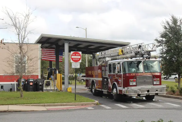
That August 2017 site study, published as Appendix 2 of the city's 2019 assessment, looked at the fire department building of that time at 1390 South Patrick Drive, a site where officials and citizens had reported shallow flooding on the driveway between the truck bay and South Patrick Drive (2019 Sea-Level Rise Technical Planning Assessment, Appendix 2). It reported that the FIRM in force at the time did not place the site in the Special Flood Hazard Area and listed a 100-year flood height of about 1.7 feet above NAVD88 for the Satellite Beach Banana River shoreline, while the HAZUS 100-year coastal flood assessment differed quite substantially from that map (2019 Sea-Level Rise Technical Planning Assessment, Appendix 2).
The study explains why the two can differ: HAZUS supports evacuation and emergency response decisions and is built to be risk-averse, while a FIRM's basic purpose is to set flood insurance rates (2019 Sea-Level Rise Technical Planning Assessment, Appendix 2). Elsewhere the report cites research indicating that a substantial proportion of flood losses occur outside designated 100-year floodplains (2019 Sea-Level Rise Technical Planning Assessment). The map that study described has since been replaced: FEMA's record now shows a currently effective Satellite Beach map dated 01/29/21 (FEMA NFIP Community Status Book record for Satellite Beach), so any lot's present zone has to be checked on the current FEMA tools.
How does flood insurance work for Satellite Beach homes?
Satellite Beach owners and renters can buy National Flood Insurance Program coverage whether or not the property is in a mapped high-risk area, and premiums now follow Risk Rating 2.0 (Satellite Beach Flood Information page).
The city describes Risk Rating 2.0 as weighing distance to water, first-floor height and other factors, and says a preferred-risk policy outside the high-risk zones is usually affordable (Satellite Beach Flood Information page). FEMA's flood insurance page says most homeowners policies leave out flood damage, so flood coverage is bought as its own policy for a building, the contents in it, or both, and a quote can go to the agent who already handles a home or auto policy (FEMA flood insurance page).
A new NFIP policy usually does not start at once: FEMA puts the typical wait at 30 days, with exceptions for coverage a government-backed lender requires and for coverage linked to a community flood map change (FEMA flood insurance page). For help finding a provider, FEMA lists the NFIP at (877) 336-2627 (FEMA flood insurance page). The city suggests asking the insurer or lender whether an Elevation Certificate would lower the premium (Satellite Beach Flood Information page).
Does Satellite Beach get a Community Rating System discount?
Satellite Beach gets no CRS discount: FEMA lists the city at Community Rating System class 10, and the record shows 0% as the discount for policies outside the Special Flood Hazard Area (FEMA NFIP Community Status Book record for Satellite Beach).
| Field | Value FEMA lists | Source |
|---|---|---|
| Participating in NFIP | Yes | FEMA NFIP Community Status Book record for Satellite Beach |
| Regular program date | 02/13/76 | FEMA NFIP Community Status Book record for Satellite Beach |
| Initial Flood Insurance Rate Map | 1976-04-23 | FEMA NFIP Community Status Book record for Satellite Beach |
| Currently effective map | 01/29/21 | FEMA NFIP Community Status Book record for Satellite Beach |
| CRS class | 10 | FEMA NFIP Community Status Book record for Satellite Beach |
| Class rating effective | 2017-10-01 | FEMA NFIP Community Status Book record for Satellite Beach |
| Discount outside the SFHA | 0% | FEMA NFIP Community Status Book record for Satellite Beach |
FEMA says a class 10 community is not participating in the CRS and receives no discount (FEMA Community Rating System page). The Community Rating System is voluntary and rewards floodplain management that goes beyond NFIP minimums (FEMA Community Rating System page). Participating classes earn premium discounts in 5% steps, from 5% at class 9 up to 45% at class 1, and the class is set from credit points across 19 creditable activities, which FEMA sorts into warning and response, flood damage reduction, mapping and regulations, and public information (FEMA Community Rating System page). For a Satellite Beach policyholder, that means the city's current listing adds no CRS reduction to the premium (FEMA NFIP Community Status Book record for Satellite Beach).
What do Satellite Beach flood rules require when building or repairing?
Any development in a Satellite Beach flood zone, from new homes and additions to fences, decks, sheds, pools and mechanical equipment, needs city review against the Florida Building Code and the city's floodplain rules (Satellite Beach Flood Information page).
The lowest floor must meet or exceed the applicable Base Flood Elevation plus adopted freeboard; Zone VE and Coastal A lots need open pile foundations, breakaway walls and special details; and mechanical and utility equipment must be elevated or flood-protected (Satellite Beach Flood Information page). When improvements or repairs equal or exceed 50 percent of a structure's market value, not counting land, the substantial improvement and substantial damage rules require the whole building to be brought up to new-construction standards (Satellite Beach Flood Information page).
An Elevation Certificate, prepared by a Florida-licensed surveyor, records the lowest floor height against the Base Flood Elevation and may be needed for building, substantial improvement or an insurance quote (Satellite Beach Flood Information page). Community Development keeps many earlier certificates on file and offers to check for one (Satellite Beach Flood Information page). The city also asks owners not to cut native dune plants or reshape dune profiles, and to contact Community Development about dune repair or post-storm sand placement (Satellite Beach Flood Information page). Oceanfront lots east of A1A face additional coastal setback rules, covered in the Digital Towns guide to Satellite Beach oceanfront construction.
How do Satellite Beach permits work after a hurricane?
After a declared emergency, Satellite Beach's post-disaster plan, written to comply with Florida's CS/CS/SB 180, opens a post-storm permitting center and speeds up review of storm repairs (Satellite Beach post-disaster permitting plan).
| Item | What the plan says | Source |
|---|---|---|
| Location | A post-storm permitting center at the Community Development office, 1390 S Patrick Drive, or at an alternate site | Satellite Beach post-disaster permitting plan |
| Service hours | At least 40 hours per week of public-facing permitting once conditions allow | Satellite Beach post-disaster permitting plan |
| Essential repair review | Completed within 1 to 3 business days | Satellite Beach post-disaster permitting plan |
| Emergency power reconnects and roofing | Same-day permitting when all documents are complete | Satellite Beach post-disaster permitting plan |
| Inspections | Scheduled within 24 to 48 hours of request, weather permitting | Satellite Beach post-disaster permitting plan |
| Fees | No permit or inspection fee increase for 180 days after the declaration; fees for essential repairs may be reduced or waived | Satellite Beach post-disaster permitting plan |
Priority goes to structural repairs, roof replacement and emergency tarping, electrical reconnections and meter resets, storm plumbing repairs, debris fencing, flood damage restoration and elevation work, and temporary housing where permitted (Satellite Beach post-disaster permitting plan). Minor repairs such as replacing screens, painting or cleaning need no permit, while structural, electrical, plumbing and roofing work typically does (Satellite Beach post-disaster permitting plan). Impact fees are not charged for replacement structures substantially similar in size and use to the original, and the plan committed to digital substantial damage and improvement letters, on request, by May 1, 2026 (Satellite Beach post-disaster permitting plan). Post-storm updates go out through the city website, social media, press releases and text alerts by texting BREVARDEOC to 888777 (Satellite Beach post-disaster permitting plan). Storm debris must stay out of swales, where it can block drainage (Satellite Beach Flood Information page).
How can Satellite Beach property owners cut flood damage?
The Satellite Beach flood page recommends raising or relocating utilities and A/C compressors, installing flood vents where they apply, keeping swales and storm inlets clear, and using flood-resistant materials in lower areas (Satellite Beach Flood Information page).
Community Development offers site visits to advise on structural and non-structural flood protection and mitigation, including flood insurance (Satellite Beach Flood Information page), and it is the office to call first for a zone check, an Elevation Certificate on file, or a substantial damage question after a storm (Satellite Beach Flood Information page). The plan names the same Building Department line, (321) 773-4409, for post-storm permitting and floodplain questions (Satellite Beach post-disaster permitting plan), and the plan is to be reviewed and updated each year by May 1 (Satellite Beach post-disaster permitting plan).
Longer-range flood exposure, including the city's sea level rise studies and drainage projects, is covered in the Digital Towns guide to Satellite Beach sea level rise and resilience.
Last verified: October 21, 2026, with fresh reads of the Satellite Beach flood information page and post-disaster permitting plan, the FEMA NFIP record for community 120028, FEMA's Community Rating System and flood insurance pages, and Appendix 2 of the 2019 city assessment.
Frequently asked questions
Is Satellite Beach in a flood zone?
Mostly yes: the city's flood page names AE or VE as the usual designations in Satellite Beach, with Zone X typical outside the high-risk zones. FEMA's record gives 01/29/21 as the date of the map now in effect.
Does Satellite Beach have a CRS flood insurance discount?
No. FEMA lists Satellite Beach at CRS class 10 and shows 0% as the discount for policies outside the Special Flood Hazard Area, and FEMA says class 10 communities do not participate in the CRS and receive no discount.
Where does a Satellite Beach owner get an elevation certificate?
Elevation Certificates are prepared by a Florida-licensed surveyor. The Satellite Beach Community Development Department, 321-773-4409, keeps many earlier certificates on file and offers to check for one.
How fast are permits issued after a hurricane in Satellite Beach?
The Satellite Beach post-disaster plan commits to reviewing essential repair permits within 1 to 3 business days, same-day permits for emergency power reconnects and roofing when documents are complete, and inspections within 24 to 48 hours.
Is there a waiting period for flood insurance in Satellite Beach?
FEMA puts the usual wait for a new NFIP policy at 30 days; the exceptions are coverage that a government-backed lender requires and coverage linked to a community flood map change.
Sources
- Flood Information, City of Satellite Beach https://www.satellitebeach.gov/departments/community-development/flood-insurance-update/ Used for: zones, FEMA tools, NFIP and Risk Rating 2.0, ECs, floodplain building rules, owner tips, contacts
- Permitting Plan, Post Disaster, City of Satellite Beach https://www.satellitebeach.gov/departments/community-development/disaster-preparedness/permitting-plan-post-disaster/ Used for: post-storm permitting commitments
- NFIP Community Status Book, Satellite Beach (OpenFEMA API) https://www.fema.gov/api/open/v1/NfipCommunityStatusBook?$filter=state%20eq%20%27FL%27%20and%20startswith(communityName,%27SATELLITE%27) Used for: NFIP participation, map dates, CRS class and discount
- Community Rating System, FEMA https://www.fema.gov/floodplain-management/community-rating-system Used for: CRS class scale and meaning of class 10
- Flood Insurance, FEMA https://www.fema.gov/flood-insurance Used for: separate policy, coverage, waiting period, NFIP phone
- Sea-Level Rise Technical Planning Assessment (2019), Appendix 2 (2017 fire department site study), city-hosted https://satellitebeach-us.govstack.com/media/tnpj1wss/att1-sealevelriseassessment.pdf Used for: FIRM versus HAZUS conflict, 1.7 ft flood height on the then FIRM
Published by Rytas Dirse, Solo Founder & AI Architect
Built with AI, held to quality gates. US sources, US brands, facts only.
How this page was made
Digital Towns uses AI assistance to research and write its guides, and every page is only as good as the sources it cites. Our goal is the most accurate, useful local information possible.
If you see an error, or anything you can show is false, tell us right away and we will take a third look.
Report an error
Thank you. We'll take a third look and correct the page if it's wrong.