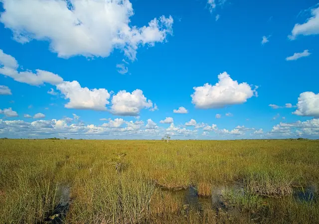
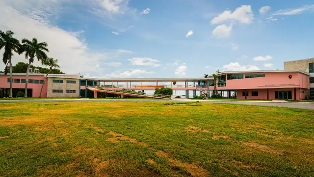
Short answer: Blind Creek Beach is the ocean side of Blind Creek Ocean To River Park, 5460 S. Ocean Drive on Hutchinson Island in Fort Pierce, a St. Lucie County preserve the county lists at 409 acres and its draft plan at 376.44 acres. It is open sunrise to sunset, free, with no lifeguards and no pets, alcohol, glass or fires. Across A1A, two lagoon impoundments offer a 240-foot fishing pier, an observation tower, crabbing platforms and a boat ramp at Little Mud Creek.
Last verified: October 22, 2026, against the sources listed at the end of this page.
What is Blind Creek Beach on Hutchinson Island?
Blind Creek Beach is the Atlantic side of Blind Creek Ocean To River Park, a St. Lucie County preserve at 5460 S Ocean Dr in Fort Pierce that runs from the Indian River Lagoon to the ocean (Blind Creek Beachside page).
The St. Lucie County beach page calls it a 409-acre coastal preserve in which 108 acres cover a mile and a half of undeveloped, dune-backed shoreline, popular for bird watching, surf fishing, swimming and beachcombing (Blind Creek Beachside page). The county's draft general management plan for the park, prepared by the Environmental Resources Department and updated in April 2025, gives a different total: 376.44 acres in two parcels, a leased property of 364.7 acres and a county-owned parcel of 11.70 acres, both zoned Conservation Public (draft Blind Creek Ocean To River Park General Management Plan).
The plan places the park on South Hutchinson Island, 6 miles south of the Ft. Pierce Inlet, in Sections 4, 5, 8 and 9 of Township 36 South, Range 41 East, and notes that the adjacent stretch of the Indian River Lagoon is an Aquatic Preserve and an Outstanding Florida Water (draft management plan). It lists the other publicly owned parks, preserves and impoundments on South Hutchinson Island as John Brooks Park, Ocean Bay Natural Area, Fredrick Douglas Park, Middle Cove and Dollman Park.
How does someone get to Blind Creek Beach from Fort Pierce or Port St. Lucie, and where is parking?
From Fort Pierce, St. Lucie County directs drivers over the South Causeway to Hutchinson Island and south on A1A for about eight miles to the Blind Creek sign on the left, just south of the FPL nuclear plant property (Blind Creek Beachside page).
From Jensen Beach or Port St. Lucie, the same St. Lucie County page routes drivers over the Jensen Beach Causeway, north on A1A for roughly eight miles, to an entrance on the right shortly after Little Mud Creek, and warns of the two-lane island road, wildlife and no lighting after dark (Blind Creek Beachside page).
| Access point | What the county lists | Source |
|---|---|---|
| Beachside North | Dune path from a free gravel and grass lot on the west side of A1A at Little Mud Creek | Beach page |
| Beachside South | Main dune crossover from the primary lot, a free lot | Beach page |
| East of A1A parking | A 200 feet by 100 feet area for up to 50 vehicles, with a 350 feet trail to the beach | Management plan |
| Boat launch lot | A 2.14-acre parking area east of A1A for the boat launch | Management plan |
| Kayak soft launch | A 0.7-acre parking area west of A1A | Management plan |
| North of Little Mud Creek | Two small parking areas of 3 vehicles each | Management plan |
Rows marked beach page come from the St. Lucie County Blind Creek Beachside page; rows marked management plan come from the draft general management plan, which says all parking areas and driveways are shell rock and that two beach access points may hold up to sixty vehicles.
What are the hours and rules at Blind Creek Beach in St. Lucie County?
St. Lucie County lists Blind Creek as open daily from sunrise to sunset with free admission and parking, no lifeguards, and no pets, alcohol, glass or fires (Blind Creek Beachside page).
The St. Lucie County beaches page says lifeguards are stationed at Pepper Park and Waveland, all county parks, beaches and preserves are open during daylight hours, and the beach conditions hotline is 772-462-1421 (St. Lucie County Beaches page). The Blind Creek page lists 772-462-2526 for the beach and asks visitors not to disturb marked sea turtle nests, which it says are common between March and October (Blind Creek Beachside page).
On accessibility, the St. Lucie County page says access to the beach is over soft-sand paths across the dunes that can be challenging for wheelchairs and strollers, and beach wheelchairs are not provided (Blind Creek Beachside page). Amenities at the South entrance include a small shaded shelter, a short interpretive trail through the dunes and a lagoon-view tower. The draft plan cites county Ordinances No. 82-10 and No. 00-15 as the public use rules for county-owned or leased properties and says the rules are posted at a kiosk at each access point (draft management plan).
What is on the Indian River Lagoon side of Blind Creek Park?
West of A1A, Blind Creek Park holds two Mosquito Control District impoundments with dike trails, a fishing pier, an observation tower, fishing and crabbing platforms and a boat ramp at Little Mud Creek (draft management plan).
The St. Lucie County plan describes a 12 feet wide concrete boat ramp east of A1A at Little Mud Creek and an unimproved shell rock canoe ramp west of A1A, plus a 240 feet long by 5 feet wide fishing pier, a 20 feet tall observation tower and four fishing and crabbing platforms along the impoundments (draft management plan). Impoundment Number 5 has the pier, two fishing docks, a pump station and six 30-inch aluminum culverts in about 3,100 feet of dike; Impoundment Number 6 has two fishing docks, the tower, four walkways, eleven 30-inch culverts and one pump station inside about 3,500 feet of dike.
According to the plan, the mangrove wetlands were extensively ditched between 1926 and 1935 and diked for mosquito control in 1963; culverts and a modified rotational impoundment management program now allow 8-month periods of free tidewater exchange, which the county credits with the return of marine organisms and wading birds (draft management plan). The Mosquito Control District's Impoundment Division page lists Blind Creek Park, ocean to river, among the lands its acquisition program helped bring into public ownership (Impoundment Division page).
What habitats and wildlife does Blind Creek protect?
The St. Lucie County plan's acreage summary lists mangrove swamp at 244 acres and 65 percent of Blind Creek Ocean To River Park, followed by beach dune, coastal or maritime hammock, sand beach, estuarine and marine communities (draft management plan).
| Community | Acres | Percent as listed |
|---|---|---|
| Mangrove swamp | 244 | 65 |
| Beach dune | 44 | 12 |
| Coastal or maritime hammock | 41 | 11 |
| Sand beach | 31 | 8 |
| Estuarine | 16 | 4 |
| Marine | 1 | under 1 |
Every figure in the table is the plan's own (draft management plan). The plan cites Florida Natural Areas Inventory records of nesting by Atlantic loggerhead and Atlantic green sea turtles on the beach dune, lists shorebirds such as sanderlings, willets and black-bellied plovers, and names snook, tarpon, redfish, mangrove snapper and blue crabs among the species using the impoundment waters, with nearby lagoon seagrass described as critical habitat for the West Indian manatee. The St. Lucie County beach page calls the beach a critical nesting area for threatened green and loggerhead sea turtles each summer (Blind Creek Beachside page).
What history is recorded at Blind Creek in St. Lucie County?
St. Lucie County records Native American shell middens and archaeological sites at Blind Creek, an early 1940s gun emplacement on its shore, and a 1998 public purchase (draft management plan; beach page).
The St. Lucie County beach page says shell middens nearby testify to centuries-old Ais tribal occupation (Blind Creek Beachside page). The draft plan states that nine archaeological sites of Native American origin, registered in the Florida Master Site File, were identified in a professional survey of the property in 2007, including shell middens, black earth middens, sand mounds, shell mounds and burial mounds, while its one-page summary lists 4 prehistoric sites (draft management plan). The plan says site-specific data is not released to the public, that kiosks state cultural resources are protected by state statute and no digging is allowed, and that one historic shipwreck lies in the nearshore Atlantic waters near the park.
The same St. Lucie County plan says an anti-aircraft and anti-submarine gun emplacement was built on the site in the early 1940s, and that the concrete bases of twin gun mounts were uncovered along the shoreline during the hurricanes of 2004 (draft management plan). The property was bought in 1998 through Conservation and Recreation Lands, the U.S. Fish and Wildlife Service National Coastal Wetlands Restoration Act program, the South Florida Water Management District and the county's Environmentally Sensitive Lands program, with title held half by the state Board of Trustees of the Internal Improvement Trust Fund and half by the district.
Who manages Blind Creek Ocean To River Park, and what is planned?
Three St. Lucie County departments share Blind Creek: Parks and Recreation runs public use, Mosquito Control runs the impoundments and Environmental Resources manages natural areas, invasive plants and historic resources (draft management plan).
St. Lucie County manages Blind Creek under FDEP Lease No. 4233 and South Florida Water Management District lease C-10485, and its draft 2023 to 2033 plan sets goals to manage natural communities, maintain hydroperiods for mosquito control, improve parking, set a carrying capacity for the beach accesses and keep working with user groups (draft management plan). The plan lists restroom, parking area and parking landscaping work among scheduled improvements, along with maintenance of existing facilities.
The St. Lucie County Mosquito Control District page links the draft plan; the district is at 3150 Will Fee Road, Fort Pierce, 772-462-1692 (Mosquito Control District page). Other island beaches are compared in the Hutchinson Island beaches guide on this site. Last verified: October 22, 2026, for Blind Creek by rereading the St. Lucie County Blind Creek Beachside and beaches pages, the Mosquito Control District and Impoundment Division pages, and the draft general management plan.
Frequently asked questions
Is Blind Creek Beach free in St. Lucie County?
Yes. The St. Lucie County page lists free admission and free parking, with the beach open daily from sunrise to sunset.
Are dogs allowed at Blind Creek Beach?
No. St. Lucie County lists pets, alcohol, glass and fires as not permitted at Blind Creek Beachside North and South.
Does Blind Creek Beach have lifeguards?
No. The county says there are no lifeguards at Blind Creek, and its beaches page says lifeguards are stationed at Pepper Park and Waveland.
Where is the boat ramp at Blind Creek?
The draft management plan describes a 12 feet wide concrete boat ramp at Little Mud Creek east of A1A, plus an unimproved shell rock canoe ramp west of A1A.
How far is Blind Creek Beach from Fort Pierce?
St. Lucie County says to cross the South Causeway to Hutchinson Island and drive south on A1A for about eight miles; the plan puts the park 6 miles south of the Ft. Pierce Inlet.
Sources
- St. Lucie County, Blind Creek Beachside North and South https://www.stlucieco.gov/things-to-do/recreation/beaches/blind-creek-beachside-north-and-south Used for: address, phone, 409 acres, 108 acres, directions, lots, amenities, hours, fees, rules, accessibility, turtles, Ais middens
- St. Lucie County, Beaches https://www.stlucieco.gov/things-to-do/recreation/beaches Used for: lifeguard beaches, daylight hours, beach conditions hotline
- St. Lucie County, DRAFT Blind Creek Ocean To River Park General Management Plan 2023-2033 (updated April 2025) https://www.stlucieco.gov/home/showpublisheddocument/9905/ Used for: acreage, location, parking, ordinances, impoundments, pier, ramps, communities, wildlife, archaeology, gun emplacement, 1998 purchase, leases, management, goals, improvements
- St. Lucie County Mosquito Control, Impoundment Division https://www.stlucieco.gov/departments-and-services/mosquito-control/impoundment-division Used for: Blind Creek among district acquisitions
- St. Lucie County Mosquito Control District https://www.stlucieco.gov/departments-and-services/mosquito-control Used for: draft plan link, address and phone
Published by Rytas Dirse, Solo Founder & AI Architect
Built with AI, held to quality gates. US sources, US brands, facts only.
How this page was made
Digital Towns uses AI assistance to research and write its guides, and every page is only as good as the sources it cites. Our goal is the most accurate, useful local information possible.
If you see an error, or anything you can show is false, tell us right away and we will take a third look.
Report an error
Thank you. We'll take a third look and correct the page if it's wrong.