Short answer: Gifford is a Census designated place in the unincorporated part of Indian River County, with Vero Beach mailing addresses and a county government based at 1801 27th Street. ACS 2020-2024 estimates count 4,668 residents, a median age of 31.7 and a median household income of $33,175 on 2.718 square miles of land. County parks include the Victor Hart Sr. complex and Gifford Dock on the Indian River Lagoon.
Last verified: October 22, 2026, against the sources listed at the end of this page.
Where is Gifford, Florida, and is it part of Vero Beach?
Gifford is a community in Indian River County, counted by the Census Bureau as Gifford CDP, that uses Vero Beach mailing addresses and lies in the unincorporated part of the county, outside any city.
The Census Bureau's 2024 place gazetteer lists Gifford CDP under GEOID 1225925 with 2.718 square miles of land and no water area (Census 2024 gazetteer, place file for Florida). The county's 2014 Gifford Neighborhood Plan places the Gifford Neighborhood area in the unincorporated portion of Indian River County (Gifford Neighborhood Plan 2014, plan area). Addresses inside it read Vero Beach on the envelope: the Census geocoder matched Gifford Middle School at 4530 28th Court, Vero Beach, FL 32967 and placed the school in Gifford CDP (GEOID 1225925), returning no incorporated place (Census geocoder, 4530 28th Court).
The Victor Hart Sr. Community Enhancement Complex, a county park in Gifford, is described by Indian River County as centrally located north of the Vero Beach Airport (Indian River County park page). Last verified: October 22, 2026, with new pulls of the four ACS 2020-2024 profile tables for Gifford CDP, the 2024 gazetteer row, the Gifford Neighborhood Plan page and 2014 plan, four county park pages, the FEMA flood insurance listing and the Gifford Middle School records.
How many people live in Gifford, and how old are they?
The American Community Survey 2020-2024 5-year estimates count 4,668 residents in Gifford CDP, whose median age is 31.7 years.
In the ACS 2020-2024 DP05 profile for Gifford CDP, the population estimate is 4668, split into 2078 male and 2590 female residents, and 12.0 percent of residents are 65 or older (ACS 2020-2024 DP05, Gifford CDP). The DP02 social profile for Gifford counts 1682 households with an average household size of 2.76; 79.5 percent of residents 25 and older hold at least a high school diploma and 20.2 percent hold a bachelor's degree or higher, and 77.9 percent of households have a broadband internet subscription (ACS 2020-2024 DP02, Gifford CDP).
| Measure | Gifford estimate | Table |
|---|---|---|
| Total population | 4,668 | DP05 |
| Median age (years) | 31.7 | DP05 |
| 65 years and over | 12.0 percent | DP05 |
| Households | 1,682 | DP02 |
| Average household size | 2.76 | DP02 |
| Median household income | $33,175 | DP03 |
| Mean travel time to work (minutes) | 16.8 | DP03 |
| Housing units | 1,979 | DP04 |
| Median value, owner-occupied homes | $236,000 | DP04 |
| Median gross rent | $892 | DP04 |
All figures in the Gifford table are ACS 2020-2024 5-year estimates for the CDP as printed by the Census Bureau, each carrying a margin of error in the source table.
What do Gifford households earn, and how do residents get to work?
Median household income in Gifford CDP is $33,175 in the ACS 2020-2024 estimates, and the mean commute to work is 16.8 minutes.
The DP03 economic profile for Gifford gives a median household income of $33175, a mean household income of $52044 and per capita income of $21217 (ACS 2020-2024 DP03, Gifford CDP). In the same table, 61.1 percent of Gifford residents 16 and older are in the labor force, the unemployment rate estimate is 5.0 percent, and 42.0 percent of all people are below the poverty level. Workers in Gifford report a mean travel time to work of 16.8 minutes.
The county's 2014 Gifford Neighborhood Plan set economic targets for the area. It set an objective that, by 2020, Gifford's unemployment rate would be 2 percentage points lower than its five year average for 2007 to 2011, which the plan gives as 11.10%, and that the Community Disadvantage Index for Census Tract 503.02 would fall below its then current value of 10 (Gifford Neighborhood Plan 2014).
What is housing like in Gifford?
Gifford CDP has 1,979 housing units in the ACS 2020-2024 estimates, with a median owner-occupied value of $236,000.
The DP04 housing profile for Gifford counts 1979 housing units, 1682 of them occupied and 297 vacant (ACS 2020-2024 DP04, Gifford CDP). Owners occupy 51.2 percent of the occupied homes and renters 48.8 percent. The median value of owner-occupied units is $236000 and the median gross rent is $892 a month.
For context on land, the 2014 Gifford Neighborhood Plan states that residential areas of Gifford are located where urban services such as roads, water, sewer, stormwater management, recreational facilities and schools are available, and that the existing residentially zoned land, totaling more than 853 acres, can accommodate projected population growth (county plan, land use analysis).
Who provides local services in Gifford?
Indian River County government provides Gifford's local services, from parks to water and sewer, and Gifford's flood insurance runs through the county's own NFIP community.
Every county park page for Gifford ends with the county's contact block: Indian River County Board of County Commissioners, 1801 27th Street, Vero Beach, phone 772 567 8000, general office hours 8:30 am to 5:00 pm Monday to Friday (Indian River County website footer). The 2014 Gifford Neighborhood Plan describes the utility picture: water and sewer lines are available for development throughout East, West and Central Gifford; potable water comes from the North and South County Reverse Osmosis Plants, and wastewater goes to the Central County Wastewater Treatment Plant (Gifford Neighborhood Plan 2014, utilities).
Drainage is a separate district. The plan says most of Gifford lies within the Indian River Farms Water Control District, the primary entity for the stormwater outfall system, whose Gifford canals include sub-lateral A-6 along the south side of 41st Street, A-7 along the south side of 45th Street and A-8 along the south side of 49th Street, maintained through an assessment of landowners in the district (county plan, stormwater). For flood insurance, FEMA lists INDIAN RIVER COUNTY, community 120119, at Community Rating System class 5 since April 1, 2023, which gives policyholders 25% off inside the special flood hazard area and 10% off outside it, on maps effective 01/26/23 (FEMA NFIP Community Status Book).
What is the Gifford Neighborhood Plan, and which area does it measure?
The Gifford Neighborhood Plan is the county's plan for the community, first undertaken in 2002 and followed by the Gifford Neighborhood Plan 2014, which measures Gifford through Census Tract 503.02 rather than the Census CDP.
The county's plan page credits the plan to a grass roots effort joining the Progressive Civic League of Gifford, the county commission and Gifford-area residents, groups and institutions, and it lists report cards the commission accepted for 2014 through 2017 (Gifford Neighborhood Plan Update page). The 2014 plan explains its statistics: Census Tract 503.02, bounded by Old Dixie Highway on the east, 58th Avenue on the west, 41st Street on the south and the North Relief Canal on the north, covers most of the plan area, so tract data stand in for Gifford (Gifford Neighborhood Plan 2014, demographics).
| Census | Tract 503.02 population |
|---|---|
| 1990 | 4,390 |
| 2000 | 5,123 |
| 2010 | 5,354 |
The plan adds that, from Census block data, the actual Gifford plan area population was 5,815 in 2010. Those tract and plan-area counts use different boundaries from the 2.718 square mile Gifford CDP behind the ACS 2020-2024 figures above.
Which county parks and schools are in Gifford?
Gifford's county parks include the 38.96 acre Victor Hart Sr. Community Enhancement Complex, the MLK, Jr. Walking Trail and Park, Hosie Shumann Park and Gifford Dock on the Indian River Lagoon, and Gifford Middle School sits inside the CDP.
The Victor Hart Sr. Community Enhancement Complex, formerly Gifford Community Park, is at 4715 43rd Ave, phone (772) 226-1875, and holds two tennis courts and a tennis wall, two basketball courts, a sand volleyball court, a football field, two baseball fields, the Gifford Pool, two pavilions and a walking trail; it is also home to the Gifford Aquatic Center and Youth Achievement Center (Victor Hart Sr. complex page). Its hours are printed two ways on the same page: Daily 7:00am-9:30pm in the hours line, and 7:00am until sunset in the description.
MLK, Jr. Walking Trail and Park at 2880 45th St, across the street from Gifford Middle School, is called the county's newest park, with a playground, benches and a half-mile walking trail, open daily 7am to sunset (MLK, Jr. Walking Trail and Park page). Hosie Shumann Park at 1760 39th Street is a two-acre park open daily from 7:00 a.m. until sunset with a playground, basketball court and picnic area (Hosie Shumann Park page). Gifford Dock, also known as the 45th Street Dock, is open 24 hours with a fishing pier and direct launching for kayaks, canoes and paddleboards into the lagoon (Gifford Dock page).
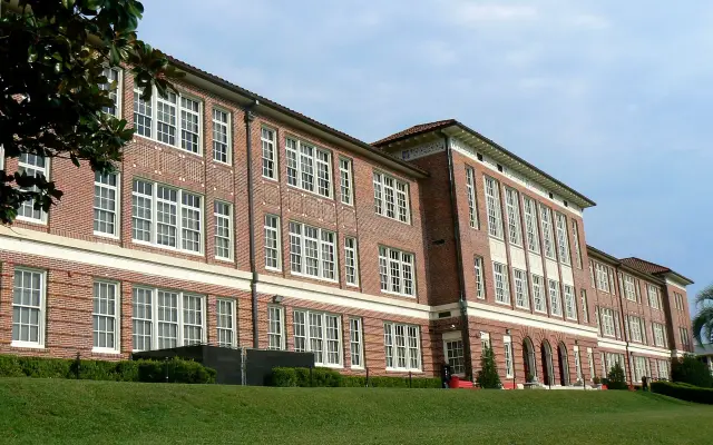
Gifford Middle School, 4530 28th Court, serves grades 6-8 from 8:10 am to 2:51 pm, phone 772-564-3550 (Gifford Middle School website), and its 2025-26 FLDOE row reads A under Grade 2026 (FLDOE 2025-26 grades workbook). The Gifford Middle School guide and the Treasure Coast Technical College guide cover those campuses, and the Gifford community history guide covers the settlement's story.
Frequently asked questions
Is Gifford, Florida part of Vero Beach?
No. Gifford is an unincorporated Census designated place in Indian River County. Its addresses carry Vero Beach mailing names, and the county's Gifford Neighborhood Plan places it in the unincorporated portion of Indian River County.
What is the population of Gifford, FL?
The ACS 2020-2024 5-year estimates put Gifford CDP at 4,668 residents, with a median age of 31.7 years and 1,682 households.
What county is Gifford, Florida in?
Indian River County. The county plan places Gifford in unincorporated Indian River County, whose Board of County Commissioners lists 1801 27th Street, Vero Beach, as its address, and the county prepared the Gifford Neighborhood Plan.
How big is Gifford, Florida?
The 2024 Census gazetteer gives Gifford CDP 2.718 square miles of land and no water area. The county plan area, measured through Census Tract 503.02, follows different boundaries.
What parks are in Gifford?
County parks in Gifford include the Victor Hart Sr. Community Enhancement Complex on 43rd Avenue, the MLK, Jr. Walking Trail and Park on 45th Street, Hosie Shumann Park on 39th Street and Gifford Dock on the Indian River Lagoon.
Sources
- ACS 2020-2024 5-year DP05, Gifford CDP https://data.census.gov/api/access/data/table?id=ACSDP5Y2024.DP05&g=160XX00US1225925 Used for: population, sex, median age, 65+
- ACS 2020-2024 5-year DP02, Gifford CDP https://data.census.gov/api/access/data/table?id=ACSDP5Y2024.DP02&g=160XX00US1225925 Used for: households, household size, education, broadband
- ACS 2020-2024 5-year DP03, Gifford CDP https://data.census.gov/api/access/data/table?id=ACSDP5Y2024.DP03&g=160XX00US1225925 Used for: income, labor force, poverty, commute
- ACS 2020-2024 5-year DP04, Gifford CDP https://data.census.gov/api/access/data/table?id=ACSDP5Y2024.DP04&g=160XX00US1225925 Used for: housing units, tenure, value, rent
- 2024 Census Gazetteer, Florida places https://www2.census.gov/geo/docs/maps-data/data/gazetteer/2024_Gazetteer/2024_gaz_place_12.txt Used for: land and water area
- Census geocoder, 4530 28th Court https://geocoding.geo.census.gov/geocoder/geographies/onelineaddress?benchmark=Public_AR_Current&vintage=Current_Current&layers=Incorporated%20Places,Census%20Designated%20Places&format=json&address=4530%2028th%20Court%2C%20Vero%20Beach%2C%20FL%2032967 Used for: Gifford CDP check
- Gifford Neighborhood Plan Update, Indian River County https://www.indianriver.gov/services/community_development/gifford_neighborhood_plan_update.php Used for: plan origin and partners, report cards
- Gifford Neighborhood Plan 2014 (PDF), Indian River County https://www.indianriver.gov/Document%20Center/Services/Planning-and-Development/45th%20Street/2014-Gifford-Neighborhood-Plan.pdf Used for: tract, population history, utilities, stormwater, objectives, residential land
- Victor Hart Sr. Community Enhancement Complex, Indian River County https://indianriver.gov/business_detail_T21_R32.php Used for: park facts, county contact block
- MLK, Jr. Walking Trail & Park, Indian River County https://indianriver.gov/business_detail_T21_R18.php Used for: park facts
- Hosie Shumann Park, Indian River County https://indianriver.gov/business_detail_T21_R16.php Used for: park facts
- Gifford Dock, Indian River County https://indianriver.gov/business_detail_T21_R5.php Used for: dock facts
- FEMA NFIP Community Status Book API https://www.fema.gov/api/open/v1/NfipCommunityStatusBook?$filter=state%20eq%20%27FL%27%20and%20contains(communityName,%27INDIAN%20RIVER%27) Used for: community 120119, CRS class
- Gifford Middle School website https://gms.indianriverschools.org/ Used for: address, grades, hours, phone
- FLDOE 2025-26 School Grades workbook https://www.fldoe.org/file/18534/SchoolGrades26.xlsx Used for: Gifford Middle School grade
Published by Rytas Dirse, Solo Founder & AI Architect
Built with AI, held to quality gates. US sources, US brands, facts only.
How this page was made
Digital Towns uses AI assistance to research and write its guides, and every page is only as good as the sources it cites. Our goal is the most accurate, useful local information possible.
If you see an error, or anything you can show is false, tell us right away and we will take a third look.
Report an error
Thank you. We'll take a third look and correct the page if it's wrong.