Short answer: The Treasure Coast Regional Planning Council defines the Treasure Coast as Indian River, St. Lucie, Martin and Palm Beach counties, with 110 miles of shoreline from Boca Raton north to the Sebastian Inlet and 2,139,636 residents. These guides cover St. Lucie and Indian River counties: Fort Pierce, Port St. Lucie, St. Lucie Village, Vero Beach and Sebastian, the Indian River Lagoon, the barrier island beaches along A1A, and Indian River citrus.
Last verified: October 22, 2026, against the sources listed at the end of this page.
What is the Treasure Coast, and where does it begin and end?
The Treasure Coast is the stretch of Florida's Atlantic coast that the Treasure Coast Regional Planning Council defines as four counties, Indian River, St. Lucie, Martin and Palm Beach, running from Boca Raton north to the Sebastian Inlet.
The council's home page says each of the four counties borders the Atlantic Ocean, with a total shoreline of 110 miles from Boca Raton in the south stretching north to the Sebastian Inlet, and that two of them are bounded by Lake Okeechobee (Treasure Coast Regional Planning Council). The same page gives the region a total of 3,589 square miles in its summary text and 3,588 square miles of land in its by-the-numbers panel, along with a population of 2,139,636. The council, based at 421 SW Camden Avenue in Stuart, marks 50 years of regional work on that page. Last verified: October 22, 2026, against the planning council home page, two Census Bureau metro tables, the FDOT scenic highway record and DEP lagoon pages.
Digital Towns uses the name more narrowly. These Treasure Coast guides cover St. Lucie County and Indian River County, the two counties at the north end of the council's region; Martin and Palm Beach counties make up the rest of the planning region and are outside these guides. The northern edge is shared with the Sebastian guides, which already cover the Sebastian Inlet, its jetties and its state park.
Which counties and towns do the Treasure Coast guides cover?
The Treasure Coast guides cover St. Lucie County, home to Fort Pierce, Port St. Lucie and St. Lucie Village, and Indian River County, whose Census metro area is named for Sebastian and Vero Beach.
St. Lucie County's website lists three local governments in its government links: the City of Fort Pierce, the City of Port St. Lucie and St. Lucie Village (St. Lucie County home page). The Census Bureau groups St. Lucie County with Martin County in the Port St. Lucie, FL Metro Area, and treats Indian River County as its own metro area under the name Sebastian-Vero Beach-West Vero Corridor (ACS table for the Port St. Lucie metro area, ACS table for the Sebastian-Vero Beach-West Vero Corridor metro area).
Each Treasure Coast town also has its own Digital Towns profile. The Fort Pierce, Port St. Lucie, St. Lucie County, Vero Beach, Sebastian and Indian River County profiles answer questions about local government, schools and utilities, while this regional root collects the subjects that cross the county line, such as the barrier island beaches, the Indian River Lagoon, the scenic highway and Indian River citrus.
How many people live on the Treasure Coast covered here?
The Census Bureau's 2020-2024 American Community Survey counts 522,676 people in the Port St. Lucie metro area and 166,936 in the Sebastian-Vero Beach-West Vero Corridor metro area, the two Census areas that hold the counties these guides cover.
The ACS 2020-2024 5-year DP05 table puts the median age of the Port St. Lucie, FL Metro Area at 47.6 years, with 26.9 percent of residents 65 or older (ACS DP05, Port St. Lucie metro area). For Indian River County's metro area the same table gives a median age of 55.3 and 34.8 percent of residents 65 or older (ACS DP05, Sebastian-Vero Beach-West Vero Corridor metro area). The Port St. Lucie metro figure includes Martin County, which is outside these guides, so it is not a St. Lucie County count.
| Census metro area | Counties | Population | Median age | 65 and older | Source |
|---|---|---|---|---|---|
| Port St. Lucie, FL Metro Area | St. Lucie, Martin | 522,676 | 47.6 | 26.9 percent | ACS DP05 |
| Sebastian-Vero Beach-West Vero Corridor, FL Metro Area | Indian River | 166,936 | 55.3 | 34.8 percent | ACS DP05 |
| Treasure Coast planning region (council figure) | Indian River, St. Lucie, Martin, Palm Beach | 2,139,636 | Not given | Not given | TCRPC |
What are the Indian River Lagoon and the Treasure Coast barrier island?
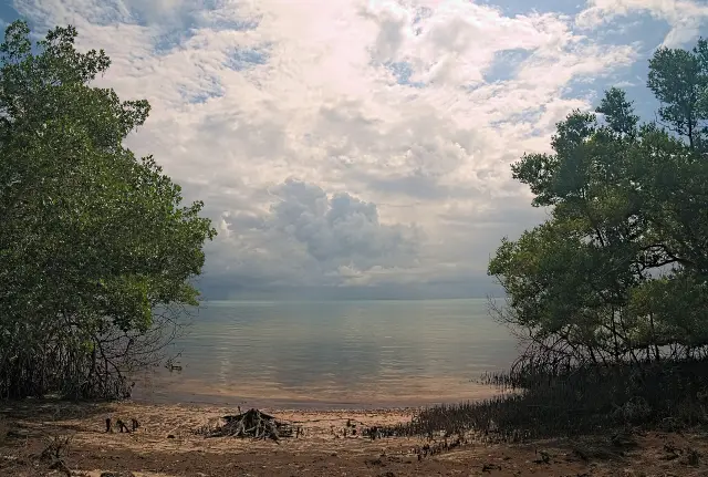
A long, shallow lagoon, the Indian River Lagoon, separates the Treasure Coast mainland from a chain of barrier islands, Orchid Island in Indian River County and Hutchinson Island in St. Lucie County, where A1A and the beaches run.
The Florida Department of Environmental Protection manages the lagoon between Vero Beach and Fort Pierce as the Indian River-Vero Beach to Fort Pierce Aquatic Preserve, set up in 1969 and covering 11,000 acres of shallow estuary, barrier island and spoil islands in Indian River and St. Lucie counties (DEP Indian River-Vero Beach to Fort Pierce Aquatic Preserve page). The same page says the preserve is open 24/7 through access points run by other agencies, and that recorded archaeological sites along the lagoon date from 10,000 BC to 1700 AD, including the Spanish Fleet Survivors and Salvors Camp and the Jungle Trail.
That preserve is one piece of a larger system. DEP's Indian River Lagoon Aquatic Preserves management plan groups the Banana River, Indian River-Malabar to Vero Beach, Indian River-Vero Beach to Ft. Pierce and Jensen to Jupiter Inlet preserves across Brevard, Indian River, St. Lucie, Martin and Palm Beach counties, with a total of 91,000 acres and 35,898 acres of seagrass bed (DEP Indian River Lagoon aquatic preserves plan). The Hutchinson Island beaches guide, the Pepper Park guide and the Fort Pierce Inlet State Park guide cover the St. Lucie side of the barrier island, and the Orchid Island beach parks guide covers the Indian River County side.
How do A1A and US 1 tie the Treasure Coast together?
A1A on the barrier island and US 1 on the mainland form the Indian River Lagoon-Treasure Coast Scenic Highway, a 42 mile state scenic highway designated on December 14, 2005.
The Florida Scenic Highways Program page lists the byway at 42 miles in FDOT District 4 and explains that US 1 carries it through Fort Pierce and Port St. Lucie on the mainland while A1A follows the Atlantic Ocean on the barrier island (Florida Scenic Highways Program page). The program says the route can be reached from I-95 south of Vero Beach and that the center axis of the byway is in Fort Pierce. It describes the Indian River Lagoon along the route as home to more than 4,000 species of plants and animals, including 50 species that are endangered or threatened.
For a driver, the scenic highway is also the thread that links many of the Treasure Coast guides. Pepper Park, for example, carries a 3302 North SR A1A address in Fort Pierce (St. Lucie County Pepper Park page), and A1A is the barrier island half of the scenic highway, while the mainland half of the route on US 1 passes through the two St. Lucie County cities named on the program page, Fort Pierce and Port St. Lucie (Florida Scenic Highways Program page).
Why is the Treasure Coast called Indian River citrus country?
Florida law reserves the Indian River name for citrus grown inside a statutory production area whose boundary runs south past Brevard County to the southwest corner of St. Lucie County, and USDA ranks St. Lucie County among the state's top citrus producing counties.
Florida Statute 601.091 says only citrus fruit grown within a specified production area may be labeled with that area's name, and it draws the Indian River production area from the Flagler and Volusia county line south along the St. Johns River and its lakes, through Brevard County, to the southwest corner of St. Lucie County and on south to the West Palm Beach Canal (Florida Statutes 601.091). The statute keeps an exception for court orders from legal proceedings begun before July 1, 1976.
Production numbers come from the USDA. The National Agricultural Statistics Service's preliminary 2025-2026 citrus summary lists St. Lucie County at 1,395 thousand boxes of citrus, including 739 thousand boxes of grapefruit, and names St. Lucie among the top 5 producing counties at 1.40 million boxes (USDA NASS Citrus Summary 2025-2026). Indian River County is listed at 659 thousand boxes, of which 369 thousand are grapefruit. The Indian River citrus district history guide, the Indian River grapefruit guide, the Honeybell oranges guide and the Florida orange season guide explain the varieties, seasons and shipping rules.
Which Treasure Coast guide answers which question?
The Treasure Coast guides are grouped by subject: parks and beaches, fishing and boating, history, the lagoon and sea turtles, and Indian River citrus.
For beaches and parks on the Treasure Coast, start with the parks section: it covers Pepper Park, Fort Pierce Inlet State Park, the St. Lucie County beaches on Hutchinson Island, Savannas Preserve State Park, the Indian River County beach parks on Orchid Island, and the rules for dogs and horses on the sand. For time on the water, the recreation guides cover the Fort Pierce jetty and inlet, St. Lucie County boat ramps, artificial reefs and public fishing piers, and the Clover Park guide covers spring training in Port St. Lucie.
For the past, the history guides cover the Urca de Lima underwater preserve off Fort Pierce, the World War II Navy Frogmen training at Fort Pierce, and the Indian River citrus district. The environment guides cover sea turtle nesting season, the aquatic preserves of the Indian River Lagoon and the Fort Pierce Inlet, and the citrus guides cover Honeybell oranges, the orange season, Indian River grapefruit and shipping Florida citrus. The live Sebastian, Vero Beach and Indian River County guides answer the same questions for the north end of the Treasure Coast.
Frequently asked questions
Which counties are in the Treasure Coast?
The Treasure Coast Regional Planning Council lists four counties: Indian River, St. Lucie, Martin and Palm Beach. The Digital Towns Treasure Coast guides cover St. Lucie and Indian River counties.
Where does the Treasure Coast start and end?
The planning council describes 110 miles of shoreline running from Boca Raton in the south north to the Sebastian Inlet.
How many people live on the Treasure Coast?
The planning council gives its four county region a population of 2,139,636. The Census Bureau ACS 2020-2024 estimates count 522,676 in the Port St. Lucie metro area and 166,936 in the Sebastian-Vero Beach-West Vero Corridor metro area.
What is the Indian River Lagoon-Treasure Coast Scenic Highway?
It is a 42 mile Florida scenic highway on A1A and US 1, designated December 14, 2005 in FDOT District 4, with its center axis in Fort Pierce.
Is Indian River citrus grown on the Treasure Coast?
Yes. Florida Statute 601.091 draws the Indian River citrus production area boundary to the southwest corner of St. Lucie County, and USDA lists St. Lucie County at 1,395 thousand boxes in the 2025-2026 season.
Sources
- Treasure Coast Regional Planning Council home page https://www.tcrpc.org/ Used for: region definition, counties, shoreline, population, area
- ACS 2020-2024 5-year DP05, Port St. Lucie, FL Metro Area (U.S. Census Bureau) https://data.census.gov/api/access/data/table?id=ACSDP5Y2024.DP05&g=310XX00US38940 Used for: population, median age, 65 and over
- ACS 2020-2024 5-year DP05, Sebastian-Vero Beach-West Vero Corridor, FL Metro Area (U.S. Census Bureau) https://data.census.gov/api/access/data/table?id=ACSDP5Y2024.DP05&g=310XX00US42680 Used for: population, median age, 65 and over
- Indian River Lagoon-Treasure Coast Scenic Highway (Florida Scenic Highways Program, FDOT) https://floridascenichighways.com/our-byways/southern-region/indian-river-lagoon-treasure-coast/ Used for: length, designation, route
- St. Lucie County home page https://www.stlucieco.gov/ Used for: local governments in the county
- Indian River-Vero Beach to Fort Pierce Aquatic Preserve (FDEP) https://floridadep.gov/rcp/aquatic-preserve/locations/indian-river-vero-beach-fort-pierce-aquatic-preserve Used for: lagoon preserve facts
- Indian River Lagoon Aquatic Preserves System Management Plan (FDEP) https://floridadep.gov/sites/default/files/Indian-River-Lagoon-AP-System-Management-Plan.pdf Used for: system acreage and seagrass
- Florida Statutes 601.091 https://www.flsenate.gov/Laws/Statutes/2025/601.091 Used for: Indian River citrus production area
- Citrus Summary 2025-2026 preliminary (USDA NASS Florida) https://www.nass.usda.gov/Statistics_by_State/Florida/Publications/Citrus/Citrus_Summary/Citrus_Summary_Prelim/cit082726.pdf Used for: county citrus production
- Pepper Park Beachside (St. Lucie County) https://www.stlucieco.gov/things-to-do/recreation/beaches/pepper-park-beachside Used for: Pepper Park address 3302 North SR A1A
Published by Rytas Dirse, Solo Founder & AI Architect
Built with AI, held to quality gates. US sources, US brands, facts only.
How this page was made
Digital Towns uses AI assistance to research and write its guides, and every page is only as good as the sources it cites. Our goal is the most accurate, useful local information possible.
If you see an error, or anything you can show is false, tell us right away and we will take a third look.
Report an error
Thank you. We'll take a third look and correct the page if it's wrong.
