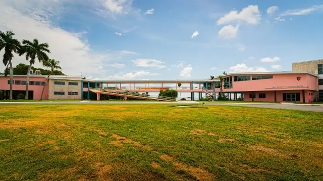
Short answer: Port St. Lucie is a 120 square mile city in St. Lucie County, incorporated on April 27, 1961, with 232,491 residents in the Census Bureau's ACS 2020-2024 estimates. A five-member council and an appointed City Manager run it from City Hall at 121 SW Port St. Lucie Blvd. (772-871-1775). Tradition and St. Lucie West sit inside the city but outside the original platted city, and hurricane season runs June 1 through November 30.
Last verified: October 22, 2026, against the sources listed at the end of this page.
Where is Port St. Lucie, and what county is it in?
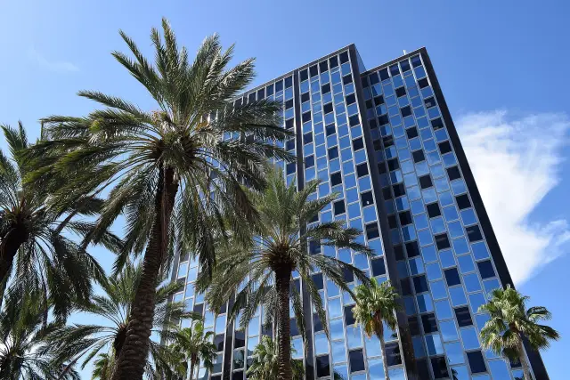
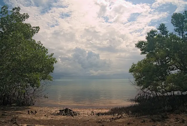
Port St. Lucie is a city of 120 square miles in St. Lucie County on Florida's east coast, about 50 miles north of West Palm Beach.
The City of Port St. Lucie states that it was incorporated on April 27, 1961 and occupies 120 square miles in St. Lucie County, and it places the city about 50 miles north of West Palm Beach, halfway between Miami and Orlando (City of Port St. Lucie About page). City Hall sits at 121 SW Port St. Lucie Blvd. in ZIP code 34984, and the city's main phone line, 772-871-1775, is printed in the footer of the city About page. The same About page describes Port St. Lucie as the largest city between Orlando and Miami.
The city reaches across Interstate 95. The planning department's FAQ lists the properties west of I-95, including Tradition, Southern Grove, Western Grove, Riverland and Wilson Groves, among the areas outside the original platted city (Port St. Lucie growth and development FAQ).
St. Lucie County runs countywide services that Port St. Lucie residents also use, such as the Alert St. Lucie notification system and the county shelter and evacuation program (St. Lucie County Emergency Preparedness Portal). The Port St. Lucie government and utilities sections explain which office handles each service.
How many people live in Port St. Lucie?
The Census Bureau's ACS 2020-2024 5-year estimates count 232,491 people in Port St. Lucie, with a median age of 43.9 (ACS DP05 for Port St. Lucie city).
The city publishes larger and smaller numbers of its own, and the official figures do not agree. The About page opens with more than 260,000 residents, while its Population and Location tab cites a 2020 Census Bureau estimate of over 204,851 residents (About PSL). The planning department's FAQ says Port St. Lucie grew from less than 300 people in 1961 to over 260,000 in 2025 (growth and development FAQ). The ACS figure is a 2020-2024 5-year estimate, and the table below lists it beside the other ACS measures for the city.
| Measure | Port St. Lucie estimate | ACS table |
|---|---|---|
| Total population | 232,491 | DP05 |
| Median age | 43.9 | DP05 |
| Residents 65 and older | 21.8% | DP05 |
| Median household income | $80,648 | DP03 |
| Mean travel time to work | 30.5 minutes | DP03 |
| Housing units | 90,911 (83,952 occupied) | DP04 |
| Owner-occupied homes | 84.0% | DP04 |
| Median value, owner-occupied homes | $369,200 | DP04 |
| Median gross rent | $1,937 | DP04 |
In that survey, 21.8% of Port St. Lucie residents were 65 or older (DP05). Median household income was $80,648 and the mean commute was 30.5 minutes (ACS DP03 for Port St. Lucie city). The ACS counted 90,911 housing units, 83,952 of them occupied; owners held 84.0% of occupied homes, the median owner-occupied value was $369,200 and median gross rent was $1,937 (ACS DP04 for Port St. Lucie city). Last verified: October 22, 2026, with the Port St. Lucie population figures re-read from the three ACS 2020-2024 tables, the city About page and the planning FAQ.
How did Port St. Lucie start, and why is it called a platted community?
Port St. Lucie began in 1961 as a city incorporated by a development group selling quarter-acre lots to retirees, on land its developer had platted mostly into single-family lots.
The city's own history page says Port St. Lucie was incorporated in 1961 by a development group with a goal to sell quarter-acre lots to retirees, and that it was formed without sidewalks, streetlights, water and sewer (City of Port St. Lucie history story). The same page notes that, unlike neighboring cities, Port St. Lucie has no historic downtown built near the old Flagler railroad stops.
The planning department fills in the developer and the timeline. General Development Corporation (GDC) developed 66 square miles into primarily single-family lots with minimal infrastructure such as roads and drainage, which is why the city is called a platted community, and that platting began in the 1950s and continued through the 1980s (Port St. Lucie Planning and Zoning FAQ). GDC brought only the land it owned into the city in 1961. The first Comprehensive Plan was approved in 1980; in the early 1980s the state adopted legislation requiring legally binding plans, and the first plan adopted by ordinance followed in 1983. The FAQ adds that a state DCA decision found certain areas platted by GDC grandfathered or vested to single-family use notwithstanding later plan changes.
Are Tradition and St. Lucie West part of Port St. Lucie?
Yes, Tradition and St. Lucie West are both inside the City of Port St. Lucie, but neither belongs to the original platted city, and St. Lucie West has its own services district.
The planning FAQ lists St. Lucie West, the properties west of I-95 (Tradition, Southern Grove, Western Grove, Riverland and Wilson Groves) and some properties along US 1 as areas that are not considered part of the original platted city (growth and development FAQ).
A city fact sheet describes Southern Grove as a 3,605-acre Development of Regional Impact south of Tradition Parkway, part of an 8,200-acre region known to the public and marketed as Tradition; the Southern Grove section runs south of Tradition Parkway and north of the Martin County line by Becker Road (Southern Grove fact sheet). The same fact sheet describes Western Grove as the undeveloped western region of Tradition, 1,593 acres that can eventually hold 4,000 residential units, and it says the Southern Grove commercial land has long been envisioned as the city's future jobs corridor.
St. Lucie West is served by the St. Lucie West Services District, which its own site describes as a community development district overseeing St. Lucie West; its Florida Administrative Code chapter 42I-1 rules on creation, boundary and supervisors carry an effective date of 1/1/1990 (Florida Administrative Code chapter 42I-1). The district's site covers drinking water, wastewater treatment and reuse, an irrigation water schedule, lake upkeep and stormwater drainage for St. Lucie West (St. Lucie West Services District). The district runs its own billing and customer service for St. Lucie West accounts.
| Area | What the source says | Source |
|---|---|---|
| Tradition | 8,200-acre region known to the public and marketed as Tradition | Southern Grove fact sheet |
| Southern Grove | 3,605-acre DRI south of Tradition Parkway | Southern Grove fact sheet |
| Western Grove | 1,593 acres, up to 4,000 residential units | Southern Grove fact sheet |
| St. Lucie West | St. Lucie West Services District rules on creation, boundary and supervisors effective 1/1/1990 | Florida Administrative Code 42I-1 |
How is Port St. Lucie governed?
Port St. Lucie has a council-manager government: a five-member elected City Council sets policy and appoints a City Manager to run daily operations and a City Attorney for legal advice.
The Mayor and City Council page explains the structure. Each council member, including the Mayor, has one vote, so legislative authority is spread equally among all five members (Port St. Lucie Mayor and City Council page). Council members must live in the district they represent, but residents throughout Port St. Lucie vote for every council seat, and the Mayor is elected at large and can live anywhere in the city. The Mayor and council members serve 4-year staggered terms.
The council office can be reached at 772-871-5159 (alternate 772-871-1775) at Port St. Lucie City Hall, 121 SW Port St. Lucie Blvd. The council page also links a council district map, the council rules and the city strategic plan. The Port St. Lucie government section covers how the departments are organized, how public records requests and city jobs work, and which office to call first.
What is changing in Port St. Lucie?
Three city items are dated on official pages: a lower property tax rate for FY 2026-27, a $65 million upgrade of the Westport wastewater plant and the 110-acre Tradition Regional Park.
At its annual Summer Workshop held July 22-23, the Port St. Lucie City Council approved a property tax (millage) rate of 4.8750 for FY 2026-27, a decrease from 4.9750 in FY 2025-26, which the city's July 24, 2026 announcement calls the 11th consecutive year of lower millage (City of Port St. Lucie millage announcement). According to the same announcement, the FY 2026-27 budget year began Oct. 1, 2026.
Port St. Lucie Utility Systems lists the Westport Wastewater Treatment Facility Upgrade as a $65 million project with construction running from January 2024 to Summer 2027, funded in part by a federal grant; the page reports it 54% complete and says Westport has the capacity to treat 6 million gallons per day (Westport upgrade project page). The upgrade targets nutrient reduction in treated wastewater.
On the west side, Tradition Regional Park at 13120 SW Tradition Parkway spans 110 acres near the Fern Lake Roundabout, and the city estimates completion by late 2026 or early 2027 (Tradition Regional Park page). Its signature feature is the PSL BMX facility, with baseball, softball, soccer and multipurpose fields, trails and a canoe and kayak launch planned around it. The park line is 772-878-2277.
What should Port St. Lucie residents know about hurricanes and flooding?
Hurricane season in Port St. Lucie runs June 1 through November 30, alerts come through St. Lucie County's Alert St. Lucie system, and flood insurance policies in the city carry a Community Rating System discount.
The Port St. Lucie Office of Emergency Management says the hurricane season runs from June 1 through November 30, asks residents to prepare before it begins, and posts storm updates on the city homepage and social media when a storm threatens (Port St. Lucie Hurricanes and Storms page). It points residents to sign up for St. Lucie County emergency notifications at stlucieco.gov/alert and recommends a supply kit with food and water for at least 1 week. The county's portal describes Alert St. Lucie as texts, emails or phone calls about major traffic accidents, weather alerts and other issues from area public safety and law enforcement agencies, and it hosts the shelter list, evacuation notices and a secure registry for family members with special needs (St. Lucie County Emergency Preparedness Portal).
Evacuation orders in Port St. Lucie go by lettered zone. The state evacuation zone program run by the Florida Division of Emergency Management explains that Zone A is typically the most vulnerable and the most likely to evacuate first (state evacuation zone page), and the city page links an interactive zone locator map that shows the evacuation zone for a Port St. Lucie address.
For flood insurance, FEMA's Community Status Book lists the City of Port St. Lucie (community 120287) as participating in the National Flood Insurance Program with a Community Rating System class of 5, worth a 25% discount on policies in the special flood hazard area and 10% outside it, and a currently effective flood map dated 02/19/20 (FEMA NFIP Community Status Book). The Port St. Lucie hurricane preparedness guide and the flood zones and flood insurance guide cover each step in detail.
Frequently asked questions
What county is Port St. Lucie in?
Port St. Lucie is in St. Lucie County on Florida's east coast. The city says it occupies 120 square miles of the county and was incorporated on April 27, 1961.
What is the population of Port St. Lucie?
The Census Bureau's ACS 2020-2024 5-year estimates put Port St. Lucie at 232,491 people with a median age of 43.9. The city's own pages cite more than 260,000 residents, and the city About page also cites a 2020 Census Bureau estimate of over 204,851.
Is Tradition in Port St. Lucie?
Yes. The city planning FAQ lists Tradition among the Port St. Lucie properties west of I-95, and a city fact sheet describes an 8,200-acre region marketed as Tradition that takes in Southern Grove and Western Grove.
Who provides water in St. Lucie West?
The St. Lucie West Services District, a community development district whose creation rule sits in Florida Administrative Code chapter 42I-1, covers drinking water, wastewater, irrigation water and stormwater drainage on its site for St. Lucie West. It runs its own billing and customer service.
How is the Port St. Lucie mayor elected?
The Mayor of Port St. Lucie is elected at large in a citywide vote, can live anywhere in the city and has one vote on the five-member City Council. The Mayor and council members serve 4-year staggered terms.
Sources
- About PSL, City of Port St. Lucie https://www.cityofpsl.com/Government/Discover-Us/About-PSL Used for: incorporation date, 120 square miles, city population statements, location
- ACS 2020-2024 5-year DP05, Port St. Lucie city, Florida (U.S. Census Bureau) https://data.census.gov/api/access/data/table?id=ACSDP5Y2024.DP05&g=160XX00US1258715 Used for: population, median age, 65 and older
- ACS 2020-2024 5-year DP03, Port St. Lucie city, Florida (U.S. Census Bureau) https://data.census.gov/api/access/data/table?id=ACSDP5Y2024.DP03&g=160XX00US1258715 Used for: median household income, mean travel time to work
- ACS 2020-2024 5-year DP04, Port St. Lucie city, Florida (U.S. Census Bureau) https://data.census.gov/api/access/data/table?id=ACSDP5Y2024.DP04&g=160XX00US1258715 Used for: housing units, occupancy, owner share, home value, rent
- City history story page, City of Port St. Lucie https://www.cityofpsl.com/News-Stories/Our-Story Used for: 1961 incorporation by a development group, quarter-acre lots, missing infrastructure
- Growth and development FAQ, Port St. Lucie Planning and Zoning https://www.cityofpsl.com/Government/Your-City-Government/Departments/Planning-Zoning/Our-Growth-Development Used for: GDC 66 square miles, platting 1950s to 1980s, 1980 and 1983 comprehensive plans, areas outside the plat, population growth
- Southern Grove fact sheet (PDF), Port St. Lucie Community Redevelopment https://www.cityofpsl.com/files/assets/public/v/1/departments/community-redevelopment/documents/southern-grove-fact-sheet.pdf Used for: Tradition 8,200 acres, Southern Grove 3,605 acres, Western Grove 1,593 acres and 4,000 units
- Florida Administrative Code chapter 42I-1, St. Lucie West Services District (Florida Department of State) https://www.flrules.org/gateway/ChapterHome.asp?Chapter=42I-1 Used for: district rules for creation, boundary and supervisors effective 1/1/1990
- St. Lucie West Services District home page https://www.slwsd.org/ Used for: water, wastewater, irrigation water, lakes and stormwater services
- Mayor and City Council, City of Port St. Lucie https://www.cityofpsl.com/Government/Your-City-Government/Mayor-City-Council Used for: five-member council, council-manager form, district residency, at-large voting, four-year staggered terms, phone
- City Council lowers millage rate for 11th straight year (City of Port St. Lucie, July 24, 2026) https://www.cityofpsl.com/News-Stories/2026/Port-St.-Lucie-City-Council-lowers-millage-rate-for-11th-straight-year Used for: FY 2026-27 millage 4.8750, prior 4.9750, budget effective Oct. 1, 2026
- Westport Wastewater Treatment Facility Upgrade Project, Port St. Lucie Utility Systems https://www.cityofpsl.com/Government/Your-City-Government/Departments/Utility-Systems/Utility-Projects-Programs/Westport-Wastewater-Treatment-Facility-Upgrade-Project Used for: $65 million, January 2024 to Summer 2027, 54% complete, 6 million gallons per day
- Tradition Regional Park (Coming Soon), Port St. Lucie Parks and Recreation https://www.cityofpsl.com/Government/Your-City-Government/Departments/Parks-Recreation/Parks/Tradition-Regional-Park Used for: 110 acres, completion estimate, PSL BMX, address
- Hurricanes and Storms, Port St. Lucie Office of Emergency Management https://www.cityofpsl.com/Government/Your-City-Government/Departments/Emergency-Management/Hurricanes-and-Storms Used for: season dates, Alert St. Lucie sign-up, Know Your Zone map, one-week kit
- NFIP Community Status Book, community 120287 (FEMA) https://www.fema.gov/api/open/v1/NfipCommunityStatusBook?$filter=communityIdNumber%20eq%20%27120287%27 Used for: NFIP participation, CRS class 5, 25% and 10% discounts, map dates
- Emergency Preparedness Portal, St. Lucie County https://www.stlucieco.gov/departments-and-services/public-safety/emergency-readiness-portal Used for: Alert St. Lucie notifications, shelters, Know Your Zone, secure registry
- Know Your Zone, Know Your Home, Florida Division of Emergency Management https://www.floridadisaster.org/knowyourzone/ Used for: zone lettering, Zone A evacuates first
Published by Rytas Dirse, Solo Founder & AI Architect
Built with AI, held to quality gates. US sources, US brands, facts only.
How this page was made
Digital Towns uses AI assistance to research and write its guides, and every page is only as good as the sources it cites. Our goal is the most accurate, useful local information possible.
If you see an error, or anything you can show is false, tell us right away and we will take a third look.
Report an error
Thank you. We'll take a third look and correct the page if it's wrong.
