Short answer: Cedar Point Preserve is 618 acres of City of Jacksonville conservation land on Cedar Point Road, joined since a 245-foot trail bridge was finished in summer 2018 to the National Park Service's 400-acre Cedar Point at the south end of Black Hammock Island. The federal side held a mission village from 1684, a tabby salt plantation built by enslaved workers, and Buddy's Fish Camp from the 1920s to the 1990s.
Last verified: October 18, 2026, against the sources listed at the end of this page.
What is Cedar Point Preserve?
Cedar Point Preserve is a 618-acre City of Jacksonville conservation area on Cedar Point Road whose trails connect by bridge to the National Park Service's Cedar Point on Black Hammock Island.
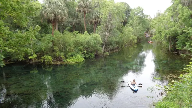
The City of Jacksonville places the preserve 10 miles northeast of downtown Jacksonville and describes oak hammocks, pine flatwoods and a freshwater marsh system surrounded by an intricate salt marsh ecosystem. The National Park Service manages Cedar Point itself, approximately 400 acres at the south end of Black Hammock Island, where visitors can reach both upland hammocks and salt marsh by land and water.
A 245-foot trail bridge over Pumpkin Hill Creek, completed in summer of 2018, connects the City's 7.3 miles of trails to the Park Service property's additional 4.4 miles of hiking and biking trails, the City says. Both sit inside the Timucuan Ecological and Historic Preserve, which the Park Service says was established by 1988 legislation and today encompasses 46,000 acres within the city limits of Jacksonville. The same Park Service page records that the Cedar Point boat ramp area was added to the park in 1997, and that federal ownership amounts to 8,430 acres, just 18 percent of the preserve.
| Item | Cedar Point Preserve (City) | Cedar Point (National Park Service) |
|---|---|---|
| Size | 618 acres (JaxParks) | Approximately 400 acres (NPS) |
| Trails | 7.3 miles for hikers, off-road bicyclists and horseback riders | An additional 4.4 miles of hiking and biking trails |
| Address | Fitzpatrick Creek Trailhead, 7116 Cedar Point Road; Black Hammock Island Trailhead, 8318 Cedar Point | 9023 Cedar Point Road, Jacksonville, Florida 32218 (NPS directions) |
| Hours and fees | Open sunrise, closed at sundown | No entrance pass required for the Timucuan Preserve (NPS fees) |
| Water access | Shore launch and fishing listed among amenities | Boat ramp, canoe, kayak and small boat launch, dock or pier |
Where is Cedar Point, and how is it reached?
Both Cedar Point properties are reached by Cedar Point Road, which the Park Service route follows from New Berlin Road out to the end of Black Hammock Island.
The Park Service directions start from I-95 at the I-295 East Beltway (Exit 362 A), leave I-295 at Heckscher Drive (Exit 41), and follow Heckscher Drive about one-fourth mile to the traffic signal at New Berlin Road. New Berlin Road leads to a triangle intersection with Cedar Point Road, which bears right at Black Hammock Island and continues to the end of the road, where the Cedar Point boat ramp is on the left. From the Arlington area the Park Service routes drivers north on I-295 across the St. Johns River on the Napoleon Bonaparte Broward Bridge at Dames Point to the same Heckscher Drive exit.
The City's preserve has two trailhead parking areas on the way in. According to the City, Fitzpatrick Creek Trailhead, at 7116 Cedar Point Road, is on the south side of Cedar Point Road just west of Pumpkin Hill Road, and the Black Hammock Island Trailhead is approximately 1.2 miles further east. The City lists the preserve as open at sunrise and closed at sundown, and the Park Service lists the Cedar Point phone as 904.641.7155.
Who lived at Cedar Point before the plantations?
Archeological finds show people at Cedar Point for at least 4,000 years, according to a Park Service exhibit on Black Hammock Island.
The Park Service exhibit Sifting through the Past names broken pottery, brass ornaments and strings of beads made from shell and bone among those finds, and says that when Europeans arrived in the 1500s the people living at Cedar Point spoke a dialect of the Timucua language and fished, hunted and gathered oysters. For the wider Timucuan Preserve, the Park Service counts over 200 archeological sites providing evidence of over 6,000 years of human habitation.
In 1684, Spanish priests and about 300 Christian converts from Timucua-speaking tribes relocated their mission village from a nearby island to Cedar Point, the same exhibit states. Caught between England and Spain for control of the Atlantic coast, the mission at Cedar Point lasted only 12 years before relocating again. Another Park Service panel at the boat ramp notes that research on ancient shell middens at Cedar Point confirms the area has supported people and shellfish for thousands of years.
What is left of the Cedar Point plantation?
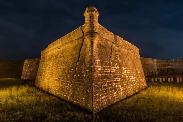
Tabby walls just off the blue trail on the Park Service side of Cedar Point are what remain of a 19th-century salt plantation.
The Park Service ruins page records that Cedar Point was heavily farmed as early as 1783, when the King of Spain granted it to the Samuel Mills family. The Fitzpatrick family acquired it in 1795 and started salt operations, followed by the Browards around 1848. During the Civil War the plantation's owners supplied salt to the Confederacy, and the owners' house and outbuildings, once visible from the St. Johns River, were shelled.
The labor was enslaved. The Park Service says at least fifteen skilled workers, held as slaves, constructed the main house, kitchen house and outbuildings of tabby, a concrete-like mixture made of oyster shells, and that enslaved people farmed and hunted the land, tended the household and boiled tons of salt from seawater. Archaeologists are systematically searching the Cedar Point area for artifacts of the daily lives of enslaved people, the Park Service adds.
Park Service photos from 2008 and 2020 show the Cedar Point walls before and after stabilization work by historic preservationists and masons, and because the ruins are unstable they are to be viewed from behind the marked signs. The exhibit at the ruins, Lives Etched in Salt and Oyster Shells, offers a reproduction tabby slab to touch in place of the fragile walls.
| Period | Use | Source |
|---|---|---|
| At least 4,000 years ago onward | Native villages; shell middens | NPS exhibits |
| 1684 to about 1696 | Spanish mission village of Timucua-speaking converts, lasting 12 years | NPS exhibits |
| 1783 | Spanish grant to the Samuel Mills family | NPS ruins |
| 1795 | Fitzpatrick family acquires the land and starts salt operations | NPS ruins |
| Around 1848 | Broward family ownership | NPS ruins |
| 20th century | Pine plantation, then Buddy's Fish Camp (1920s to 1990s) | NPS Cedar Point |
| 1997 | Cedar Point boat ramp area added to the Timucuan Preserve | NPS Timucuan |
What was Buddy's Fish Camp?
Buddy's Fish Camp was a popular boat launch and fishing destination at Cedar Point that lasted from the 1920s to the 1990s, the Park Service says.
The Park Service Cedar Point page says the area was managed as a pine plantation during the 20th century and later became a popular boat launch and fishing destination known as Buddy's Fish Camp. The Park Service's Fun Times at Fish Camp panel, at the end of the parking lot near the water, describes the routine: Buddy's would rent the boat, sell live bait, clean the catch and fry it, and anglers could spend the night in a rustic cabin.
The same panel lists flounder, sheepshead, black drum, croaker and redfish among favorite catches. The Cedar Point boat ramp at the same end of the road was refurbished and reopened with a ribbon cutting on August 25, 2009, according to a Park Service news release, which says the project was funded through the National Park Service Centennial Initiative with financial support from the City of Jacksonville.
What can be done at Cedar Point today?
Cedar Point offers hiking, off-road cycling and horseback riding on the City side, and hiking, biking, boating and birding on the Park Service side.
The City lists 7.3 miles of trails for hikers, off-road bicyclists and horseback riders, plus picnic facilities, wildlife viewing and scenic overlooks. On the federal side, the Park Service exhibits describe the Cedar Point Loop Trail through maritime hammock with views of the salt marsh and the ruins of an 1800s plantation, and the Pinelands Trail through pine uplands to the marsh alongside Cedar Point/Pumpkin Hill Creek. The Park Service says birdwatchers come to Cedar Point to see over 200 species of birds, including the painted bunting, and that the boat ramp is a popular launch site for boaters, kayakers and paddle boarders.
The City states that protecting Cedar Point Preserve maintains the salt marsh tidal creek ecosystem and the biological and hydrological functions of the upland forests, which provide habitat for many wintering and migratory birds. Park Service panels describe the change from open pine upland to maritime hammock of water oaks, magnolias and cabbage palms, and name ospreys, eagles, bobcats and white-tailed deer among the wildlife of Cedar Point's woods and marshes.
Cedar Point Preserve belongs to the 7 Creeks Recreation Area, which the City says encompasses over 5,600 acres of contiguous conservation lands, including Pumpkin Hill Creek Preserve State Park, Betz-Tiger Point Preserve, Cedar Point (NPS), Bogey Creek Preserve and Jim Wingate Preserve, with more than 30 miles of natural-surface trails. A Park Service panel at the bridge credits the City of Jacksonville, Florida State Parks, the National Park Service and the Timucuan Parks Foundation with working together since 1999 to connect more than 80,000 acres of protected habitat along the Nassau and St. Johns rivers. The foundation's own 7 Creeks site announces its 7 Creeks Fest for February 20, 2027.
Last verified: October 18, 2026, by re-reading the JaxParks Cedar Point Preserve page and the National Park Service's Cedar Point, ruins, exhibits, directions, fees and Timucuan Preserve pages.
Frequently asked questions
Is Cedar Point Preserve a city park or a national park?
Both names apply to neighbors. The City of Jacksonville manages the 618-acre Cedar Point Preserve, and the National Park Service manages about 400 acres at the south end of Black Hammock Island inside the Timucuan Ecological and Historic Preserve. A 245-foot bridge finished in 2018 links their trails.
Where are the Cedar Point plantation ruins?
The tabby ruins stand just off the blue trail on the National Park Service side of Cedar Point, at the end of Cedar Point Road. They are unstable and the Park Service asks that they be viewed from behind the marked signs.
What was the mission at Cedar Point?
In 1684 Spanish priests and about 300 Christian converts from Timucua-speaking tribes moved their mission village from a nearby island to Cedar Point, the National Park Service says. It lasted only 12 years before relocating again.
How many miles of trail are at Cedar Point?
The City lists 7.3 miles of trails in Cedar Point Preserve and 4.4 more miles on the National Park Service property across the Pumpkin Hill Creek bridge. The surrounding 7 Creeks Recreation Area has more than 30 miles of natural-surface trails.
Does Cedar Point charge an entrance fee?
The National Park Service says no entrance pass is required for the Timucuan Ecological and Historic Preserve, which includes its Cedar Point tract. The City's Cedar Point Preserve page lists hours of sunrise to sundown and posts no fee.
Sources
- Cedar Point Preserve (City of Jacksonville, JaxParks) https://www.jacksonville.gov/departments/parks-and-recreation/jaxparks/preservation-parks/cedar-point-preserve Used for: 618 acres, trailheads, hours, habitats, 7.3 miles, 2018 bridge, 7 Creeks 5,600 acres and 30 miles
- Cedar Point (National Park Service) https://www.nps.gov/places/cedar-point.htm Used for: 400 acres, land-use history, Buddy's Fish Camp, 200 bird species, amenities
- Timucuan Ecological and Historic Preserve (National Park Service place page) https://www.nps.gov/places/crtimucuan.htm Used for: 1988 legislation, 46,000 acres, 1997 boat ramp addition, 8,430 federal acres, 6,000 years
- Cedar Point Ruins (National Park Service) https://www.nps.gov/timu/learn/historyculture/cpruins.htm Used for: 1783 Mills grant, Fitzpatrick 1795, Browards 1848, tabby, fifteen skilled workers, salt, shelling, stabilization
- Cedar Point Exhibits (National Park Service) https://www.nps.gov/timu/learn/historyculture/cedar-point-exhibits.htm Used for: 4,000 years, Timucua dialect, 1684 mission, Buddy's Fish Camp, trails, wildlife, partnership since 1999
- Directions to Cedar Point (National Park Service) https://www.nps.gov/timu/planyourvisit/directions_cedarpoint.htm Used for: address, phone, driving route
- Fees and Passes, Timucuan Preserve (National Park Service) https://www.nps.gov/timu/planyourvisit/fees.htm Used for: no entrance pass required
- Cedar Point Boat Ramp Ribbon Cutting (National Park Service news release, August 19, 2009) https://www.nps.gov/timu/learn/news/cp_ribbon_cutting.htm Used for: 2009 ramp reopening, Centennial Initiative, City support
- 7 Creeks Recreation Area (Timucuan Parks Foundation) https://7creeksjax.org/ Used for: the foundation's own 7 Creeks Fest date only
How this page was made
Digital Towns uses AI assistance to research and write its guides, and every page is only as good as the sources it cites. Our goal is the most accurate, useful local information possible.
This page was fact-checked twice before publishing.
If you see an error, or anything you can show is false, tell us right away and we will take a third look.
Report an error
Thank you. We'll take a third look and correct the page if it's wrong.