Short answer: Merritt Island's everyday public parks are Brevard County parks. The main ones are Kelly Park East and West on Banana River Drive, Kiwanis Island Park with its ramp into Sykes Creek, Manatee Cove Park on North Tropical Trail and Woody Simpson Park on Schoolhouse Street, all with free parking. Veterans Memorial Park and its amphitheatre are promoted by the Merritt Island Redevelopment Agency, and the federal wildlife refuge is an overlay of NASA's Kennedy Space Center.
Last verified: October 21, 2026, against the sources listed at the end of this page.
Which parks are on Merritt Island, and who runs each one?
Merritt Island's public parks and preserves are run by Brevard County Parks and Recreation, the county's Environmentally Endangered Lands program and the U.S. Fish and Wildlife Service, while the Merritt Island Redevelopment Agency features Veterans Memorial Park.
| Site | Run by | Size | Where |
|---|---|---|---|
| Kelly Park East | Brevard County Parks and Recreation | 15.37 acres | 2550 North Banana River Drive (county listing) |
| Kelly Park West | Brevard County Parks and Recreation | 40.93 acres | 2455 North Banana River Drive (county listing) |
| Kiwanis Island Park | Brevard County Parks and Recreation | 18.38 acres | 951 Kiwanis Island Park Road (county listing) |
| Manatee Cove Park | Brevard County Parks and Recreation | 29.49 acres | 4905 North Tropical Trail (county listing) |
| Woody Simpson Park | Brevard County Parks and Recreation | 12 acres | 1590 Schoolhouse Street (county listing) |
| Pine Island Conservation Area | County EEL program, Central Region | 879 acres | North Merritt Island, east side of the Indian River Lagoon (EEL FAQs) |
| Veterans Memorial Park | Featured by the Merritt Island Redevelopment Agency | 82 acres or 66 acres, both stated (MIRA site) | Central Merritt Island |
| Merritt Island National Wildlife Refuge | U.S. Fish and Wildlife Service | 140,000 acres (refuge page) | About 60 miles east of Orlando, an overlay of NASA's Kennedy Space Center (refuge page) |
The county's park directory list also names a Rotary Park Merritt Island (Brevard County park directory list). Each owner sets its own Merritt Island rules, fees and hours, so the right phone number depends on the site: Central Area Operations at (321) 633-1874 for most county parks (Kelly Park East contact), and the EEL Central Region line at (321) 449-4720 for Pine Island (EEL land management page).
Does Brevard County run the parks on Merritt Island?
Yes: the everyday Merritt Island parks are Brevard County parks, and each listing carries county contacts with the Board of County Commissioners address, 2725 Judge Fran Jamieson Way, Viera (Kelly Park East listing footer).
The Merritt Island park pages list the Central Area Operations inbox and phone lines, and the county states that parking areas stay public and are not part of a pavilion booking (Manatee Cove Park listing). Each of the five county listings, for Kelly Park East, Kelly Park West, Kiwanis Island, Manatee Cove and Woody Simpson, marks parking as free (Kelly Park East, Kelly Park West, Kiwanis Island, Manatee Cove, Woody Simpson).
Referendum projects show up in two Merritt Island parks. The county credits the Parks Referendum with the playground, benches, picnic tables and grill at Manatee Cove Park (Manatee Cove Park listing) and with the computer lab in the Woody Simpson community center, along with turning that park's basketball courts into multiuse tennis and basketball courts (Woody Simpson Park listing). Redevelopment is a separate track: the Merritt Island Redevelopment Agency, established in 1988 under Brevard County ordinances, features its own projects such as Veterans Memorial Park (MIRA site).
Which Merritt Island park fits a boat, a ball game or an indoor workout?
On Merritt Island, boats launch at Kelly Park East and Kiwanis Island, ball games suit Kiwanis Island and Kelly Park West, and indoor gyms sit at Kiwanis Island and Woody Simpson (Kiwanis Island listing).
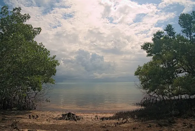
Water first: Kelly Park East pairs a 4 lane motorized boat ramp with a windsurfing and catamaran beach on the Banana River (Kelly Park East listing), while the 2 lane ramp at Kiwanis Island gives boaters, rowers and paddlers a way into Sykes Creek and on toward the Barge Canal or Banana River (Kiwanis Island listing). Manatee Cove Park, entered past an equestrian facility, offers a small lagoon with a canoe launch and shoreline fishing (Manatee Cove listing).
For sport, Kiwanis Island Park lists 8 lighted tennis courts and 2 lighted softball fields along with lighted 3 wall and 4 wall racquetball courts, and Kelly Park West has lighted multi-use fields (Kiwanis Island listing, Kelly Park West listing). Indoors, the 9,250-square-foot Kiwanis Island center has a basketball gym (Kiwanis Island listing), and the Woody Simpson center gym holds 1 basketball and 4 pickleball courts (Woody Simpson listing). Center hours, pavilion sizes and launch details for each park are laid out in the Merritt Island things to do guide.
What is happening at Veterans Memorial Park on Merritt Island?
The Merritt Island Redevelopment Agency says an outdoor amphitheatre opened at Veterans Memorial Park in 2026, with tiered lawn seating capacity of 5,000 (Merritt Island Redevelopment Agency site).
The agency describes the park in two ways on the same Merritt Island site. One entry gives Veterans Memorial Park 82 acres set inside a 165-acre stormwater basin, with lakes, trails and an upcoming entertainment venue; the amphitheatre entry places the venue within a 66-acre Veterans Memorial Park (Merritt Island Redevelopment Agency site).
Other projects on the agency's list include Griffis Landing at Blue Crab Cove, a 2.7-acre historic working waterfront site, and landscaped medians and perimeter landscaping along the SR 520 corridor, whose commercial core sub-area the agency says extends from the Indian River Lagoon on the west to the Banana River Lagoon on the east (Merritt Island Redevelopment Agency site).
What is the Pine Island Conservation Area on North Merritt Island?
Pine Island Conservation Area is an 879-acre county preserve in North Merritt Island, on the lagoon's eastern shore, that the county acquired together with the St. Johns River Water Management District (Brevard County EEL FAQs).
The county's Environmentally Endangered Lands program lists the Pine Island habitats as pine flatwoods, cabbage palm and hardwood hammocks, mangrove forests and salt marshes, and names the West Indian manatee, bottlenose dolphin, gopher tortoise and eastern indigo snake among the wildlife it shelters (EEL FAQs). The program picked Pine Island as a Category 1 site, the class with the most room for public access, and says the restored Historic Sams House will let it host the Management and Education Center for the Central Region (EEL FAQs).
Across Brevard County, the EEL FAQs credit the program, started in 1990, with helping preserve approximately 28,000 acres with $42 million in partner and grant funding (EEL FAQs). Its Central Region list groups Pine Island Conservation Area and Sams House at Pine Island with the Cruickshank, Thousand Island and Ulumay sites (EEL land management page).
How is the Merritt Island National Wildlife Refuge different from the county parks?
The Merritt Island National Wildlife Refuge is federal land, established in 1963 and covering 140,000 acres, not a county park (U.S. Fish and Wildlife Service refuge page).
The U.S. Fish and Wildlife Service says the Merritt Island refuge was established as an overlay of NASA's Kennedy Space Center, and under the agreement with NASA the Kennedy Space Center lands and waters serve the space program first and a wildlife refuge or park second (Merritt Island refuge page). Unlike the free parking at the county parks, the refuge charges for entry to Black Point Wildlife Drive and Bio Lab Road through a Refuge Pass, sold at the Visitor Center or, for annual, daily and foot or bicycle passes, on Recreation.gov (Merritt Island refuge page).
Which Merritt Island parks guide answers which question?
This Merritt Island parks section gathers the island's park guides as they are published, and each answers a different kind of question.
The Merritt Island things to do guide answers the practical park questions: where to launch, which courts are lit, when the community centers open and which pavilion fits a party. For the federal refuge land, including passes and wildlife viewing, the Space Coast section carries separate guides to the Merritt Island National Wildlife Refuge and to Black Point Wildlife Drive. The Merritt Island Public Library guide covers the county library branch.
Last verified: October 21, 2026, following a fresh pass over the Brevard County directory pages for Kelly Park East and West, Kiwanis Island, Manatee Cove and Woody Simpson parks, two Environmentally Endangered Lands pages, the Merritt Island Redevelopment Agency home page and the refuge page of the U.S. Fish and Wildlife Service, with the two Veterans Memorial Park acreages left as published.
Frequently asked questions
Where is the boat ramp on Merritt Island?
Brevard County lists a 4-lane motorized ramp at Kelly Park East, 2550 North Banana River Drive, on the Banana River, and a 2-lane ramp at Kiwanis Island Park, 951 Kiwanis Island Park Road, reaching Sykes Creek.
Is parking free at Merritt Island parks?
Yes. Brevard County marks parking as free on each listing for Kelly Park East, Kelly Park West, Kiwanis Island, Manatee Cove and Woody Simpson, and a pavilion booking does not reserve any parking.
Who runs the parks on Merritt Island?
Several public bodies do. Brevard County Parks and Recreation manages parks such as Kelly Park and Kiwanis Island, the county EEL program manages Pine Island Conservation Area, and the federal refuge is run by the U.S. Fish and Wildlife Service.
How big is Veterans Memorial Park on Merritt Island?
The Merritt Island Redevelopment Agency gives two figures on its site: 82 acres inside a 165-acre stormwater basin in one entry, and 66 acres in the entry for the amphitheatre that opened in 2026.
Is the Merritt Island wildlife refuge a county park?
No. Merritt Island National Wildlife Refuge is run by the U.S. Fish and Wildlife Service, was established in 1963, covers 140,000 acres and requires a Refuge Pass to enter Black Point Wildlife Drive.
Sources
- Kelly Park East, Brevard County Parks and Recreation https://www.brevardfl.gov/ParksAndRecreation/ParkDirectory/KellyEast Used for: 15.37 acres on the Banana River, windsurfing and catamaran launch, 4-lane boat ramp, pavilion sizes, address, phone; park directory list naming Rotary Park Merritt Island
- Kelly Park West, Brevard County Parks and Recreation https://www.brevardfl.gov/ParksAndRecreation/ParkDirectory/KellyWest Used for: 40.93 acres, boardwalk, fishing pier on a 2.48-acre brackish lake, .75 mile path, courts and fields, pavilion, address
- Kiwanis Island Park, Brevard County Parks and Recreation https://www.brevardfl.gov/ParksAndRecreation/ParkDirectory/KiwanisIsland Used for: 18.38 acres in a wildlife sanctuary, 2-lane ramp to Sykes Creek, courts and softball, community center size and hours, pavilions, address and phone
- Manatee Cove Park, Brevard County Parks and Recreation https://www.brevardfl.gov/ParksAndRecreation/ParkDirectory/ManateeCove Used for: 29.49 acres, equestrian facility, lagoon canoe launch, pavilion, address
- Woody Simpson Park, Brevard County Parks and Recreation https://www.brevardfl.gov/ParksAndRecreation/ParkDirectory/WoodySimpson Used for: 12 acres, community center and gym, pickleball, center hours, pavilion, address and phone
- Merritt Island Redevelopment Agency (MIRA) https://www.mymerrittislandfl.com/ Used for: Veterans Memorial Park acreage statements, amphitheatre opened 2026 with 5,000 lawn seats, Griffis Landing at Blue Crab Cove, SR 520 corridor
- EEL Program FAQs, Brevard County https://www.brevardfl.gov/EELProgram/EELProgramFAQs Used for: EEL since 1990, about 28,000 acres with $42 million partner funding; Pine Island Conservation Area 879 acres in North Merritt Island on the Indian River Lagoon, a Category 1 site; Sams House to host the Central Region center
- EEL Land Management and Restoration, Brevard County https://www.brevardfl.gov/EELProgram/LandManagementAndRestoration Used for: Central Region sites (Cruickshank, Pine Island CA, Sams House at Pine Island, Thousand Island CA, Ulumay) and Central Region phone (321) 449-4720
- Merritt Island National Wildlife Refuge, U.S. Fish and Wildlife Service https://www.fws.gov/refuge/merritt-island Used for: established 1963, 140,000 acres, overlay of Kennedy Space Center, Refuge Pass for Black Point Wildlife Drive
Published by Rytas Dirse, Solo Founder & AI Architect
Built with AI, held to quality gates. US sources, US brands, facts only.
How this page was made
Digital Towns uses AI assistance to research and write its guides, and every page is only as good as the sources it cites. Our goal is the most accurate, useful local information possible.
If you see an error, or anything you can show is false, tell us right away and we will take a third look.
Report an error
Thank you. We'll take a third look and correct the page if it's wrong.