Short answer: Merritt Island is not a city. It is an unincorporated Brevard County community that the Census Bureau counts as the Merritt Island CDP, home to 34,992 people (ACS 2020-2024 5-year) between the Indian River and Banana River lagoons. The Brevard County Commission governs it, and a county-created Merritt Island Redevelopment Agency with a seven-member appointed board funds projects along SR 520, Courtenay Parkway, the Barge Canal and Cone Road.
Last verified: October 21, 2026, against the sources listed at the end of this page.
Is Merritt Island, Florida a city?
No: Merritt Island is an unincorporated community that the Census Bureau counts as a census designated place, so it has no mayor or city council and is governed by Brevard County.
The Census Bureau's 2024 place gazetteer lists Merritt Island CDP, place code 1244275, and a separate North Merritt Island CDP, code 1249435 (Census 2024 Florida place gazetteer). The Census Bureau defines CDPs as the statistical counterparts of incorporated places, drawn for settled concentrations of population that are identifiable by name but are not legally incorporated under state law (Census Bureau geography glossary). With no city hall, Merritt Island looks to the Brevard County Board of County Commissioners, which lists its offices at 2725 Judge Fran Jamieson Way in Viera (Brevard County MIRA page).
Merritt Island does have one body of its own. Under Sec. 163.356 of the Florida Statutes, the County Commission by Ordinance No. 88-43 of November 15, 1988 established a seven-member Board of Directors for the Merritt Island Redevelopment Agency, with four-year terms; the county fills a vacancy for the rest of the term (Brevard County MIRA page). The MIRA website describes the same seven-member volunteer board as appointed by the District 2 County Commissioner (Merritt Island Redevelopment Agency website). MIRA is a redevelopment agency, not a city government: it plans and funds projects in its designated sub-areas.
Where is Merritt Island, and how big is it?
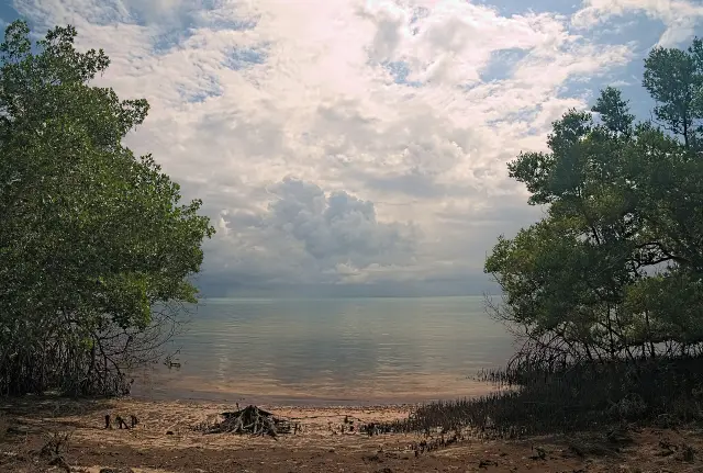
Merritt Island lies in Brevard County between the Indian River Lagoon to the west and the Banana River Lagoon to the east, and the Census Bureau puts more water than land inside the Merritt Island CDP.
The gazetteer gives Merritt Island CDP 16.971 square miles of land and 29.185 square miles of water, while North Merritt Island CDP has 16.858 square miles of land and 11.932 of water (Census 2024 gazetteer). Two state roads frame the community. The MIRA website describes the SR 520 corridor, the Merritt Island Causeway, as the primary west to east arterial, running from the Indian River Lagoon to the Banana River Lagoon, and SR 3 as the primary north to south corridor, covering properties on Courtenay Parkway from the SR 528 interchange south to Merritt Avenue (MIRA redevelopment zones). The Barge Canal sub-area takes in SR 528 and the lands to the north that front on the Barge Canal.
County addresses show the postal pattern: the Merritt Island Public Library is at 1195 North Courtenay Parkway, Merritt Island, FL 32953 (Merritt Island Public Library page), while Kelly Park East on North Banana River Drive carries the Merritt Island 32952 ZIP code (Kelly Park East page).
How many people live in Merritt Island?
The Census Bureau's ACS 2020-2024 5-year estimates count 34,992 residents in the Merritt Island CDP, with a median age of 50.2 (ACS DP05 for Merritt Island CDP).
Merritt Island is older than Brevard County as a whole. In the same release, 27.6 percent of Merritt Island residents were 65 or older, against 24.5 percent countywide, where the median age was 46.7 among 632,780 residents (ACS DP05 for Brevard County). Median household income in Merritt Island was $94,012, and workers averaged 25.3 minutes to work (ACS DP03 for Merritt Island CDP). The separate North Merritt Island CDP adds 9,025 residents with a median age of 52.6 (ACS DP05 for North Merritt Island CDP), so a figure quoted for Merritt Island alone leaves the northern community out.
Housing in Merritt Island is mostly owner occupied. The survey estimates 17,006 housing units, 14,166 of them occupied and 16.7 percent vacant; 80.0 percent of occupied homes were owner occupied, the median owner-occupied value was $402,900 and median gross rent $1,441 (ACS DP04 for Merritt Island CDP).
| Measure | Merritt Island CDP | Comparison |
|---|---|---|
| Population | 34,992 | North Merritt Island CDP 9,025 |
| Median age | 50.2 | Brevard County 46.7 |
| Residents 65 and older | 27.6 percent | Brevard County 24.5 percent |
| Median household income | $94,012 | DP03 |
| Housing units | 17,006 (14,166 occupied) | 16.7 percent vacant |
| Owner occupied | 80.0 percent | DP04 |
| Median owner-occupied value | $402,900 | Median gross rent $1,441 |
Who provides public services in Merritt Island?
Brevard County agencies have offices on Merritt Island itself: the Sheriff's East Precinct and the MIRA office share an address on North Courtenay Parkway, and the county runs the library and parks.
The Brevard County Sheriff's Office East Precinct is at 2575 N. Courtenay Parkway, Merritt Island, Florida 32953, with an operations line at (321) 454-6652 and a civil line at (321) 454-6632, open Monday to Friday 8:00 AM to 5:00 PM (Brevard County Sheriff precinct list). The Merritt Island Redevelopment Agency office is at 2575 N. Courtenay Parkway #214, phone (321) 454-6610 (Brevard County MIRA page).
The Merritt Island Public Library, (321) 455-1369, is open Monday 9 a.m. to 8 p.m., Tuesday and Wednesday 9 a.m. to 6 p.m., Thursday 12 p.m. to 8 p.m., Friday and Saturday 9 a.m. to 5 p.m., and is closed Sunday (Merritt Island Public Library hours). Its Carlton-Taylor Auditorium holds up to 80 people and the Joe Pessaro Conference Room 15, both reserved through the library director. County-wide questions such as property tax, trash pickup, building permits, zoning and elections are answered in the Brevard County guides on this site.
What is there to do on Merritt Island?
Merritt Island's public draws include county river parks on the Banana River and Sykes Creek, the 140,000-acre national wildlife refuge, and markers that trace the island's citrus and church history.
Kelly Park East, at 2550 North Banana River Drive, is a 15.37-acre county park that Brevard County calls an internationally recognized windsurfing area on the Banana River, with a sandy catamaran and sailboard launch and a 4 lane boat ramp with dock (Kelly Park East page). Kiwanis Island Park, at 951 Kiwanis Island Park Road, is an 18.38-acre river park in a wildlife sanctuary whose 2 lane ramp leads into Sykes Creek and on to the Barge Canal or Banana River (Kiwanis Island Park page).
Merritt Island National Wildlife Refuge, which shares the island's name, was established in 1963 for the protection of migratory birds and covers 140,000 acres of coastal dunes, saltwater marshes, managed impoundments, scrub, pine flatwoods and hardwood hammocks (U.S. Fish and Wildlife Service refuge page). History runs deep here too. The Brevard County Historical Commission records that Fort Ann was established late in 1837 as a supply depot on a narrow strip of Merritt Island near the boat haulover point (Brevard County Historical Commission history summary). Florida's marker list places a Dummett Grove marker inside the Merritt Island refuge on Courtenay Parkway North, after the Haulover Canal, crediting Douglas Dummett with developing Indian River oranges in the 19th century, and a marker at 4725 North Tropical Trail for Bethel A.M.E. Church of Merritt Island, established in 1892 (Florida Division of Historical Resources marker list).
What is changing on Merritt Island?
Two Merritt Island changes MIRA features are the Veterans Memorial Amphitheatre, which MIRA says opened in 2026, and a hospital project MIRA expects to open by 2027.
The MIRA website says the amphitheatre outdoor event complex opened in 2026 with tiered lawn seating for 5,000, inside the 66-acre Veterans Memorial Park, yet the same page elsewhere describes Veterans Memorial Park as an 82-acre park within a 165-acre stormwater basin (MIRA featured projects); the page does not explain the difference. MIRA also lists a 14-acre Health First hospital and medical office building that broke ground in 2024 with a projected opening by 2027.
MIRA posts its board meeting notices on the events calendar of its website. The agency's own founding date also reads two ways: the county page cites Ordinance No. 88-43 of November 15, 1988 for the board (Brevard County MIRA page), while the MIRA website footer gives an establishment date of October 4, 1988 and lists county ordinance 1988-37 (MIRA website). Both records are stated here as each source prints them.
What should Merritt Island residents know about flood insurance and storms?
As unincorporated land, Merritt Island falls under Brevard County's own flood insurance community, which FEMA rates at Community Rating System class 8 with a 10 percent discount inside the special flood hazard area.
FEMA's record for Brevard County, community 125092, shows a currently effective flood map dated 01/29/21 and class 8 since October 1, 2024, with discounts of 10% in the special flood hazard area and 5% outside it (FEMA NFIP record 125092). The Merritt Island CDP counts 29.185 square miles of water against 16.971 of land in the Census gazetteer. The Brevard County safety guides on this site cover hurricane shelters, sandbags, AlertBrevard and evacuation steps. Last verified: October 21, 2026, through fresh reads of the Census tables for both Merritt Island CDPs, the county MIRA and library pages, the MIRA website, two county park listings, the Sheriff precinct list and the FEMA record for unincorporated Brevard.
Frequently asked questions
Is Merritt Island a city or a town?
Neither. Merritt Island is an unincorporated census designated place in Brevard County, so it has no mayor or city council; the Brevard County Commission governs it, and a county-created redevelopment agency, MIRA, funds projects in four sub-areas.
What county is Merritt Island, Florida in?
Merritt Island is in Brevard County. The Brevard County Sheriff's Office East Precinct is at 2575 N. Courtenay Parkway in Merritt Island, and the county runs its library and parks.
What is the population of Merritt Island, FL?
The Census Bureau's ACS 2020-2024 5-year estimates count 34,992 residents in the Merritt Island CDP, with a median age of 50.2. The separate North Merritt Island CDP adds 9,025 residents.
What ZIP codes does Merritt Island use?
Brevard County pages use Merritt Island, FL 32953 for the Merritt Island Public Library on North Courtenay Parkway and the Sheriff's East Precinct, and Merritt Island, FL 32952 for Kelly Park East and Kiwanis Island Park.
What is the Merritt Island Redevelopment Agency?
MIRA is a redevelopment agency created by the Brevard County Commission in 1988 with a seven-member board serving four-year terms. Its office is at 2575 N. Courtenay Parkway #214, phone (321) 454-6610.
Sources
- ACS 2020-2024 5-year DP05, Merritt Island CDP, Florida (U.S. Census Bureau) https://data.census.gov/api/access/data/table?id=ACSDP5Y2024.DP05&g=160XX00US1244275 Used for: population, median age, 65 and older
- ACS 2020-2024 5-year DP03, Merritt Island CDP, Florida (U.S. Census Bureau) https://data.census.gov/api/access/data/table?id=ACSDP5Y2024.DP03&g=160XX00US1244275 Used for: median household income, travel time to work
- ACS 2020-2024 5-year DP04, Merritt Island CDP, Florida (U.S. Census Bureau) https://data.census.gov/api/access/data/table?id=ACSDP5Y2024.DP04&g=160XX00US1244275 Used for: housing units, occupancy, tenure, value, rent
- ACS 2020-2024 5-year DP05, North Merritt Island CDP, Florida (U.S. Census Bureau) https://data.census.gov/api/access/data/table?id=ACSDP5Y2024.DP05&g=160XX00US1249435 Used for: separate CDP population and median age
- ACS 2020-2024 5-year DP05, Brevard County, Florida (U.S. Census Bureau) https://data.census.gov/api/access/data/table?id=ACSDP5Y2024.DP05&g=050XX00US12009 Used for: county comparison
- Glossary, Geography Program (U.S. Census Bureau) https://www.census.gov/programs-surveys/geography/about/glossary.html Used for: definition of census designated places
- 2024 Census Gazetteer, Florida places (U.S. Census Bureau) https://www2.census.gov/geo/docs/maps-data/data/gazetteer/2024_Gazetteer/2024_gaz_place_12.txt Used for: Merritt Island CDP and North Merritt Island CDP land and water area
- Merritt Island Redevelopment Agency, Brevard County https://www.brevardfl.gov/MerrittIslandRedevelopmentAgency Used for: Ordinance 88-43 of November 15, 1988, seven-member board, four-year terms, office address and phone
- Merritt Island Redevelopment Agency (MIRA) website https://www.mymerrittislandfl.com/ Used for: board appointment by District 2 commissioner, sub-areas, featured projects, meeting dates, establishment line
- Merritt Island Public Library, Brevard County Library Services https://www.brevardfl.gov/LibraryServices/LocationsAndHours/MerrittIsland Used for: address, phone, hours
- Precincts, Brevard County Sheriff's Office https://www.brevardsheriff.com/units-services/precincts/ Used for: East Precinct address and phones
- FEMA NFIP Community Status Book, Brevard County unincorporated (125092) https://www.fema.gov/api/open/v1/NfipCommunityStatusBook?$filter=communityIdNumber%20eq%20%27125092%27 Used for: CRS class 8 and discounts for unincorporated Brevard
- Merritt Island National Wildlife Refuge, U.S. Fish and Wildlife Service https://www.fws.gov/refuge/merritt-island Used for: established 1963, 140,000 acres, habitats
- Kiwanis Island Park, Brevard County Parks and Recreation https://www.brevardfl.gov/ParksAndRecreation/ParkDirectory/KiwanisIsland Used for: 18.38-acre river park, boat ramp to Sykes Creek, address
- Kelly Park East, Brevard County Parks and Recreation https://www.brevardfl.gov/ParksAndRecreation/ParkDirectory/KellyEast Used for: 15.37-acre windsurfing park on the Banana River, boat ramp, address
- History Summary, Brevard County Historical Commission https://www.brevardfl.gov/HistoricalCommission/HistorySummary Used for: Fort Ann 1837 on Merritt Island
- Florida Historical Markers, Brevard County (Florida Division of Historical Resources) https://apps.flheritage.com/markers/markers.cfm?county=brevard Used for: Dummett Grove and Bethel A.M.E. Church markers in Merritt Island
Published by Rytas Dirse, Solo Founder & AI Architect
Built with AI, held to quality gates. US sources, US brands, facts only.
How this page was made
Digital Towns uses AI assistance to research and write its guides, and every page is only as good as the sources it cites. Our goal is the most accurate, useful local information possible.
If you see an error, or anything you can show is false, tell us right away and we will take a third look.
Report an error
Thank you. We'll take a third look and correct the page if it's wrong.
