Short answer: The Space Coast is Brevard County, 72 miles of central Florida's east coast with 16 cities and towns, Kennedy Space Center and Patrick Space Force Base. ACS 2020-2024 estimates count 632,780 residents. A Board of County Commissioners elected from five districts governs the county, and the Canaveral Port Authority, with its own elected board, manages Canaveral Harbor. Launches, cruises, Canaveral National Seashore and Merritt Island National Wildlife Refuge anchor the regional guides.
Last verified: October 21, 2026, against the sources listed at the end of this page.
What area do the Space Coast guides cover?
The Space Coast guides cover Brevard County, which the county describes as reaching 72 miles from north to south on the east coast of central Florida, with 16 municipalities, Kennedy Space Center and Patrick Space Force Base (Brevard County).
The name is also used by public bodies: the Space Coast Transportation Planning Organization serves as the regional transportation planning agency for Brevard County (Space Coast TPO). The name itself, and the legal edges of the region, are explained in the separate Digital Towns South Brevard guide to what the Space Coast is. This page is the starting point for the regional guides that cross town lines: rocket launches, the Port Canaveral cruise terminals, the beaches, Canaveral National Seashore and Merritt Island National Wildlife Refuge.
Brevard County government primarily serves the unincorporated areas, the places outside any city or town, with building permits, code enforcement, local roads and utilities, while countywide services such as 9-1-1, emergency medical services, emergency management, mosquito control, libraries and parks are offered countywide (Brevard County, About).
Which cities and towns are on the Space Coast?
Brevard County has 16 cities and towns, and the Brevard County Supervisor of Elections lists each one with its precincts (Supervisor of Elections, City and Town Maps).
| City or town | Population | Median age |
|---|---|---|
| City of Titusville | 49,385 | 42.2 |
| City of Cocoa | 19,554 | 44.9 |
| City of Rockledge | 29,133 | 49.0 |
| City of Cape Canaveral | 10,006 | 60.1 |
| City of Cocoa Beach | 11,377 | 59.2 |
| City of Satellite Beach | 11,313 | 42.6 |
| City of Indian Harbour Beach | 9,025 | 47.9 |
| Town of Indialantic | 3,065 | 51.8 |
| Town of Melbourne Beach | 3,250 | 56.4 |
| Town of Palm Shores | 1,458 | 44.9 |
| City of Melbourne | 86,576 | 42.5 |
| Town of Melbourne Village | 778 | 60.0 |
| City of West Melbourne | 28,795 | 39.4 |
| City of Palm Bay | 130,132 | 41.0 |
| Town of Malabar | 3,066 | 53.1 |
| Town of Grant-Valkaria | 4,921 | 59.7 |
The list of municipalities comes from the Supervisor of Elections city and town map page (votebrevard.gov), and the population and age figures from the ACS 2020-2024 5-year DP05 table for places in Brevard County (Census DP05, Brevard places).
The same Census table counts 34,992 residents in the Merritt Island census-designated place, 25,120 in Port St. John, 17,984 in Viera West, 12,570 in Viera East and 7,610 in Mims, none of them on the Supervisor of Elections list of 16 cities and towns (Census DP05).
How many people live on the Space Coast?
Brevard County had 632,780 residents in the ACS 2020-2024 5-year estimates, with a median age of 46.7 and 24.5 percent of residents aged 65 or older (Census DP05, Brevard County).
The county's own About page gives a rounder and lower figure, a population of approximately 600,000 residents (Brevard County). The two figures come from different sources and both are stated here.
In the same Census table, Cape Canaveral's median age is 60.1 and Cocoa Beach's is 59.2, while West Melbourne's is 39.4 and the Patrick AFB census-designated place records 24.9 (Census DP05, Brevard places). In Micco, at the south end of the county, 61.4 percent of residents are 65 or older.
Who runs local government on the Space Coast?
Brevard County is governed by a Board of County Commissioners elected from five districts, which appoints a County Manager to run daily operations with 2,350 employees (Brevard County).
The County Manager oversees 24 county offices in four groups: Community Services, Development and Environmental, Public Safety and Support Services (Brevard County, About). The county also lists the other constitutional offices and organizations that serve Brevard residents: the Clerk of Courts, Property Appraiser, School Board, Sheriff's Office, Supervisor of Elections and the State Attorney of the 18th Judicial Circuit. The Board of County Commissioners is based at 2725 Judge Fran Jamieson Way in Viera.
Port Canaveral has a government of its own. The Canaveral Port Authority was established in 1939 by a Special Act of the Florida Legislature as an independent governmental agency, and Canaveral Harbor was officially dedicated on November 4, 1953 (Canaveral Port Authority). The Canaveral Port District covers central and northern Brevard County in five regions. Each region elects a representative to the Board of Commissioners, commissioners are elected at-large for four-year terms, and the board meets in public with agendas posted online in advance.
The Brevard County Supervisor of Elections is reached at 321-290-VOTE (8683), with offices in Titusville at 400 South Street, Viera at 2725 Judge Fran Jamieson Way, Melbourne at 1515 Sarno Road and Palm Bay at 450 Cogan Drive SE (Supervisor of Elections).
What is there to do on the Space Coast?
The Space Coast regional guides cover rocket launches from Cape Canaveral, cruises from Port Canaveral, Atlantic beaches, Canaveral National Seashore and Merritt Island National Wildlife Refuge.
Launches: every launch in Florida begins on a pad at Cape Canaveral Space Force Station or Kennedy Space Center, according to NASA, whose Kennedy viewing page links to the agency's launch schedule (NASA, See a Launch Up Close). The Space Coast launches guide explains where schedules, forecasts and closures are posted and what the sonic booms are. Cruises: Port Canaveral reports 8.6M passenger movements and 16 homeport ships in fiscal year 2025 (Port Canaveral); the cruise guides cover the airport route, terminals and parking.
Federal lands: Canaveral National Seashore holds nearly 58,000 acres of barrier island, lagoon, hammock, flatwoods and offshore waters with 24 miles of beach, and two thirds of the park lies in Mosquito Lagoon (NPS, Canaveral National Seashore). Merritt Island National Wildlife Refuge, established in 1963 for migratory birds, covers 140,000 acres as an overlay of Kennedy Space Center, and a Refuge Pass is required for Black Point Wildlife Drive, Bio Lab Road and the Bairs Cove, Beacon 42 and Bio Lab boat ramps (USFWS, Merritt Island NWR).
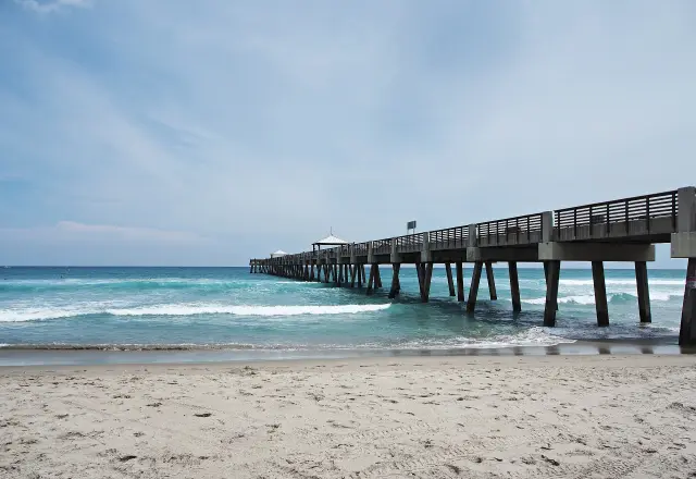
Beaches: the federal shore protection project, for which Brevard County is the local sponsor, covers a 9.8-mile North Reach from the Port Canaveral jetty to Patrick Space Force Base, a 7.6-mile Mid Reach south to Flug Avenue in Indialantic and a 3.8-mile South Reach to Spessard Holland Park North; the non-federal South Beaches run between Spessard Holland South and Sebastian Inlet State Park (Brevard County Beach Management Program).
What is changing on the Space Coast beaches?
The main scheduled beach project is South Reach nourishment between Spessard Holland Park and Flug Avenue, which missed its December 2025 to April 2026 window and is now expected between November 2026 and March 2027 (Brevard County).
Brevard County says the Army Corps of Engineers manages the South Reach work and that the Army Corps and its contractor missed the original deadline because of equipment problems, with equipment staged between Spessard Holland North and South parks (Brevard County Beach Management Program). Farther north, restoration after Hurricane Ian and Tropical Storm Nicole was completed in the North Reach and Mid Reach in 2024 and 2025, so no beach restoration work is expected there in 2026.
On the South Beaches, Brevard County completed dune sand placement from Bonsteel Park north to Spessard Holland Park South between December 2025 and April 2026, and planted sea oats from April 6 to 18, 2026 where erosion was worst, with more possible in early 2027 (Brevard County). The program page lists the Natural Resources Management Office at (321) 633-2016.
How does the Space Coast prepare for hurricanes and floods?
Brevard County lists emergency management among its countywide services (Brevard County, About), and its AlertBrevard system sends address-based calls, texts or emails about evacuation orders, shelter-in-place orders and boil-water notices (Brevard County Emergency Management).
The hazards Brevard County Emergency Management plans for include flooding, storm surge, tropical cyclones and tornados, and a launch anomaly (Brevard County). The office can be reached at (321) 637-6670. Registration with AlertBrevard is tied to an address, so a home, a business or an elderly parent's home can each be signed up.
The Brevard County guides on this site go further: AlertBrevard sign-up, hurricane shelters and the special needs registry, sandbag sites, mobile home evacuation and the county emergency management office each have their own page. Last verified: October 21, 2026, against the Brevard County about, emergency management and beach program pages, the Supervisor of Elections town list, ACS 2020-2024 DP05 tables, NPS, USFWS, NASA and Canaveral Port Authority pages.
Frequently asked questions
What county is the Space Coast in?
The Space Coast is Brevard County, Florida, the county served by the Space Coast Transportation Planning Organization, which the county describes as reaching 72 miles from north to south on the east coast of central Florida, with 16 municipalities, Kennedy Space Center and Patrick Space Force Base.
What cities are on the Space Coast?
Brevard County's 16 cities and towns are Titusville, Cocoa, Rockledge, Cape Canaveral, Cocoa Beach, Satellite Beach, Indian Harbour Beach, Indialantic, Melbourne Beach, Palm Shores, Melbourne, Melbourne Village, West Melbourne, Palm Bay, Malabar and Grant-Valkaria.
What is the population of the Space Coast?
The ACS 2020-2024 5-year estimates count 632,780 residents in Brevard County, with a median age of 46.7. The county's own website gives approximately 600,000.
Is Merritt Island a city?
No. Merritt Island is a census-designated place with 34,992 residents in ACS 2020-2024 estimates, and it is governed by Brevard County rather than a city council.
Who runs Port Canaveral?
The Canaveral Port Authority, an independent governmental agency created in 1939 by a Special Act of the Florida Legislature, manages Canaveral Harbor under a Board of Commissioners with one representative from each of five regions of central and northern Brevard County.
Sources
- Brevard County, About Brevard County https://www.brevardfl.gov/AboutBrevardCounty Used for: 72 miles, 16 municipalities, approximately 600,000, five districts, County Manager, 2,350 employees, county service split, constitutional offices
- Brevard County Supervisor of Elections, City and Town Maps https://www.votebrevard.gov/Data-and-Maps/City-and-Town-Maps Used for: list of the 16 cities and towns, Cocoa precincts, office addresses and phone
- U.S. Census Bureau, ACS 2020-2024 5-year DP05, Brevard County (API) https://data.census.gov/api/access/data/table?id=ACSDP5Y2024.DP05&g=050XX00US12009 Used for: county population, median age, 65 and older
- U.S. Census Bureau, ACS 2020-2024 5-year DP05, places in Brevard County (API) https://data.census.gov/api/access/data/table?id=ACSDP5Y2024.DP05&g=050XX00US12009$1600000 Used for: city, town and CDP populations and median ages
- Canaveral Port Authority, Board of Commissioners https://www.portcanaveral.com/about/board-of-commissioners Used for: 1939 Special Act, Canaveral Harbor November 4, 1953, five regions, four-year terms
- NASA Kennedy Space Center, See a Launch Up Close https://www.nasa.gov/kennedy/see-a-launch-up-close Used for: all Florida launches begin at CCSFS or KSC
- Canaveral Port Authority, Cruise https://www.portcanaveral.com/cruise Used for: FY2025 passenger movements and homeport ships
- National Park Service, Canaveral National Seashore Basic Information https://www.nps.gov/cana/planyourvisit/basicinfo.htm Used for: 58,000 acres, 24 miles of beach, Mosquito Lagoon
- U.S. Fish and Wildlife Service, Merritt Island National Wildlife Refuge https://www.fws.gov/refuge/merritt-island Used for: 1963, 140,000 acres, KSC overlay, Refuge Pass
- Brevard County, Beach Management Program https://www.brevardfl.gov/NaturalResources/Beaches/BeachManagementProgram Used for: shore reaches, South Reach delay to November 2026 to March 2027, South Beaches dune work and sea oats
- Brevard County, Emergency Management https://www.brevardfl.gov/EmergencyManagement Used for: AlertBrevard, hazard list including launch anomaly, office phone
- Space Coast Transportation Planning Organization, About Us https://spacecoasttpo.com/about-us/ Used for: SCTPO is the regional transportation planning agency for Brevard County (Space Coast name tied to the county); added by the fact-checker
Published by Rytas Dirse, Solo Founder & AI Architect
Built with AI, held to quality gates. US sources, US brands, facts only.
How this page was made
Digital Towns uses AI assistance to research and write its guides, and every page is only as good as the sources it cites. Our goal is the most accurate, useful local information possible.
If you see an error, or anything you can show is false, tell us right away and we will take a third look.
Report an error
Thank you. We'll take a third look and correct the page if it's wrong.
