Short answer: Palm Bay is a FEMA Community Rating System Class 7 city, so National Flood Insurance Program policies get a 15 percent discount inside the Special Flood Hazard Area and 5 percent outside it. Flood zones come from the Brevard County Flood Insurance Rate Map; the city's 2021 report lists most Palm Bay panels as dated March 17, 2014, with coastal panels along the Indian River Lagoon effective January 29, 2021. The Growth Management Department at 120 Malabar Road SE handles zone determinations, Elevation Certificates and floodplain permits at (321) 952-3400 ext. 5246.
Last verified: October 12, 2026, against the sources listed at the end of this page.
What flood zones and maps apply in Palm Bay?
Palm Bay flood zones come from the Brevard County Flood Insurance Rate Map, where five coastal panels along the Indian River Lagoon took effect January 29, 2021 while the city's 2021 progress report says the rest of its panels were still dated March 17, 2014.
The 2021 panels carry the suffix H and the older Palm Bay panels the suffix G, according to the city's Floodplain Management Plan Progress Report (City of Palm Bay progress report, page 3). In FEMA's Community Status Book, the City of Palm Bay is NFIP community 120404, with its first Flood Insurance Rate Map dated September 3, 1980 and a currently effective map date of 01/29/21 (FEMA Community Status Book).
The coastal update added Velocity and Coastal A zones on the lagoon side of Palm Bay. The report notes that none of the Velocity Zones reach the shoreline in the city, while a Limited Wave Action (LiMWA) line crosses many riverfront parcels; at Castaway Point Park the line passes through a small picnic pavilion without requiring renovations (2021 progress report). Coastal A is the AE area between that LiMWA line and the Velocity Zone, and building there must meet Velocity Zone construction standards.
The bigger change for most Palm Bay owners came earlier. About 2000 structures and more than 5000 residential lots were taken out of the Special Flood Hazard Area when the March 17, 2014 digital map replaced the 1989 paper maps, so flood insurance became optional for those properties under a federally backed mortgage (City of Palm Bay Flood Information). The city page explains that the Special Flood Hazard Area is the 100-year floodplain and appears on the map as zones beginning with A or V.
How much does the CRS discount save Palm Bay flood policies?
Palm Bay is a Community Rating System Class 7 city, which FEMA records as a 15 percent premium discount for National Flood Insurance Program policies inside the Special Flood Hazard Area and 5 percent outside it, effective May 1, 2019.
The FEMA record for Palm Bay shows class 7, an SFHA discount of 15% and a non-SFHA discount of 05% (FEMA Community Status Book). FEMA's program page sets the scale: discounts run from 5% to 45% in 5% steps, and Class 7 corresponds to 1,500 to 1,999 credit points earned through creditable floodplain activities (FEMA Community Rating System). The Palm Bay flood page states the same rating and frames it as a 15% reduction in FEMA flood insurance for city residents (City of Palm Bay Flood Information).
| Community | CRS class | Discount in SFHA | Discount outside SFHA | Class effective |
|---|---|---|---|---|
| City of Palm Bay | 7 | 15% | 5% | May 1, 2019 |
| City of Melbourne | 7 | 15% | 5% | April 1, 2026 |
| Brevard County (unincorporated) | 8 | 10% | 5% | October 1, 2024 |
| City of Cape Canaveral | 6 | 20% | 10% | October 1, 2026 |
| Town of Malabar | No class listed | None | None | None listed |
| Town of Grant-Valkaria | No class listed | None | None | None listed |
The comparison matters for buyers weighing Palm Bay against its neighbors. FEMA lists Brevard County at class 8 with a 10% discount, and shows no class at all for the Town of Malabar or the Town of Grant-Valkaria (FEMA Community Status Book, Brevard County communities). The city submits its Floodplain Management Plan Progress Report to the Insurance Service Office for recertification (City of Palm Bay news, April 28, 2021).
Who answers flood zone questions at Palm Bay City Hall?
Floodplain administration and CRS coordination for Palm Bay sit in the Growth Management Department at 120 Malabar Road SE.
Calls to (321) 952-3400 ext. 5246 cover flood zone determinations, Base Flood Elevations, Elevation Certificates, LOMA applications and floodplain permits for Palm Bay properties.
That contact list comes from the city's Flood Information page, last checked for this guide on October 12, 2026 (City of Palm Bay Flood Information). The Palm Bay Building department software holds floodplain reviews with FEMA Elevation Certificates issued since 1993, and copies of FEMA Letters of Map Amendment and Revision are also on file. Elevation Certificates are on file at the city for homes built after 1993 that were required to have a floodplain permit, so a house outside that group may have none on file.
The same page offers more than paperwork. Palm Bay's Professional Engineers, Floodplain Manager and drainage staff can inspect a property to identify weaknesses that raise flood risk and suggest fixes (Palm Bay Flood Information). For questions about a LOMA or LOMR-F, the page also lists the Building Department at (321) 953-8924.
Last verified: October 12, 2026, on the City of Palm Bay Flood Information page.
When is flood insurance required for a Palm Bay home?
Flood insurance is mandatory for a Palm Bay building in the Special Flood Hazard Area when it carries a federally backed or federally regulated mortgage, while elsewhere in the city federal law does not require a policy, though a lender may still ask for one.
The Palm Bay flood page explains that the city participates in the National Flood Insurance Program, which makes federally backed flood insurance available for all buildings, whether in a floodplain or not (City of Palm Bay Flood Information). The mandatory purchase requirement covers loans from regulated lenders and mortgages bought by Fannie Mae or Freddie Mac, and lenders must check the map before closing. Policies offer two coverages, structural and contents, and contents coverage can be bought separately.
Owners whose Palm Bay house sits above the Base Flood Elevation can ask FEMA to take the building out of the hazard area. A Letter of Map Revision based on Fill (LOMR-F) carries a $425 one time FEMA application fee, while a Letter of Map Amendment for a house on a simple pad at natural grade has no application fee (Palm Bay Flood Information). With an approved letter, flood insurance stops being mandatory for a federally insured mortgage. The city does not process LOMR-F applications for lots; for new homes in Palm Bay the contractor applies to FEMA, and the city wants the approved LOMR-F at or before final inspection.
What does building in a Palm Bay flood zone involve?
A new building in a Palm Bay flood zone needs a floodplain review with a $60.00 fee, a sealed survey in NAVD88 elevations, a formboard survey before concrete, and Elevation Certificates during and after construction before the certificate of occupancy.
The Palm Bay review starts at the Building Department with a signed and sealed survey showing elevations at the four corners, the center and the crown of the road, plus flood hazard lines and Base Flood Elevations (City of Palm Bay floodplain review process). The $60.00 fee applies to residential or commercial structures, sheds and small accessory structures included. At the construction stage a formboard survey is required before any concrete is poured, and an Elevation Certificate (Building Under Construction) must follow before vertical work starts. The final Lowest Adjacent Grade must sit above the Base Flood Elevation.
The rules behind those steps sit in Palm Bay's floodplain ordinances. In December 2020 the city adopted ordinances 2020-82, 2020-83 and 2020-84, moving floodplain coordinator and CRS duties between departments (2021 progress report, page 1), and Ordinance 2020-84 adopted the January 29, 2021 Brevard County Flood Insurance Study and maps by reference (2021 progress report, page 2). Storm-damaged Palm Bay buildings in mapped flood zones must be inspected for substantial damage before the city issues repair permits (City of Palm Bay Flood Information).
Where does flooding come from in Palm Bay, and what is the city doing about it?
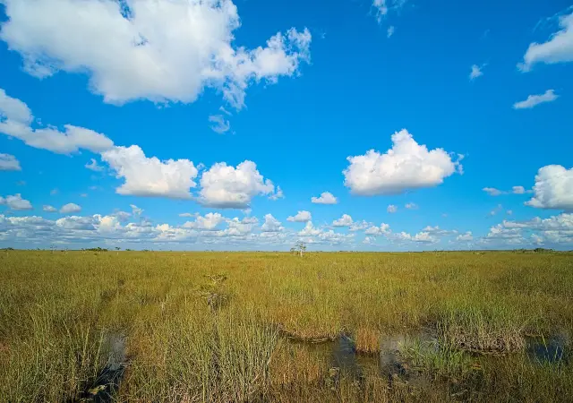
Palm Bay's flood hazards come from the Indian River Lagoon on its eastern edge and the St. Johns River and marsh to the west during severe rain, and the city answers with canal maintenance, outreach and a FEMA-funded buyout of flood-prone homes.
The city flood page notes that, historically, there has been little structural flood damage in Palm Bay even during major storms (City of Palm Bay Flood Information). It points residents to real-time USGS gauges on Turkey Creek at Palm Bay, the St. Johns River near Melbourne, the North Prong St. Sebastian River near Micco and the C-54 Canal near Fellsmere.
Palm Bay drainage upkeep follows Public Works Standard Operating Procedure 26. After storms of 3 inches or more, roadways that cross major canals are checked for clogging, and drainage right-of-way channels are mowed twice a year (2021 progress report, page 2). The 2021 report says a mailer with the flood map goes to the city's repetitive loss areas every year before hurricane season (2021 progress report, page 3). In 2021 Palm Bay said it would keep attending Melbourne-Tillman Water Control District meetings and stay active in the St. Johns River Water Management District (City of Palm Bay news, 2021).
The largest single project was a buyout. On August 24, 2020, Palm Bay learned of a $2,052,539 FEMA Hazard Mitigation Grant Program award to acquire and demolish 13 flood-prone homes in northeast Palm Bay (2021 progress report). The grant covers 75 percent of costs, and $684,179 in CDBG-DR funds met the 25 percent share (2021 progress report, page 4).
Frequently asked questions
Is Palm Bay in a flood zone?
Parts of Palm Bay are. The 2021 coastal map added Velocity and Coastal A zones along the Indian River Lagoon, and the city names the St. Johns River and marsh to the west as a hazard in severe rain, but about 2,000 structures and over 5,000 lots left the hazard area on the March 17, 2014 FEMA map, according to the city.
What is Palm Bay's CRS class?
FEMA lists the City of Palm Bay as Community Rating System class 7, effective May 1, 2019. Policies in the Special Flood Hazard Area get a 15 percent discount and policies outside it get 5 percent.
Where can a Palm Bay owner get an Elevation Certificate on file?
The Palm Bay Building department software keeps Elevation Certificates issued since 1993 for homes that needed a floodplain permit. Requests go to the Growth Management Department at 120 Malabar Road SE, (321) 952-3400 ext. 5246.
How much does FEMA charge for a LOMR-F in Palm Bay?
The city flood page says FEMA charges a $425 one time application fee for a Letter of Map Revision based on Fill. A Letter of Map Amendment for a Palm Bay house built on a natural-grade pad has no application fee.
Does the Town of Malabar get the same flood insurance discount as Palm Bay?
No. FEMA's Community Status Book shows no CRS class for the Town of Malabar or the Town of Grant-Valkaria, while Palm Bay and Melbourne are class 7 and unincorporated Brevard County is class 8.
Sources
- Flood Information, City of Palm Bay Building (Permits/Inspections) https://www.palmbayfl.gov/government/city-departments-a-to-e/building-permits-inspections/flood-information Used for: floodplain office, CRS 7 / 15%, contacts, elevation certificates since 1993, 2014 map change, review process and fees, LOMR-F rules, mandatory purchase, gauges, flood hazard geography
- FEMA OpenFEMA NFIP Community Status Book: Palm Bay, City of https://www.fema.gov/api/open/v1/NfipCommunityStatusBook?$filter=communityName%20eq%20%27PALM%20BAY%2C%20CITY%20OF%27 Used for: community 120404, initial FIRM 1980, current map 01/29/21, CRS class 7 effective 2019-05-01, SFHA 15% and non-SFHA 5%
- FEMA OpenFEMA NFIP Community Status Book: Brevard County communities https://www.fema.gov/api/open/v1/NfipCommunityStatusBook?$filter=county%20eq%20%27BREVARD%20COUNTY%27%20and%20state%20eq%20%27FL%27&$select=communityIdNumber,communityName,classRating,sfhaDiscount,nonSfhaDiscount,classRatingEffectiveDate,currentlyEffectiveMapDate Used for: CRS class comparison table for Palm Bay, Melbourne, Brevard County, Malabar, Grant-Valkaria, Cape Canaveral
- Floodplain Management Plan Progress Report, April 15, 2021, City of Palm Bay (page 1) https://www.palmbayfl.gov/home/showpublisheddocument/24243/637547561237700000#page=1 Used for: Resolution 2020-54, ordinances 2020-82 to 2020-84, January 29 2021 coastal FIRM
- Floodplain Management Plan Progress Report, 2021 (page 2) https://www.palmbayfl.gov/home/showpublisheddocument/24243/637547561237700000#page=2 Used for: Public Works SOP 26 canal checks after 3 inches of rain, DROW mowing
- Floodplain Management Plan Progress Report, 2021 (page 3) https://www.palmbayfl.gov/home/showpublisheddocument/24243/637547561237700000#page=3 Used for: Velocity and Coastal A zones, LiMWA at Castaway Point, panel suffixes H and G, repetitive loss mailer, $2,052,539 HMGP award
- Floodplain Management Plan Progress Report, 2021 (page 4) https://www.palmbayfl.gov/home/showpublisheddocument/24243/637547561237700000#page=4 Used for: 75/25 HMGP cost share, $684,179 CDBG-DR
- Community Rating System, FEMA https://www.fema.gov/floodplain-management/community-rating-system Used for: CRS class points and discount table
- 2021 Floodplain Management Plan Progress Report released, City of Palm Bay news https://www.palmbayfl.gov/Home/Components/News/News/10319 Used for: ISO recertification, fourth year as Class 7, Melbourne Tillman Water Control District