Short answer: April in Sebastian averages a high of 81.9°F and a low of 62.4°F, with 3.06 inches of rain, on NOAA's 1991 to 2020 normals for the Vero Beach station. Rain varies widely: April 2025 brought 0.16 inches and April 2026 brought 8.13 inches. Beach water at Trident Pier, north of Sebastian Inlet, averages 78.9°F. Storm risk comes from squall lines, hail and the first sea breeze thunderstorms.
Last verified: October 11, 2026, against the sources listed at the end of this page.
What are normal April temperatures and rainfall in Sebastian?
Normal April weather in Sebastian, read from the Vero Beach record, is an 81.9°F afternoon, a 62.4°F night and 3.06 inches of rain over the month.
Those figures are NOAA's 1991 to 2020 normals for the Vero Beach airport station, the long record that NWS Melbourne reports for Indian River County (NOAA NCEI monthly normals). The April mean of 72.1°F is 4.1 degrees above March, and April averages 1.6 days at 90°F or hotter. Nights under 40°F disappear from the April normals in Sebastian, and nights under 50°F drop to 2.2.
| April item | Figure |
|---|---|
| Normal high | 81.9°F |
| Normal low | 62.4°F |
| Normal mean | 72.1°F |
| Normal rain | 3.06 inches |
| Days at 90°F or hotter | 1.6 |
| Days with an inch of rain or more | 0.9 |
| Record high | 97°F (April 13, 2020) |
| Record low | 36°F (April 5, 1987) |
| Wettest April | 10.45 inches (1997) |
| Driest April | 0.02 inches (1946) |
| Trident Pier water | 78.9°F |
| Canaveral buoy water | 74.3°F |
| Lake Worth Pier water | 77.8°F |
April's day to night spread narrows to 19.5 degrees at Vero Beach, down from 20.8 in March, for Sebastian and the Indian River Lagoon shoreline. The record April range at the station runs from 36°F on April 5, 1987 to 97°F on April 13, 2020, according to the NWS Melbourne April report (NWS Melbourne April 2026 climate report, IEM archive).
How much does April rain vary in Sebastian?
April rain in Sebastian swings from almost nothing to more than double the normal, and the last two Aprils at Vero Beach show both ends: 0.16 inches in 2025 and 8.13 inches in 2026.
April 2025 measured 0.16 inches at Vero Beach, 2.90 inches below normal, with rain on 3 days and only 1 day reaching a tenth of an inch (NWS Melbourne April 2025 climate report, IEM archive). The station's driest April remains 0.02 inches in 1946, and its wettest is 10.45 inches in 1997.
April 2026 went the other way in Sebastian. The station measured 8.13 inches, 5.07 above normal, with 3 days of an inch or more and 4.69 inches between April 8 and April 9 (April 2026 report). Wind came from the northeast and east during that storm: a 43 mph gust from 040 degrees on April 7 and 30 mph sustained from 070 degrees on April 8.
The NOAA normals frame how unusual those totals were for the Vero Beach station south of Sebastian. A quarter of Aprils in the 1991 to 2020 record end with less than 1.52 inches, and a quarter end with more than 4.06 inches, so 2025 sat far below the low quartile and 2026 roughly doubled the high one.
What were temperatures like in April 2025 and April 2026 in Sebastian?
Both recent Aprils in Sebastian topped out at 91°F at the Vero Beach station, but April 2026 ran with warmer nights, cloudier skies and stronger wind than April 2025.
In April 2026 the warmest afternoons reached 91°F on April 26 and April 30, and the coolest morning was 59°F on April 17. Average lows ran 3.9 degrees above normal at 66.3°F, while average highs ran 0.8 degrees below normal at 81.1°F, a pattern that fits a cloudy, wet month on the Treasure Coast. The report classed 20 days as partly cloudy and only 6 as fair.
April 2026 was also the windiest of the two Aprils over the Indian River Lagoon and the riverfront along Indian River Drive, with an average wind speed of 10.2 mph at Vero Beach and heavy rain on 5 days. April 2025 averaged 9.6 mph, reached 91°F on April 7 and fell to 52°F on April 14, its average low still 2.6 degrees above normal at 65.0°F.
How warm is the water off Sebastian in April?
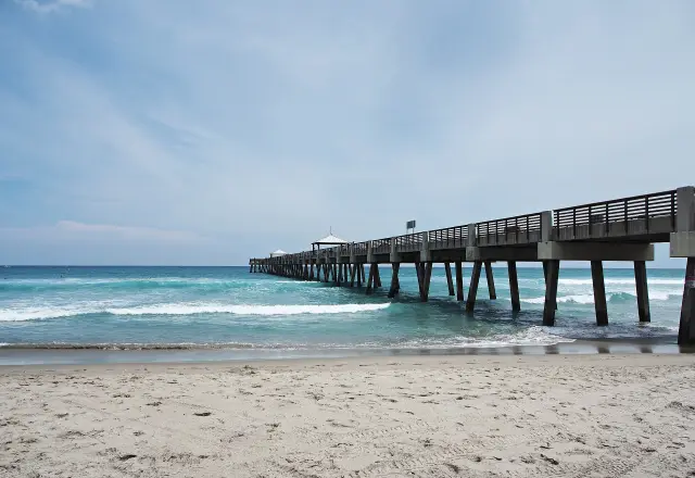
April beach water north of Sebastian Inlet averages 78.9°F at Trident Pier, 4.6 degrees warmer than the offshore Canaveral buoy, the widest lead the pier holds over the buoy in any month.
NOAA's monthly averages put the Canaveral buoy 20 nautical miles offshore at 74.3°F in April and Lake Worth Pier, south of Sebastian, at 77.8°F (NOAA Coastal Water Temperature Guide). Trident Pier's April average of 78.9°F is 4.5 degrees above its March figure.
For the beaches at Sebastian Inlet State Park and Wabasso Beach, which lie between those stations, April is the month when shallow coastal water runs warmest relative to the open Atlantic. By May the gap at Trident Pier shrinks to 2.8 degrees, as the offshore water catches up.
Is April fire weather season around Sebastian?
April is a fire weather month in east central Florida, including Sebastian and Indian River County: NWS Melbourne's lightning climatology calls April the driest month of the year for Florida as a whole.
At the Vero Beach station itself, February is drier, at 2.20 inches against April's 3.06, but April adds heat: its normal high is 6.3 degrees above February's. NWS Melbourne's climatology also notes that lightning increases in April even as the state dries, with sea breeze forcing beginning along the coast of the peninsula (NWS Melbourne lightning climatology).
NWS Melbourne's fire weather page gathers the tools used for that season near Sebastian, including the Red Flag Watch and Warning product, Florida Forest Service fire danger ratings and the Keetch-Byram Drought Index (NWS Melbourne fire weather). Its storm survey list includes the April 27, 2006 Port St. John wildfire in Brevard County (NWS Melbourne storm surveys).
What storms reach Sebastian in April?
April storms near Sebastian are mostly squall lines and hail or wind storms ahead of late season fronts, joined by the first sea breeze thunderstorms of the year.
NWS Melbourne's storm survey list for April includes hail and wind storms across central Florida on April 8, 2004, a microburst in Melbourne on April 27, 2004, a squall line on April 14, 2009, EF0 tornadoes at Viera, Rockledge and Cocoa on April 14, 2013, and the Fort Drum EF2 tornado on April 6, 2017. All of those places lie within the same forecast area as Sebastian.
Lightning doubles in April. NWS Melbourne estimates about 576 cloud to ground strikes in neighboring Brevard County in a typical April, against about 288 in March (NWS Melbourne lightning statistics). April 2026 at Vero Beach recorded thunder on 4 days and April 2025 on 1 day.
The current NWS Melbourne dry season outlook, issued September 30, 2026, runs through April 30, 2027 and headlines increased potential for well above normal rainfall and severe weather, so April 2027 in Sebastian is inside its forecast window (NWS Melbourne dry season outlook). Readings for Sebastian itself post from Sebastian Municipal Airport (KX26) on the NWS forecast page (NWS forecast for Sebastian).
Frequently asked questions
How hot does Sebastian get in April?
The Vero Beach normal April high is 81.9°F, with about 1.6 days of 90°F or more. Both April 2025 and April 2026 reached 91°F, and the April record at the station is 97°F, set on April 13, 2020.
Is April a dry month in Sebastian?
Usually, though not reliably. The Vero Beach normal is 3.06 inches, but April 2025 brought only 0.16 inches while April 2026 brought 8.13 inches, including 4.69 inches on April 8 and 9.
What is the water temperature near Sebastian Inlet in April?
NOAA averages put April water at 78.9°F at Trident Pier north of the inlet, 74.3°F at the Canaveral buoy offshore and 77.8°F at Lake Worth Pier to the south.
Does Sebastian get thunderstorms in April?
Some. Vero Beach recorded thunder on 4 days in April 2026 and 1 day in April 2025, and NWS Melbourne estimates about 576 lightning strikes in a typical April in Brevard County, next to Sebastian.
Sources
- NOAA NCEI 1991-2020 monthly normals, Vero Beach station USW00012843 https://www.ncei.noaa.gov/access/services/data/v1?dataset=normals-monthly-1991-2020&stations=USW00012843&format=csv&dataTypes=MLY-TMAX-NORMAL,MLY-TMIN-NORMAL,MLY-TAVG-NORMAL,MLY-PRCP-NORMAL,MLY-TMAX-AVGNDS-GRTH090,MLY-TMIN-AVGNDS-LSTH040,MLY-TMIN-AVGNDS-LSTH050,MLY-PRCP-AVGNDS-GE010HI,MLY-PRCP-AVGNDS-GE100HI,MLY-PRCP-25PCTL,MLY-PRCP-75PCTL,MLY-DUTR-NORMAL Used for: April normals, quartiles, February comparison
- NWS Melbourne climate report for Vero Beach, April 2026 (CLMVRB, Iowa Environmental Mesonet archive) https://mesonet.agron.iastate.edu/cgi-bin/afos/retrieve.py?pil=CLMVRB&sdate=2026-05-01&edate=2026-05-06&fmt=html&limit=1 Used for: April 2026 observations and April records
- NWS Melbourne climate report for Vero Beach, April 2025 (CLMVRB, Iowa Environmental Mesonet archive) https://mesonet.agron.iastate.edu/cgi-bin/afos/retrieve.py?pil=CLMVRB&sdate=2025-05-01&edate=2025-05-06&fmt=html&limit=1 Used for: April 2025 observations
- NOAA NCEI Coastal Water Temperature Guide, monthly averages https://www.ncei.noaa.gov/access/coastal-water-temperature-guide/all_table.html Used for: April water temperatures
- NWS Melbourne monthly Florida lightning climatology https://www.weather.gov/mlb/fl_lightning_climo Used for: April driest month for Florida; sea breeze onset
- NWS Melbourne fire weather https://www.weather.gov/mlb/firewx Used for: fire weather products and drought index
- NWS Melbourne storm surveys and summaries https://www.weather.gov/mlb/surveys Used for: April wildfire and storm events
- NWS Melbourne lightning statistics https://www.weather.gov/mlb/lightning_stats Used for: Brevard County lightning strikes by month
- NWS Melbourne 2026-2027 Central Florida dry season outlook https://weather.gov/mlb/mlbnino Used for: forecast window and headline
- NWS forecast page for Sebastian, FL https://forecast.weather.gov/MapClick.php?lat=27.8164&lon=-80.4706 Used for: Sebastian Municipal Airport observations