Short answer: August is the warmest and wettest month in Sebastian: NOAA 1991 to 2020 normals for the Vero Beach airport give a high of 90.6 degrees, a low of 73.6 and 7.35 inches of rain on about 9 to 10 rainy days. The ocean off Sebastian Inlet averages 84 to 86 degrees, and tropical storm risk rises sharply from mid-August.
Last verified: October 11, 2026, against the sources listed at the end of this page.
What are normal August temperatures in Sebastian?
August is Sebastian's warmest month, with a normal high of 90.6 degrees and a normal low of 73.6 at the Vero Beach airport, the NOAA climate station closest to the city.
The 1991 to 2020 NOAA NCEI normals for Vero Beach give August a mean of 82.1 degrees, the highest of any month in Indian River County, edging July by two tenths of a degree. The peak comes early. Per the August daily normals, the expected high is 91.0 degrees on August 1 and slides to 89.7 by August 31, while the low holds between 73.4 and 73.7 for the whole month. The first days of August are the hottest stretch of the Sebastian year on paper.
Hot afternoons are the rule rather than the exception in Sebastian during August. NOAA's threshold counts average 20.8 days of 90 degrees or more at Vero Beach in August, the highest count of the year. The record high for the month is 98, reached on August 2, 1999, and on August 7 in both 1989 and 1956, and the coolest August reading since 1942 is 63 on August 3, 1972, per the NWS Melbourne August 2026 summary.
The Melbourne airport normals, from the Brevard County station on the other side of the Sebastian River and Micco, show the coastal pattern: a cooler August afternoon at 89.3 degrees but a warmer night at 74.7.
Is August the rainiest month in Sebastian?
Yes, August is the wettest month at the Vero Beach station that represents Sebastian, with a 1991 to 2020 normal of 7.35 inches, just ahead of September's 7.04.
The total comes from frequent storms. NOAA averages 9.5 August days at Vero Beach with a tenth of an inch of rain or more and 2.3 days with a full inch, the most inch-plus days of any month. The spread between dry and wet Augusts is the widest of the year in Indian River County: one August in four brings under 4.34 inches, and one in four brings more than 10.25.
The extremes come from tropical systems as much as from daily storms. The wettest August in the Vero Beach record is 2008 at 18.91 inches, the month of Tropical Storm Fay, while the driest is 1980 at 1.22 inches, according to the NWS Melbourne monthly summary. Melbourne, north of Sebastian in Brevard County, averages a little less, 6.67 inches.
August sits deep inside the summer rainy season that NWS Melbourne measured on its wet season statistics page: over 22 years of north Melbourne data, the wet season averaged 138 days and held 64 percent of the rainfall in 38 percent of the year. In Sebastian that means saturated ground through much of August, which is one reason the Indian River County fertilizer ordinance also bars fertilizer whenever more than two inches of rain in 24 hours is likely, on top of the June 1 to September 30 blackout.
How did August 2026 compare with normal in Sebastian?
August 2026 was warmer than normal but slightly drier at Vero Beach, averaging 83.3 degrees with 6.68 inches of rain, while a 52 mph gust on August 4 was the month's strongest wind.
| Measure | August 2026 | Normal | August 2025 |
|---|---|---|---|
| Average high (F) | 91.5 | 90.6 | 92.0 |
| Average low (F) | 75.0 | 73.6 | 74.5 |
| Mean (F) | 83.3 | 82.1 | 83.2 |
| Days at 90 F or above | 23 | 20.8 | 27 |
| Rainfall (inches) | 6.68 | 7.35 | 5.87 |
| Days with measurable rain | 17 | 15.0 | 18 |
| Ocean water near Sebastian Inlet (F, NOAA August average) | 83.7 Canaveral buoy; 83.8 Trident Pier; 85.7 Lake Worth Pier | ||
The Vero Beach climate summary for August 2026, issued by NWS Melbourne on September 1, 2026, shows warm nights doing most of the work: the average low of 75.0 ran 1.4 degrees above normal, more than the 0.9 degree departure in the average high. The hottest readings were 96 degrees on August 17 and 18. Thunderstorms were reported on 22 days, and the top gust, 52 mph from the north northwest on August 4, was stronger than any gust at the station in July 2026.
Rain fell on 17 days but added up to 0.67 inches less than normal, with no single day above 1.89 inches. August 2025 was hotter by day, with a 92.0 degree average high and 27 days at 90 or warmer, and drier still at 5.87 inches. Two straight Augusts below the 7.35 inch normal at Vero Beach show how a Sebastian August can miss its average without a tropical storm.
Which tropical storms have hit Sebastian in August?
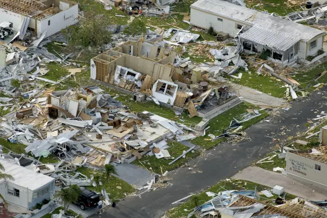
Two August storms stand out for Sebastian: Hurricane Erin, which came ashore near Vero Beach on August 2, 1995, and Tropical Storm Fay, which left a 22.25 inch storm total in Sebastian in August 2008.
Erin brought hurricane conditions straight onto the Indian River County coast south of Sebastian Inlet. The Weather Prediction Center summary of Erin states that it made landfall very early on August 2 near Vero Beach as a Category 1 hurricane with estimated maximum winds of 85 mph, then crossed the peninsula and made a final landfall near Pensacola on August 3.
Fay was a rain event rather than a wind event. The Weather Prediction Center describes Fay weakening as it moved offshore near Melbourne on August 19, 2008, then stalling and dropping heavy rain along the east central Florida coast for a prolonged period. The NWS Melbourne post storm report lists a public storm total of 22.25 inches at Sebastian, one of the highest in Indian River County, and calls Fay the third wettest tropical cyclone to affect Florida and by far the wettest for east central Florida. That storm is behind the 18.91 inch August 2008 total that still stands as the Vero Beach record for the month.
Both storms fit the National Hurricane Center climatology, which places most Atlantic activity between mid-August and mid-October and says the first hurricane of an average season forms in early to mid-August. For Sebastian, August is when the season turns from mostly heat and lightning to a real tropical threat.
What does August heat do to the Indian River Lagoon at Sebastian?
August heat can push the shallow Indian River Lagoon at Sebastian into the mid 80s, warmer than the open ocean, and hot spells have coincided with small fish kills along the city shoreline.
On August 3, 2023, Sebastian Daily reported a minor fish kill in Sebastian the previous weekend and noted that kills of this kind can happen in the lagoon on hot summer days. The paper put the lagoon water at 85 degrees, with some local scientists reporting 87 during their studies. That is warmer than the 83.7 degree August average NOAA lists for the offshore Canaveral buoy.
The same report found fishing at Sebastian Inlet holding up through the heat, with young mangrove snapper under 10 inches at the north and south jetties. The difference between the lagoon and the inlet comes down to depth and exchange: the inlet carries ocean water in and out with each tide, while the lagoon west of Orchid Island is shallow and heats with the August air, which averages 82.1 degrees at Vero Beach.
How warm is the ocean near Sebastian in August?
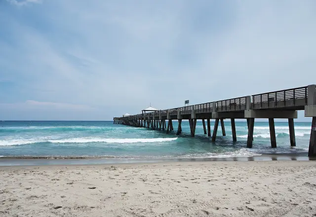
The Atlantic near Sebastian Inlet averages about 84 to 86 degrees in August, from 83.7 at the Canaveral buoy to 85.7 at Lake Worth Pier, the warmest month for the southern station.
The NOAA NCEI Coastal Water Temperature Guide gives August averages of 83.7 degrees offshore at the Canaveral 20 NM buoy, 83.8 at Trident Pier near Port Canaveral and 85.7 at Lake Worth Pier. Sebastian Inlet lies along the coast between those sites, and Lake Worth reaches its annual high in August, while the offshore buoy keeps warming into September. Ocean water and the 82.1 degree air mean at Vero Beach run within about two degrees of each other in August.
The beaches east of Sebastian are busy with sea turtles in the same weeks. The U.S. Fish and Wildlife Service lists May through August as peak nesting months on the Archie Carr National Wildlife Refuge, and notes that a nest takes approximately 60 days to incubate, so August nests on the beaches near Wabasso Beach and Sebastian Inlet State Park may not hatch until October.
Frequently asked questions
What is the wettest month in Sebastian, FL?
August, with a 1991 to 2020 normal of 7.35 inches at the Vero Beach airport station, ahead of September at 7.04 and June at 6.76. The wettest August on record there was 2008 at 18.91 inches, the month of Tropical Storm Fay.
How hot is Sebastian in August?
The NOAA normal high at Vero Beach is 90.6 degrees in August, with 20.8 days at 90 or warmer in an average year. The record high for August is 98 degrees, last reached on August 2, 1999.
Has a hurricane made landfall near Sebastian in August?
Yes. Hurricane Erin made landfall near Vero Beach early on August 2, 1995 as a Category 1 hurricane with estimated winds of 85 mph, according to the NOAA Weather Prediction Center.
How much rain did Tropical Storm Fay drop on Sebastian?
The NWS Melbourne post storm report for Fay lists a public storm total of 22.25 inches at Sebastian for August 18 to 23, 2008. Fay stalled off the coast near Melbourne after moving offshore on August 19.
Sources
- NOAA NCEI 1991-2020 monthly climate normals, Vero Beach Regional Airport (USW00012843) https://www.ncei.noaa.gov/access/services/data/v1?dataset=normals-monthly-1991-2020&stations=USW00012843&format=csv&dataTypes=MLY-TAVG-NORMAL,MLY-TMAX-NORMAL,MLY-TMIN-NORMAL,MLY-PRCP-NORMAL Used for: August normal high 90.6, low 73.6, mean 82.1 and rainfall 7.35 inches, the warmest and wettest month
- NOAA NCEI 1991-2020 daily climate normals for August, Vero Beach Regional Airport https://www.ncei.noaa.gov/access/services/data/v1?dataset=normals-daily-1991-2020&stations=USW00012843&startDate=2010-08-01&endDate=2010-08-31&format=csv&dataTypes=DLY-TMAX-NORMAL,DLY-TMIN-NORMAL Used for: normal high of 91.0 on August 1 easing to 89.7 on August 31; normal low 73.4 to 73.7
- NOAA NCEI 1991-2020 monthly normals: threshold days and rainfall percentiles, Vero Beach https://www.ncei.noaa.gov/access/services/data/v1?dataset=normals-monthly-1991-2020&stations=USW00012843&format=csv&dataTypes=MLY-TMAX-AVGNDS-GRTH090,MLY-TMIN-AVGNDS-LSTH050,MLY-TMIN-AVGNDS-LSTH032,MLY-PRCP-AVGNDS-GE010HI,MLY-PRCP-AVGNDS-GE100HI,MLY-PRCP-25PCTL,MLY-PRCP-75PCTL Used for: August 20.8 days at 90 or above, 9.5 days with 0.10 inch, 2.3 days with an inch; 25th and 75th percentile rainfall 4.34 and 10.25 inches
- NOAA NCEI 1991-2020 monthly climate normals, Melbourne Orlando International Airport (USW00012838) https://www.ncei.noaa.gov/access/services/data/v1?dataset=normals-monthly-1991-2020&stations=USW00012838&format=csv&dataTypes=MLY-TAVG-NORMAL,MLY-TMAX-NORMAL,MLY-TMIN-NORMAL,MLY-PRCP-NORMAL Used for: Melbourne August normals 89.3, 74.7 and 6.67 inches
- NWS Melbourne, Vero Beach climate summary for the month of August 2026 (issued September 1, 2026) https://forecast.weather.gov/product.php?site=NWS&issuedby=VRB&product=CLM&format=CI&version=2&glossary=0 Used for: August 2026 observed values, 52 mph gust on August 4, record highs and lows, wettest August 18.91 inches in 2008
- NOAA NCEI Coastal Water Temperature Guide, all stations table https://www.ncei.noaa.gov/access/coastal-water-temperature-guide/all_table.html Used for: August water averages 83.7 Canaveral buoy, 83.8 Trident Pier, 85.7 Lake Worth Pier
- National Hurricane Center, Tropical Cyclone Climatology https://www.nhc.noaa.gov/climo/ Used for: most activity between mid-August and mid-October; first hurricane forms in early to mid-August
- NOAA Weather Prediction Center, Hurricane Erin, August 1-7, 1995 https://www.wpc.ncep.noaa.gov/tropical/rain/erin1995.html Used for: Erin landfall near Vero Beach on August 2, 1995 as a Category 1 hurricane with 85 mph winds
- NWS Melbourne, Tropical Storm Fay post tropical cyclone report, August 18-23, 2008 https://www.weather.gov/mlb/fay Used for: Sebastian public storm total of 22.25 inches; third wettest tropical cyclone in Florida
- NOAA Weather Prediction Center, Tropical Storm Fay, August 14-28, 2008 https://www.wpc.ncep.noaa.gov/tropical/rain/fay2008.html Used for: Fay moved offshore near Melbourne on August 19 and stalled along the east central Florida coast
- U.S. Fish and Wildlife Service, Archie Carr National Wildlife Refuge, seasons of wildlife https://www.fws.gov/refuge/archie-carr/species Used for: nests take about 60 days to incubate; August nests may hatch in October
- Indian River County, Fertilizer Ordinance https://indianriver.gov/services/natural_resources/stormwater/fertilizer_ordinance.php Used for: summer fertilizer blackout June 1 to September 30 and rule for days with more than two inches of rain forecast
- NWS Melbourne, Some Wet Season Statistics from North Melbourne https://www.weather.gov/mlb/wet_stats Used for: wet season length of 138 days; 64 percent of rain in 38 percent of the year
- Sebastian Daily, Sebastian Leads in Lagoon Health Amid Minor Fish Kill (August 3, 2023) https://sebastiandaily.com/inlet/sebastian-leads-in-lagoon-health-amid-minor-fish-kill-53777 Used for: lagoon water at 85 degrees with 87 reported by local scientists; minor fish kill on hot summer days; mangrove snapper at the inlet jetties
- U.S. Census Bureau American Community Survey 2023 https://www.census.gov/programs-surveys/acs Used for: Sebastian population and median age