Short answer: The Indian River Lagoon-Treasure Coast Scenic Highway is a 42 mile Florida Scenic Highway in FDOT District 4, designated December 14, 2005. It follows A1A on the barrier island from the Martin County line to the St. Lucie County line, US 1 from the North Bridge Causeway to Seaway Drive in Fort Pierce, and Indian River Drive south to Martin County. A corridor committee staffed by the St. Lucie TPO, 772-462-1593, manages it under section 335.093, Florida Statutes.
Last verified: October 22, 2026, against the sources listed at the end of this page.
Which roads make up the Indian River Lagoon-Treasure Coast Scenic Highway?
The scenic highway follows three St. Lucie County roads: A1A on the barrier island, US 1 from the North Bridge Causeway to Seaway Drive in Fort Pierce, and Indian River Drive south to Martin County.
The 2004 agreement that created the corridor management entity lists the roads in St. Lucie County that make up the plan: A1A from the Martin County line to the St. Lucie County line, U.S. Highway 1 from North Bridge Causeway to Seaway Drive, and Indian River Drive from Seaway Drive to the Martin County line (Treasure Coast CME member handbook, 2004 agreement). The Florida Scenic Highways Program, run by FDOT, describes the same byway as sections of A1A along the Atlantic and US 1 on the mainland through Fort Pierce and Port St. Lucie, with a length of 42 miles (Florida Scenic Highways Program).
| Item | Official detail | Source |
|---|---|---|
| Length | 42 miles | FSHP |
| Designated | December 14, 2005 | FSHP |
| FDOT district | District 4 | FSHP |
| Barrier island segment | A1A, Martin County line to St. Lucie County line | CME agreement |
| Mainland segment | U.S. Highway 1, North Bridge Causeway to Seaway Drive | CME agreement |
| River road segment | Indian River Drive, Seaway Drive to Martin County line | CME agreement |
| Legal basis | Section 335.093, Florida Statutes | Florida Statutes |
FSHP gives access to the route from I-95 south of Vero Beach and places the center axis of the byway in Fort Pierce (FSHP directions). The handbook map gives the drive from Orlando as 120 miles and from Miami as 125 miles, both by I-95 Exit 129 or Florida's Turnpike Exit 152 to SR 70, east on Okeechobee Road, right on Virginia Avenue and then north on US 1 into Fort Pierce (handbook map).
What stops does the Treasure Coast scenic highway map list?
The byway map in the Treasure Coast handbook numbers its stops from Avalon State Park and Pepper Park on North Hutchinson Island through downtown Fort Pierce to the Savannas and the Walton Scrub Preserve.
The public stops on the map include Avalon Beach State Park, Pepper Park, Fort Pierce Inlet State Park, the Manatee Observation Center, the Fort Pierce City Marina and Marina Square, the St. Lucie County History Center and Aquarium, Seaway Drive Park, Jetty Park, the Savannas Recreation Area on Midway Road, the public access beaches along A1A on South Hutchinson Island, Savannas Preserve State Park on Walton Road, and the Walton Scrub Preserve with its half-mile self-guided trail (Treasure Coast handbook, byway map key). The map also lists two private museums in Fort Pierce, and the map shows the Vero Beach to Fort Pierce and Jensen Beach to Jupiter Inlet aquatic preserves along the lagoon side of the route.
Two of the A1A stops post their own entry rules. Avalon State Park, on State Road A1A North on North Hutchinson Island, opens 8 a.m. to sunset every day and posted a $2 fee per vehicle, pedestrian and bicyclist, paid by honor box with correct change, as of October 22, 2026 (Florida State Parks, Avalon State Park). Pepper Park, at 3302 North SR A1A in Fort Pierce, is open 24 hours, and St. Lucie County says its nearshore reefs lie less than 100 yards off the beach, with the Urca de Lima preserve in about 20 feet of water (St. Lucie County, Pepper Park). The Pepper Park guide covers that stop in detail.
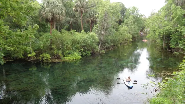
The two official sources describe the lagoon along the Fort Pierce corridor with different species counts. The FSHP page calls it home to more than 4,000 species of plants and animals, including 50 that are endangered or threatened (FSHP overview), while the CME handbook calls the 156 mile lagoon home to more than 4,300 species (CME handbook).
How does a Florida road become a scenic highway like the Treasure Coast route?
Section 335.093 of the Florida Statutes provides that the Department of Transportation “may, after consultation with other state agencies and local governments, designate public roads as scenic highways,” and FSHP lists the Treasure Coast route as designated December 14, 2005.
The statute states that public roads designated as scenic highways “are intended to preserve, maintain, and protect a part of Florida’s cultural, historical, and scenic routes for vehicular, bicycle, and pedestrian travel,” and that the department “may by rule adopt appropriate criteria for the designation of scenic highways and may specify appropriate planning and design standards including corridor management plans on such scenic highways” (section 335.093). For local governments along the Treasure Coast route, such as St. Lucie County, Fort Pierce and Port St. Lucie, subsection (3) adds that designation and its criteria “are not intended to affect or limit existing or customary uses in commercial or industrial areas that are adjacent to designated scenic highways nor is designation intended to limit the ability of local government entities to control or limit land uses in commercial or industrial areas within their jurisdictions.”
The program guidance bound into the Treasure Coast handbook traces the history (FSHP guidance, July 2016, in the CME handbook). The National Scenic Byways Program was established under the Intermodal Surface Transportation Efficiency Act of 1991, and under it roads are recognized based on archaeological, cultural, historic, natural, recreational and scenic intrinsic qualities. Florida had no official statewide scenic byway program before that law. State legislation passed in 1993, FDOT began developing criteria in 1994, and the Florida Scenic Highways Program launched in 1996. The guidance, dated July 2016, counts 25 designated Florida Scenic Highways, five of them also National Scenic Byways and one an All-American Road. FSHP lists the Treasure Coast route among its Southern Region byways (FSHP byway page).
Who manages the Treasure Coast scenic highway corridor?
A local corridor management entity created by a 2004 agreement, staffed by the St. Lucie TPO in Port St. Lucie, manages the Treasure Coast scenic highway and now meets as the Treasure Coast Scenic Highway Committee.
The 2004 agreement brought together a corridor advocacy group of residents, St. Lucie County, the City of Fort Pierce, the City of Port St. Lucie, the Treasure Coast Regional Planning Council, the St. Lucie Metropolitan Planning Organization, FDOT, the Florida Department of Environmental Protection, the Fort Pierce Utilities Authority and the Marine Resources Council of East Florida (CME agreement). It set the entity at 19 members, with the advocacy group appointing six, including one resident of Indian River Drive, one of North Hutchinson Island and one each from the incorporated and unincorporated parts of South Hutchinson Island.
Bylaws adopted September 8, 2016 make the St. Lucie TPO staff the support for the Treasure Coast entity, require a majority of voting members for a quorum, open all meetings to the public with generally at least seven days notice, and send records requests to the TPO at 466 SW Port St. Lucie Boulevard, Suite 111, Port St. Lucie, or 772-462-1593 (CME bylaws).
FSHP meeting notices list the body as the Treasure Coast Scenic Highway (TCSH) Committee, meeting at the Coco Vista Centre, 466 SW Port St. Lucie Boulevard, Suite 111, in Port St. Lucie, with annual work reports submitted to the Florida Scenic Highways Program, and they send accommodation and translation requests to the St. Lucie TPO at 772-462-1593 at least five days before a meeting (FSHP meeting notice).
What goals guide the Treasure Coast scenic highway plan?
The Treasure Coast corridor management plan, adopted March 10, 2017 and amended October 13, 2017, sets five goals: protect, preserve and maintain; enhance access; increase support; educate and promote; and sustain.
Under the first goal the plan calls for shoreline stabilization, shoreline habitat restoration and preservation of scenic views along the St. Lucie County corridor, plus removal of exotic vegetation (corridor management plan goals). The access goal aims at safe, non-congested, multi-modal transportation, cooperation on trails, walkways and bikeways, and a master plan for directional signs along A1A, US 1 and Indian River Drive.
The remaining Treasure Coast goals focus on people. The plan seeks volunteers for hands-on programs such as pepper busting, water quality monitoring and native plant work, a public information center for the Indian River Lagoon, promotion of low-impact, resource-based tourism, and compliance with Florida Scenic Highways Program requirements through annual work plans and reports (plan goals 3 to 5). The entity's vision statement, also adopted September 8, 2016, is to preserve and enhance the area's cultural, historic, recreational and natural resources and to promote appreciation of them through better access, information and education.
Last verified: October 22, 2026, with the FSHP byway and meeting pages, the CME handbook on the Fort Pierce agenda site, statute 335.093 and the Avalon and Pepper Park pages each reopened for this scenic highway guide.
Frequently asked questions
How long is the Indian River Lagoon-Treasure Coast Scenic Highway?
The Florida Scenic Highways Program lists it at 42 miles, in FDOT District 4, running through Fort Pierce and Port St. Lucie.
When was the Treasure Coast scenic highway designated?
The Florida Scenic Highways Program gives the designation date for the Treasure Coast route as December 14, 2005.
Does the scenic highway include Indian River Drive?
Yes. The 2004 corridor agreement lists Indian River Drive from Seaway Drive to the Martin County line, along with A1A and part of US 1.
Does scenic highway status limit businesses along the Treasure Coast route?
Section 335.093 says designation and its criteria “are not intended to affect or limit existing or customary uses in commercial or industrial areas that are adjacent to designated scenic highways.”
Who can answer questions about the Treasure Coast scenic highway?
The St. Lucie TPO, which staffs the corridor committee, at 466 SW Port St. Lucie Boulevard, Suite 111, or 772-462-1593.
Sources
- Florida Scenic Highways Program (FDOT): Indian River Lagoon - Treasure Coast Scenic Highway https://floridascenichighways.com/our-byways/southern-region/indian-river-lagoon-treasure-coast/ Used for: 42 miles, designated December 14, 2005, FDOT District 4, A1A and US 1, more than 4,000 species, access from I-95 south of Vero Beach, center axis in Fort Pierce
- Treasure Coast Corridor Management Entity Member Handbook (September 2019), City of Fort Pierce agenda item December 2, 2019 https://public.destinyhosted.com/fortpdocs/2019/CCREG/20191202_1356/10218_IRLSH_TCCME_Member_Handbook-September_2019.pdf Used for: byway map stops, directions via SR 70, CME agreement of 2004 (roads, parties, 19 members), bylaws adopted September 8, 2016, vision, goals adopted March 10, 2017 and amended October 13, 2017, FSHP guidance history (ISTEA 1991, 1993 law, 1994 criteria, 1996 launch, 25 designated highways), 156-mile lagoon and 4,300 species
- Florida Statutes 335.093 (2025): Scenic highway designation https://www.flsenate.gov/Laws/Statutes/2025/335.093 Used for: FDOT designation authority, purpose, criteria and corridor management plans, no limit on commercial or industrial uses or local land use control
- Florida Scenic Highways Program: Treasure Coast Scenic Highway Meeting, January 16, 2026 https://floridascenichighways.com/meeting/treasure-coast-scenic-highway-meeting-jan-2026/ Used for: Treasure Coast Scenic Highway (TCSH) Committee regular meeting at Coco Vista Centre, St. Lucie TPO contact 772-462-1593, agenda items: 2025 Annual Work Report for FSHP, corridor management plan update guidance
- St. Lucie County: Pepper Park Beachside https://www.stlucieco.gov/things-to-do/recreation/beaches/pepper-park-beachside Used for: byway stop: 3302 North SR A1A, Fort Pierce 34949, open 24 hours, 772-462-1522, nearshore reefs, Urca de Lima in about 20 feet of water
- Florida State Parks: Avalon State Park https://www.floridastateparks.org/parks-and-trails/avalon-state-park Used for: byway stop: 8 a.m. to sunset, $2 per vehicle, pedestrians and bicyclists by honor box, State Road A1A North, North Hutchinson Island, 772-468-4007
Published by Rytas Dirse, Solo Founder & AI Architect
Built with AI, held to quality gates. US sources, US brands, facts only.
How this page was made
Digital Towns uses AI assistance to research and write its guides, and every page is only as good as the sources it cites. Our goal is the most accurate, useful local information possible.
If you see an error, or anything you can show is false, tell us right away and we will take a third look.
Report an error
Thank you. We'll take a third look and correct the page if it's wrong.