Short answer: Reddie Point Preserve is a 102-acre City of Jacksonville park at the end of Yachtsman Way in Arlington, where the St. Johns River bends east toward the ocean. Bought by the City on November 21, 2002 for $3,060,877, it has a 700-foot fishing pier, boat docks, a kayak launch and hammock trails. The land was once Captain William Reddy's plantation and later Chaseville, a Gullah Geechee community.
What is Reddie Point Preserve?
Reddie Point Preserve is a 102-acre city park on the Arlington side of the St. Johns River, at the end of Yachtsman Way off University Boulevard. The City of Jacksonville states that Reddie Point Preserve consists of 102 acres, purchased on November 21, 2002 for $3,060,877, with the help of a Florida Communities Trust grant (01-115-FF1). JaxParks runs it as one of its preservation parks, alongside Camp Milton, Cedar Point and Castaway Island, and lists it as open from sunrise to sundown.
Most people in Jacksonville know it as a fishing spot. The City describes a 700-foot fishing pier with boat docks, a kayak launch, a picnic pavilion, wildlife observation areas, a multi-use play field and nature trails. What makes the place unusual is what lies under the grass and hammock: an 18th-century plantation and, after the Civil War, a Gullah Geechee settlement called Chaseville that gave University Boulevard its first name.
Where on the St. Johns River is Reddie Point?
Reddie Point is the knob of land where the St. Johns River swings east after running north past downtown. WJCT News described it in July 2017 as stretching along the St. Johns River as it bends between downtown Jacksonville and the ocean, in old Arlington, at a land protrusion into the river's curve toward the Atlantic Ocean. The Timucuan Parks Foundation likewise places it at the bend of the St. Johns River, with views of the river and downtown Jacksonville.
That position explains the view from the end of the pier. WJCT lists panoramic views from the St. Johns River to downtown Jacksonville, the cruise terminal and the Dames Point Bridge. Looking upstream from the pier, the river runs back toward the Northbank and Southbank; looking east, the Dames Point Bridge marks the way out toward Blount Island and the mouth of the river.
The land itself is maritime hammock and marsh. WJCT lists wading and song birds, deer, foxes and gopher tortoises among the wildlife, and describes unpaved trails that wind through the mature hammock toward the marsh. The Jaxson gives the trail total as 1.5 miles. The preserve is not obvious from the road: The Jaxson notes in 2019 that it sits behind a residential subdivision off University Boulevard and is easy to miss. The Jaxson's 2019 article also reproduces a 1918 USGS topographic map that shows the community of Chaseville at Reddie Point, a reminder that the point was a settled place long before it was a park.
Who lived at Reddie Point before the park?
The name comes from a planter of the British period. The Jaxson, in a 2019 history by urban planner Ennis Davis, AICP, writes that much of the land was an 800 acre plantation owned by Captain William Reddy during Florida's period of British occupation in the late 18th century. Both spellings survive: The Jaxson uses Reddy Point for the historic place and the shipyard, while the City's park name is Reddie Point.
In the 19th century the point drew a free African American community before the Civil War. According to The Jaxson, it grew after Charles McNeill, the nephew of Zephaniah Kingsley of Kingsley Plantation on Fort George Island, and his wife Elizabeth Coffee, a free person of color, settled there to raise their family. The McNeill connection reaches into art history. Charles's sister, Anna McNeill Whistler, visited the McNeill plantation and later wrote about it to her son, the painter James Abbott McNeill Whistler, and in 1871 she became the focus of his best-known painting, commonly called Whistler's Mother.
The Kingsley tie places Reddie Point inside a wider story of the lower St. Johns. Jacksonville Today's 2026 heritage list records that Zephaniah Kingsley, Jr. acquired the Fort George Island plantation in 1817, that his wife Anna Madgigine Jai managed it in his absence, and that the property became part of the National Park Service's Timucuan Ecological and Historic Preserve in 1991.
What was Chaseville, the community at Reddy Point?
Chaseville was a Gullah Geechee community that grew on the point after the war. The Jaxson records that after being destroyed during the Civil War, the Gullah Geechee community of Chaseville developed when shipyard owner Samuel Chase began hiring former United States Colored Troops as workers at Reddy Point. By 1876 the community had its own post office, and it later became the home of churches, schools and cemeteries.
Chaseville has drawn new attention in recent years. In February 2026, The Jaxson and Jacksonville Today listed Reddie Point Preserve among 11 Black cultural heritage sites in Jacksonville, alongside Kingsley Plantation, Cedar Point, the Ritz Theatre and Museum and Old City Cemetery, noting that the Gullah Geechee community of Chaseville emerged as Samuel Chase employed former U.S. Colored Troops at his Reddy Point shipyard. Jacksonville lies inside the Gullah Geechee Cultural Heritage Corridor, a National Heritage Area established by the U.S. Congress for the Gullah Geechee people of the coastal areas and sea islands of North Carolina, South Carolina, Georgia and Florida.
How did Chaseville become University Park and a city preserve?
The bridge changed everything in Arlington. WJCT reported in 2013 that the Mathews Bridge opened to traffic in the spring of 1953, that before it many could reach Arlington only by ferry, and that its completion caused Arlington to boom and even helped pave the way for the consolidation of the city and county governments. The Jaxson writes that during the 20 years following the 1953 opening of the Arlington Bridge, much of the rural Gullah Geechee community was developed into the University Park subdivision that remains today.
The old road name went at the same time. With the development of University Park and Jacksonville University, The Jaxson notes, Chaseville Road was renamed University Boulevard on January 5, 1959. Jacksonville University, founded in 1934, describes its 260-acre campus in Jacksonville's historic Arlington neighborhood with a half-mile stretch along the St. Johns River, a short way up the boulevard from the preserve.
The point itself nearly went the same way as the rest of Chaseville. WJCT reported in 2017 that the swath was pegged for condominium development, including a private marina and clubhouse, before the City of Jacksonville bought it. The purchase closed on November 21, 2002, with Florida Communities Trust money covering part of the $3,060,877 price, and the land has been public open space on the Arlington riverfront since.
What is at Reddie Point Preserve today?
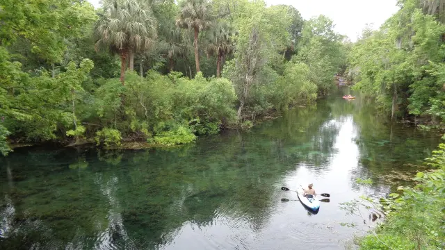
The City of Jacksonville lists benches, bike racks, a birding trail, a boat dock, car parking, a drinking fountain, fishing, a hiking trail, a nonmotorized launch, picnic shelters and tables, restrooms and a scenic overlook. It also sets one firm rule for boaters: no overnight mooring at the docking facility is permitted. WJCT counted room for 20 cars in the parking lot in 2017 and described a floating docking port and a canoe and kayak launch that puts paddlers straight onto the St. Johns.
The Timucuan Parks Foundation describes nature trails that take wide grassy corridors to paths under the tree canopy, and lists no fees for parking or park access as of October 2026, with biking, bird watching, fishing, hiking and paddle sports among the listed activities and pets allowed. The WJCT guide was one of 19 short videos on First Coast parks produced in 2017 by the University of North Florida's Environmental Center and the Public Trust Environmental Legal Institute of Florida. For directions, WJCT's 2017 guide runs from I-95 at Union Street across the Mathews Bridge to University Boulevard, then a little over 4 miles to Yachtsman Way, which leads to the preserve.
Frequently asked questions
Why is it spelled Reddie Point when the history says Reddy?
The point takes its name from Captain William Reddy, who held an 800-acre plantation there in the British period. The Jaxson uses Reddy Point for the historic place and shipyard, while the City of Jacksonville named the park Reddie Point Preserve.
Can boats tie up at Reddie Point Preserve overnight?
No. The City of Jacksonville lists boat docks beside the 700-foot fishing pier but states that overnight mooring at the docking facility is not permitted. The park is open from sunrise to sundown.
What can be seen from the Reddie Point fishing pier?
WJCT described views in 2017 from the pier across the St. Johns River to downtown Jacksonville, the cruise terminal and the Dames Point Bridge, since the point sits on the river's eastward bend in old Arlington.
How did University Boulevard get its name?
The road through the area was Chaseville Road, named for the Chaseville community at Reddy Point. The Jaxson reports it was renamed University Boulevard on January 5, 1959, as University Park and Jacksonville University developed.
Is there a fee to visit Reddie Point Preserve?
The Timucuan Parks Foundation lists no fees for parking or park access. WJCT counted about 20 parking spaces in 2017, and the City lists restrooms, picnic shelters and a kayak launch.
Sources
- Reddie Point Preserve (City of Jacksonville, JaxParks) https://www.jacksonville.gov/departments/parks-and-recreation/jaxparks/preservation-parks/reddie-point-preserve Used for: address, acreage, 2002 purchase price and date, FCT grant, pier, amenities, mooring rule, hours
- Reddie Point Preserve: The Lost Community of Chaseville (The Jaxson, Sept. 2, 2019) https://www.thejaxsonmag.com/article/reddie-point-preserve-the-lost-community-of-chaseville/ Used for: Reddy plantation, McNeill family, Whistler, Chaseville, post office, University Park, University Boulevard rename, trails
- 11 Black cultural heritage sites to visit in town (The Jaxson, Feb. 16, 2026) https://www.thejaxsonmag.com/article/11-black-cultural-heritage-sites-to-visit-in-town/ Used for: heritage site listing, Samuel Chase shipyard
- THE JAXSON: 11 Black cultural heritage sites to visit in Jacksonville (Jacksonville Today, Feb. 11, 2026) https://jaxtoday.org/2026/02/11/the-jaxson-11-black-cultural-heritage-sites-to-visit-in-jacksonville/ Used for: heritage site listing, Reddy plantation
- VIDEO: Explore Northeast Florida's Reddie Point Preserve (WJCT News, July 21, 2017) https://news.wjct.org/first-coast/2017-07-21/video-explore-northeast-floridas-reddie-point-preserve Used for: habitat, wildlife, condo plan, views, parking, directions
- Reddie Point Preserve (Timucuan Parks Foundation) https://www.timucuanparks.org/reddie-point-preserve/ Used for: bend of river, fees, trails
- Gullah Geechee Cultural Heritage Corridor https://www.gullahgeecheecorridor.org/ Used for: National Heritage Area definition
- About Jacksonville University https://www.ju.edu/about/ Used for: JU founding year, campus, Arlington riverfront
- Mathews Bridge Turns 60 (WJCT, April 10, 2013) https://news.wjct.org/community/2013-04-10/mathews-bridge-turns-60 Used for: 1953 opening, Arlington access by ferry, Arlington growth
How this page was made
Digital Towns uses AI assistance to research and write its guides, and every page is only as good as the sources it cites. Our goal is the most accurate, useful local information possible.
If you see an error, or anything you can show is false, tell us right away and we will take a third look.
Report an error
Thank you. We'll take a third look and correct the page if it's wrong.