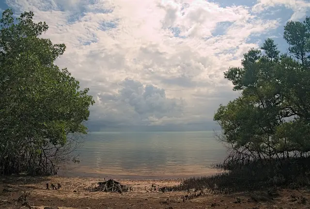
Short answer: The Indian River-Vero Beach to Fort Pierce Aquatic Preserve is an 11,000 acre state preserve in the Indian River Lagoon, in Indian River and St. Lucie counties, established in 1969. Its statutory reference lines are the 1970 Vero Beach city line and the North Beach Causeway. It has been Outstanding Florida Waters since 1979, seagrass damage can bring a fine up to $1,000, and there is no fee. Access is through Round Island, Stan Blum and Fort Pierce Inlet State Park.
Last verified: October 22, 2026, against the sources listed at the end of this page.
What is the Indian River-Vero Beach to Fort Pierce Aquatic Preserve?
It is the state-protected stretch of the Indian River Lagoon between Vero Beach and the Fort Pierce Inlet, an 11,000 acre aquatic preserve in Indian River and St. Lucie counties established in 1969.
The Florida Department of Environmental Protection lists the preserve with County: Indian River, St. Lucie, Established: 1969 and Acres: 11,000, and classes it as a shallow estuary with barrier island and spoil island habitat (FDEP preserve page). FDEP describes the water off Vero Beach and Fort Pierce as part of a long, wide and shallow estuarine lagoon where freshwater from rivers and creeks mixes with ocean water.
| Item | Official figure | Source |
|---|---|---|
| Counties | Indian River, St. Lucie | FDEP |
| Established | 1969 | FDEP |
| Size | 11,000 acres | FDEP |
| Legal description | Indian River County Official Records Book 368, pages 9-12; St. Lucie County Official Records Book 187, pages 1083-1086 | section 258.39(8) |
| Outstanding Florida Waters | 1979, Rule 62-302.700(9), F.A.C. | IRL system plan |
| First management plan | Adopted 1985 | IRL system plan |
| Visitor fee | None | FDEP FAQ |
The preserve is one of four that FDEP manages together as the Indian River Lagoon Aquatic Preserves system, with the Malabar to Vero Beach preserve to the north, Jensen Beach to Jupiter Inlet and the Banana River (IRL Aquatic Preserves System Management Plan). The North Fork, St. Lucie preserve west of Fort Pierce has its own plan, and both neighbors have their own guides: the North Fork, St. Lucie Aquatic Preserve guide and the Sebastian guide to the Malabar to Vero Beach preserve.
Where does the aquatic preserve between Vero Beach and Fort Pierce begin and end?
Florida law fixes the preserve by recorded county descriptions and names two reference lines in them: the southern city line of Vero Beach as it stood on June 3, 1970, and State Road A1A, the North Beach Causeway, north of the Fort Pierce Inlet.
Item (8) of section 258.39 of the Florida Statutes adopts the descriptions recorded in Indian River County Official Records Book 368 and St. Lucie County Official Records Book 187 (Florida Statutes section 258.39). It then pins down two reference lines. The southern corporate line of Vero Beach means the city boundary as it existed on June 3, 1970, which is also a westerly projection of the south boundary of the Indian Bay subdivision recorded in Plat Book 3, page 43. State Road A1A means the North Beach Causeway, north of the Fort Pierce Inlet.
A second official map of the same reach comes from shellfish management. The IRL system plan describes shellfish area 70, Indian River/St. Lucie, as all waters of the Indian River north of the U.S. Highway A1A (Seaway Drive) bridge at the Fort Pierce Inlet and south of the State Road 60 bridge at Vero Beach (IRL system plan, shellfish areas). Within it the plan lists 2,025 acres in the approved class 7001 and 4,055 acres in the restricted class 7005, the latter closed by FDACS except during supervised relay operations.
The Fort Pierce Inlet State Park management plan states that the waters around the park are designated Outstanding Florida Waters and are included in the Indian River-Vero Beach to Fort Pierce Aquatic Preserve (Fort Pierce Inlet State Park unit management plan).
How is the preserve between Vero Beach and Fort Pierce protected?
The Florida Legislature designated the Vero Beach to Fort Pierce preserve in 1969, it was included in the Aquatic Preserves Act of 1975, and it was designated Outstanding Florida Waters in 1979.
The IRL system plan states that the Indian River-Malabar to Vero Beach, Indian River-Vero Beach to Ft. Pierce and Jensen Beach to Jupiter Inlet preserves were designated by the Florida Legislature as aquatic preserves in 1969, that all four lagoon preserves were included in the Aquatic Preserves Act of 1975, and that they were designated Outstanding Florida Waters in 1979 under Rule 62-302.700(9) of the Florida Administrative Code (IRL system plan). The plan adds that FDEP affords the highest level of protection to these waters. It records the first management plan for the Vero Beach to Ft. Pierce preserve as adopted in 1985 and describes the system plan as its first update.
On the water, the FDEP rules for boaters near Vero Beach and Fort Pierce are short: follow current FWC saltwater fishing and boating regulations, stay out of shallow water and raise the motor over seagrass (FDEP safety FAQ). Seagrass is protected inside aquatic preserves, and FDEP warns that damage to it can bring a fine of up to $1,000. Pets may come along, but FDEP asks that they not run free in areas not set aside for pets, because the preserve borders conservation land with nesting birds. Injured animals are reported to FWC at 1-888-404-FWCC (3922).
Where can boaters and paddlers get onto the Vero Beach to Fort Pierce preserve?
FDEP names Round Island Boat Ramp, Stan Blum Boat Ramp and the Ft. Pierce Inlet State Park kayak launch as access points, since the preserve itself has no parking or facilities.
The FDEP page says the preserve is open 24/7 but depends on public access points managed by other entities, and that parking, restrooms, a kayak launch and boat ramps may be available through Fort Pierce Inlet State Park, which sits next to the preserve (FDEP visitation information). Listed activities are fishing, boating, hiking, birding, beach activities and camping, and FDEP names fall and spring as the best seasons to visit. There are no fees.
On the Indian River County end, Round Island Riverside Park at 2200 South Highway A1A in Vero Beach has two boat ramps, a canoe launch and 12 boat trailer parking spaces, and the county lists the boat ramp as open 24 hours (Indian River County, Round Island Riverside Park). The Treasure Coast boat ramp guides cover Stan Blum, the North Causeway and the other St. Lucie County ramps in detail.
The IRL system plan, dated 2016, reports aquatic preserve signs at the Round Island and North Causeway boat ramps in the Vero Beach to Fort Pierce preserve, and on spoil islands IR36, IR43 and SL3 (IRL system plan, signage). Accessibility depends on each launch: FDEP says ADA accommodations are specific to each access point and the agency that runs it (FDEP FAQ).
What lives in the lagoon and on the spoil islands near Fort Pierce?
The preserve between Vero Beach and Fort Pierce shelters seagrass, mangroves, oysters, manatees, dolphins, green and loggerhead sea turtles and game fish, and its spoil islands hold most of the lagoon's bird rookeries.
FDEP's species list for this part of the Indian River Lagoon names oysters, horseshoe crabs and seahorses; wading birds, seabirds and shorebirds; the Atlantic bottlenose dolphin and West Indian manatee; green and loggerhead sea turtles; redfish, black drum, tarpon, snook and mullet; and seagrasses with red, black and white mangroves (FDEP wildlife information).
The spoil islands off Vero Beach and Fort Pierce are man-made. FDEP explains that they were created from dredge material during construction of the Intracoastal Waterway, built of sand, shell, muck and limestone rubble, and that much of their vegetation is exotic, mainly Brazilian pepper and Australian pine (FDEP spoil island description). Their shallow edges have been colonized by mangrove forest, salt marsh and seagrass, and FDEP credits them with most of the bird rookeries across the lagoon's aquatic preserves. FDEP's conservation work in the preserve includes protecting bird nesting areas, planting mangroves, restoring oyster reefs and surveying seagrass.
What history and research belong to the preserve off Vero Beach and Fort Pierce?
Archaeological sites along the Indian River Lagoon preserves date from 10,000 BC to 1700 AD, and the lagoon near Fort Pierce has been studied by research stations there since the early 1970s.
FDEP says archaeological sites adjacent to the lagoon preserve system date from 10,000 BC to 1700 AD and include the Spanish Fleet Survivors and Salvors Camp, the Jungle Trail and Mount Elizabeth, and that many historic shell mounds along the Indian River Lagoon were destroyed for road fill for U.S. Highways 1 and A1A, other highways and train beds (FDEP history and archaeology). The IRL system plan's table of sites adjacent to the Vero Beach to Ft. Pierce preserve includes IR00835 Washup, an inundated Archaic habitation site dated 8500 B.C. to 1000 B.C., and IR00016 Beachland, a prehistoric midden and mound site of the St. Johns II period, A.D. 800 to 1500 (IRL system plan, site table B.5.1.3).
The ground under the preserve is old too. FDEP places it on the Atlantic Coastal Ridge, with the Anastasia Formation, a fossil-rich limestone formed over 5.3 million years ago, along its western shore near Vero Beach and Fort Pierce (FDEP geology).
Research on this reach is centered in Fort Pierce. The 2016 IRL system plan reported that scientists at Harbor Branch Oceanographic Institute at Florida Atlantic University had conducted high-frequency water quality monitoring in the Vero Beach to Ft. Pierce preserve since May 2005, that the South Florida Water Management District monitored monthly stations in its southern half, and that scientists at the Smithsonian Marine Station at Ft. Pierce have studied the lagoon since the early 1970s (IRL system plan, research). FDEP lists beach and spoil island cleanups as volunteer work, with IRLAP@FloridaDEP.gov as the contact and 772-448-5930 as the preserve contact phone (FDEP volunteer information).
Last verified: October 22, 2026, with a fresh read of the FDEP preserve page, statute 258.39, the lagoon system plan, the Fort Pierce Inlet State Park plan and the Round Island Riverside listing for this preserve guide.
Frequently asked questions
How big is the aquatic preserve between Vero Beach and Fort Pierce?
FDEP lists it at 11,000 acres in Indian River and St. Lucie counties, established in 1969.
Does the Vero Beach to Fort Pierce aquatic preserve charge a fee?
No. FDEP says there are no fees; the preserve is reached through ramps and parks run by other agencies.
Where does the preserve begin at Vero Beach?
Section 258.39 uses the southern corporate line of Vero Beach as it existed on June 3, 1970, as one of its reference lines.
Where is the closest parking to the preserve near Fort Pierce?
FDEP points to Fort Pierce Inlet State Park, next to the preserve, for parking, restrooms and a kayak launch.
What is the fine for damaging seagrass off Fort Pierce?
FDEP says damage to seagrass in the preserve can result in a fine up to $1,000.
Sources
- FDEP Florida Aquatic Preserves: Indian River-Vero Beach to Fort Pierce Aquatic Preserve https://floridadep.gov/rcp/aquatic-preserve/locations/indian-river-vero-beach-fort-pierce-aquatic-preserve Used for: counties, established 1969, 11,000 acres, water body type, visitation, parking and launch points, history, archaeology, geology, spoil islands, species, FAQ (fees, pets, seagrass fine, best season), volunteer contact
- Florida Statutes 258.39 (2025): Boundaries of preserves https://www.flsenate.gov/Laws/Statutes/2025/258.39 Used for: item (8) official records books and pages, Vero Beach southern corporate line as of June 3, 1970, Indian Bay subdivision plat, SR A1A North Beach Causeway north of Fort Pierce Inlet
- FDEP: Indian River Lagoon Aquatic Preserves System Management Plan https://floridadep.gov/sites/default/files/Indian-River-Lagoon-AP-System-Management-Plan.pdf Used for: designation by the Legislature in 1969, 1975 Act, Outstanding Florida Waters 1979 (Rule 62-302.700(9)), initial plan adopted 1985, shellfish area extents and acreages, signage at ramps and spoil islands IR36, IR43, SL3, HBOI monitoring since May 2005, SFWMD monthly stations, Smithsonian Marine Station, archaeological site table
- FDEP: Fort Pierce Inlet State Park Unit Management Plan (2021) https://floridadep.gov/sites/default/files/2021%20Approved%20UMP%20Fort%20Pierce%20Inlet%20State%20Park.pdf Used for: waters around the park designated Outstanding Florida Waters and included in the preserve
- Indian River County: Round Island Riverside Park https://indianriver.gov/business_detail_T21_R24.php Used for: access point: 2200 South Highway A1A, two boat ramps, canoe launch, 12 trailer spaces, boat ramp open 24 hours
Published by Rytas Dirse, Solo Founder & AI Architect
Built with AI, held to quality gates. US sources, US brands, facts only.
How this page was made
Digital Towns uses AI assistance to research and write its guides, and every page is only as good as the sources it cites. Our goal is the most accurate, useful local information possible.
If you see an error, or anything you can show is false, tell us right away and we will take a third look.
Report an error
Thank you. We'll take a third look and correct the page if it's wrong.