Short answer: Black Point Wildlife Drive is a 7-mile, one-way auto tour through salt and freshwater marshes on Merritt Island National Wildlife Refuge, entered from State Road 406 one mile east of State Road 402 near Titusville. A refuge pass is required, $10 per vehicle per day, payable at an honor box at the entrance. Stop 9 has restrooms, a tower and the Cruickshank Trail; fishing is barred except at L Pond Road.
Last verified: October 21, 2026, against the sources listed at the end of this page.
What is Black Point Wildlife Drive?
Black Point Wildlife Drive is a 7-mile, one-way auto tour through salt and freshwater marshes on Merritt Island National Wildlife Refuge, near Titusville (USFWS refuge brochure).
The U.S. Fish and Wildlife Service calls the drive the refuge's most popular wildlife viewing area (USFWS wildlife watching), and the refuge brochure names it the main route for seeing wildlife on Merritt Island, with hiking trails, towers, decks and dike roads as the alternatives (USFWS refuge brochure). As an auto tour, Black Point is driven with a printed guide whose numbered stops describe the marsh along the way (USFWS refuge brochure).
The drive lies inside a refuge set on space center land. The refuge home page explains that Merritt Island National Wildlife Refuge was established by agreement as an overlay of NASA's John F. Kennedy Space Center, with the lands and waters serving the space program first and the refuge second (USFWS refuge home page). The USFWS notes that NASA may restrict refuge roads during launch operations, covered in the rules section below. The wider refuge, including the visitor center, other trails and the manatee deck, has its own Merritt Island National Wildlife Refuge guide.
Where does Black Point Wildlife Drive start?
The entrance to Black Point Wildlife Drive is on State Road 406, one mile east of where State Road 402 meets State Road 406 on Merritt Island (USFWS refuge brochure).
From the mainland, the USFWS route is I-95 exit 220, the Titusville State Road 406 exit, then east on SR 406, also called Garden Street, for 4 miles and across the Max Brewer Causeway Bridge, where the refuge begins on the east side (USFWS, Visit Us). The same directions put the visitor center 4 miles past the refuge entrance, keeping right at the fork, which is the stop for anyone who wants the printed guide or a pass from staff before starting Black Point (USFWS, Visit Us).
The auto tour brochure is also stocked at the refuge visitor center, five miles east of US 1 on State Road 402 in Titusville (USFWS refuge brochure). It keeps Tuesday through Saturday hours; the Contact Us page opens with 8 AM until 4 PM and then lists 8:30 am to 4:00 pm, closed Sundays, Mondays, Thanksgiving, Christmas and New Year's Day (USFWS, Contact Us). For a stop before the drive, the brochure also lists a wheelchair accessible observation deck at the refuge entrance on SR 406.
How much does Black Point Wildlife Drive cost?
Driving Black Point requires a Merritt Island refuge pass, which the USFWS prices at $10 per vehicle per day or $25 per vehicle per year (USFWS refuge home page, USFWS, Visit Us).
| Option | Price | Where to get it |
|---|---|---|
| Merritt Island Daily Pass | $10.00 per vehicle | Visitor center, self-pay station or Recreation.gov (USFWS) |
| Merritt Island Annual Pass | $25.00 per vehicle | Visitor center or Recreation.gov (USFWS) |
| Federal Duck Stamp, current and signed | $25.00, valid July 1 to June 30 | Replaces the refuge pass (USFWS) |
| Interagency pass (America the Beautiful and related) | Varies; senior lifetime $80.00 | Replaces the refuge pass (USFWS) |
| Honor-system envelope at the drive entrance | $10.00 daily pass | Fee envelopes and depository at the Black Point entrance (USFWS, brochure) |
Payment at the entrance is low-tech. The Visit Us page says daily passes can be bought at self-pay stations with exact change, that the refuge accepts cash, and that when the visitor center is closed the fee envelopes and depository at the Black Point Wildlife Drive entrance handle daily passes (USFWS, Visit Us). Buying online at Recreation.gov before arriving avoids the exact-change problem.
The printed brochure differs from the current web page on two points. It says the $10 Refuge Daily Pass is valid for entry to Canaveral National Seashore as well and that payment must be cash or check, with no credit cards (USFWS refuge brochure); the Visit Us page calls the daily pass valid only at Merritt Island National Wildlife Refuge, says the refuge accepts cash and offers online purchase at Recreation.gov (USFWS, Visit Us). Neither source changes the $10 price for the drive itself.
What are the stops along Black Point Wildlife Drive?
The Black Point auto tour brochure, picked up at the drive entrance or the visitor center, numbers the stops and explains the natural history and management of each part of the marsh (USFWS refuge brochure).
| Stop | What is there | Source |
|---|---|---|
| Entrance on SR 406 | Honor-system fee station and auto tour brochures | USFWS brochure |
| Stop 4 | Wild Bird Trail: 1/4 mile round trip in the brochure; the trails page lists 0.19 miles, up to a 1/2 mile round trip on a gravel path to two bird observation blinds | USFWS brochure, USFWS trails |
| Stop 9 | Parking lot, restrooms, observation tower, wheelchair accessible platform and the Cruickshank Trail trailhead | USFWS brochure |
| Cruickshank Trail | Loop on a mowed grass dike around a managed salt marsh: 5 miles and 2 hours in the brochure, 4.73 miles and up to 4 hours on the trails page; two observation towers near the start, one handicap accessible | USFWS brochure, USFWS trails |
| L Pond Road | The only side road off the drive where fishing, crabbing and launching small craft are allowed | USFWS 2026 regulations |
Stop 9 matters for planning a Black Point trip, since the brochure lists restrooms at the Refuge Visitor Center, Stop 9 and Playalinda Beach (USFWS refuge brochure). The Wild Bird Trail at Stop 4 connects two bird observation platforms over the marsh, and the brochure rates it easy, about 30 minutes.
The Cruickshank Trail is the longer option from the drive, and the two USFWS sources describe it differently: the brochure gives a 5-mile loop of about 2 hours, while the trails page lists 4.73 miles and warns it may take up to 4 hours depending on pace (USFWS refuge brochure, USFWS trails page). The brochure says the trail honors Allan Cruickshank, who pressed for protecting the wet landscapes when NASA began planning Kennedy Space Center, and advises carrying water and insect repellent on the open, sunny dike.
What wildlife can be seen from Black Point Wildlife Drive?
Wading birds, shorebirds, raptors, waterfowl, alligators and otters are the animals the USFWS brochure names for Black Point Wildlife Drive (USFWS refuge brochure).
Season matters on Black Point. The brochure places Merritt Island on the Atlantic Flyway as a key resting stop for migratory birds, rates the refuge's trails, towers, decks and dike roads as excellent alternative viewing especially in fall and winter, and calls hiking most pleasant in fall, winter and early spring (USFWS refuge brochure). The Merritt Island trails page adds that summers are hot and humid with possible daily lightning storms, that many trails lack shade and that biting insects can appear in any season (USFWS trails page).
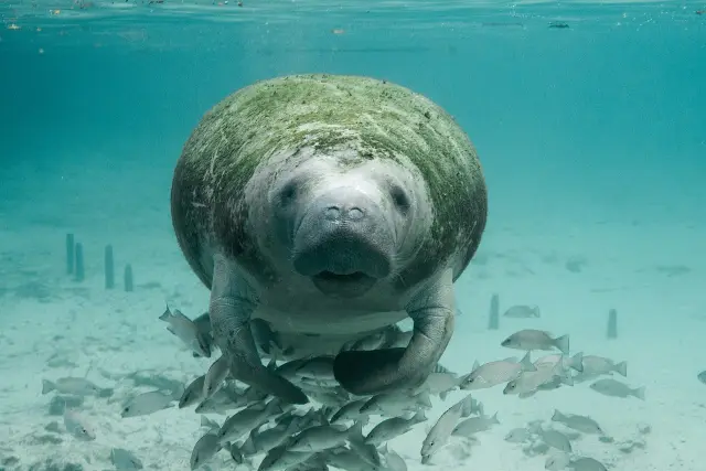
Many refuge dike roads besides Black Point also offer wildlife observation and photography, according to the USFWS wildlife watching page, which also names the handicap accessible Manatee Observation Deck as a place to see manatees in the wild (USFWS wildlife watching). Feeding, watering, enticing or disturbing alligators and other wildlife is not permitted on the refuge, the brochure's general regulations say (USFWS refuge brochure).
What is not allowed on Black Point Wildlife Drive, and when does it close?
Black Point Wildlife Drive follows refuge hours of sunrise to sunset every day, and NASA can restrict refuge roads during Kennedy Space Center launch operations (USFWS, Visit Us).
Water use is tightly limited along the route. The 2026 Merritt Island boating and fishing regulations bar crabbing and fishing from Black Point Wildlife Drive or any side road connected to it, except L Pond Road, and bar launching boats, canoes, kayaks or stand up paddleboards from the drive or its side roads, again except L Pond Road (USFWS 2026 boating and fishing regulations). Anyone fishing at L Pond Road needs the self-issuing Refuge Sports Fishing Permit, and impoundments and interior ponds are closed to night fishing.
Other refuge rules apply on the drive as well: pets must be leashed and under control, collecting plants, animals or artifacts is prohibited, and camping, open fires and grills are not permitted (USFWS refuge brochure). Bicycles are not permitted on any listed Merritt Island trail, including Cruickshank and the Wild Bird Trail (USFWS trails page). Last verified: October 21, 2026, by checking the Black Point entries in the Merritt Island refuge brochure, the July 2026 boating and fishing rules, and the USFWS pass, trail, contact and wildlife watching pages.
Frequently asked questions
How long is Black Point Wildlife Drive?
The drive is 7 miles and one-way, through salt and freshwater marshes on Merritt Island National Wildlife Refuge, according to the USFWS refuge brochure and wildlife watching page.
How much does it cost to drive Black Point Wildlife Drive?
A Merritt Island Daily Pass costs $10.00 per vehicle and an annual pass $25.00 per vehicle, per the USFWS Visit Us page. A current signed Federal Duck Stamp or an interagency pass also covers the drive, and daily passes can be paid by envelope at the entrance.
Where is the entrance to Black Point Wildlife Drive?
On State Road 406, one mile east of the intersection of State Road 402 and State Road 406, according to the USFWS refuge brochure. From I-95, the USFWS directions use exit 220 and Garden Street.
Are there restrooms on Black Point Wildlife Drive?
Yes, at Stop 9, which also has a parking lot, an observation tower, a wheelchair accessible platform and the Cruickshank Trail trailhead, according to the USFWS refuge brochure.
Can visitors fish from Black Point Wildlife Drive?
No, except at L Pond Road. The 2026 Merritt Island boating and fishing regulations prohibit crabbing, fishing and launching boats or kayaks from the drive or its side roads other than L Pond Road.
Sources
- USFWS, Merritt Island NWR wildlife watching https://www.fws.gov/refuge/merritt-island/visit-us/activities/wildlife-watching Used for: 7 mile auto tour, most popular viewing area, dike roads
- USFWS, Merritt Island NWR brochure (PDF) https://www.fws.gov/sites/default/files/documents/merritt-island-national-wildlife-refuge.pdf Used for: drive length, one-way, location, honor fee, auto tour brochure, Stop 4 and Stop 9, wildlife, restrooms, rules
- USFWS, Merritt Island NWR home page https://www.fws.gov/refuge/merritt-island Used for: pass required for the drive, KSC overlay
- USFWS, Merritt Island NWR Visit Us https://www.fws.gov/refuge/merritt-island/visit-us Used for: pass prices, payment, fee envelopes, directions, hours, NASA restrictions
- USFWS, Merritt Island NWR trails https://www.fws.gov/refuge/merritt-island/visit-us/trails Used for: Cruickshank and Wild Bird trail details, bicycles
- USFWS, Merritt Island NWR Contact Us https://www.fws.gov/refuge/merritt-island/contact-us Used for: visitor center hours
- USFWS, Merritt Island NWR boating and fishing regulations 2026 (PDF) https://www.fws.gov/sites/default/files/documents/2026-07/merritt-island-nwr-boating-fishing-regs.pdf Used for: no fishing or launching from the drive except L Pond Road
Published by Rytas Dirse, Solo Founder & AI Architect
Built with AI, held to quality gates. US sources, US brands, facts only.
How this page was made
Digital Towns uses AI assistance to research and write its guides, and every page is only as good as the sources it cites. Our goal is the most accurate, useful local information possible.
If you see an error, or anything you can show is false, tell us right away and we will take a third look.
Report an error
Thank you. We'll take a third look and correct the page if it's wrong.